Property Record
229 S Main St, Mcgregor, TX 76657
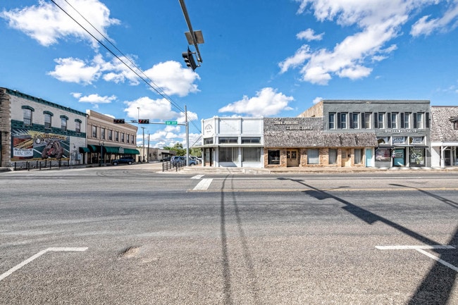

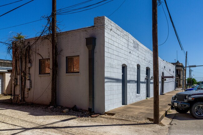
This Property Is For Sale
Property Detail
229 S Main St
Waco, TX
MCGREGOR OT LOT 10B BLOCK 64 ACRES .0661
34-134000-036800-9
McLennan
Commercialnec
Texas
B and X Area of moderate flood hazard, usually the area between the limits of the 100-year and 500-year floods.
10b
2024
0.07 AC
2025
Waco
003902
Other Market Areas
2,862 SF
NEARBY LISTINGS FOR SALE OR LEASE
-
-
View all Mcgregor listings for sale on LoopNet.com
DEMOGRAPHICS near 229 S Main St
1 mile
3 mile
5 mile
2025 Total Population
4,867
6,153
6,984
2030 Population
5,069
6,403
7,273
Pop Growth 2025-2030
+ 4.15%
+ 4.06%
+ 4.14%
Average Age
37
37
38
2025 Total Households
1,729
2,179
2,474
HH Growth 2025-2030
+ 4.22%
+ 4.13%
+ 4.16%
Median Household Inc
$69,735
$74,788
$77,614
Avg Household Size
2.80
2.80
2.80
2025 Avg HH Vehicles
2.00
2.00
2.00
Median Home Value
$265,193
$273,140
$291,790
Median Year Built
1973
1974
1976
Nearby Places
Map Layers
Map Styles
 Street
 Aerial
Layers
 Traffic
 Biking
Places
Listings with unknown addresses are not visible on the map
- Restaurants
- Banks
- Shops
- Fitness
- Groceries
PUBLIC TRANSPORTATION
COMMUTER RAIL
Mcgregor Amtrak (Texas Eagle - Amtrak)
Drive
Walk
Distance
Mcgregor Amtrak (Texas Eagle - Amtrak)
1 min
7 min
0.4 mi
AIRPORT
Waco Regional
Drive
Walk
Distance
Waco Regional
38 min
22.6 mi
Killeen Municipal
Drive
Walk
Distance
Killeen Municipal
57 min
43.5 mi
Freight Ports
Port of Houston
Drive
Walk
Distance
Port of Houston
235 min
204.7 mi
Nearby Properties
Address
Land Use
TOTAL SIZE
Lot Size
Zoning
Address
Land Use
TOTAL SIZE
Lot Size
Zoning
101,361 SF
42.31 AC
Address
Land Use
TOTAL SIZE
Lot Size
Zoning
70,898 SF
22.71 AC
Address
Land Use
TOTAL SIZE
Lot Size
Zoning
61,844 SF
4.50 AC
C
Address
Land Use
TOTAL SIZE
Lot Size
Zoning
85,182 SF
30 AC
R
Address
Land Use
TOTAL SIZE
Lot Size
Zoning
52,876 SF
15 AC
C
Address
Land Use
TOTAL SIZE
Lot Size
Zoning
161,600 SF
40 AC
R
Address
Land Use
TOTAL SIZE
Lot Size
Zoning
78,000 SF
16.28 AC
R
Address
Land Use
TOTAL SIZE
Lot Size
Zoning
1.50 AC
R
Address
Land Use
TOTAL SIZE
Lot Size
Zoning
25,923 SF
3.93 AC
C
Address
Land Use
TOTAL SIZE
Lot Size
Zoning
24,210 SF
1.38 AC
R
Address
Land Use
TOTAL SIZE
Lot Size
Zoning
37,244 SF
27 AC
R
Address
Land Use
TOTAL SIZE
Lot Size
Zoning
54,371 SF
3.20 AC
C
Address
Land Use
TOTAL SIZE
Lot Size
Zoning
42,957 SF
8.26 AC
Address
Land Use
TOTAL SIZE
Lot Size
Zoning
39,303 SF
11.86 AC
C
Address
Land Use
TOTAL SIZE
Lot Size
Zoning
29,020 SF
1.63 AC
R
Address
Land Use
TOTAL SIZE
Lot Size
Zoning
71,570 SF
7.75 AC
Address
Land Use
TOTAL SIZE
Lot Size
Zoning
4,000 SF
1.04 AC
C
Address
Land Use
TOTAL SIZE
Lot Size
Zoning
181,852 SF
31 AC
C
Address
Land Use
TOTAL SIZE
Lot Size
Zoning
42,750 SF
2 AC
Address
Land Use
TOTAL SIZE
Lot Size
Zoning
170.93 AC
Address
Land Use
TOTAL SIZE
Lot Size
Zoning
16,498 SF
3.39 AC
C
Address
Land Use
TOTAL SIZE
Lot Size
Zoning
11,495 SF
2.13 AC
C
Address
Land Use
TOTAL SIZE
Lot Size
Zoning
40,048 SF
19.11 AC
C
Address
Land Use
TOTAL SIZE
Lot Size
Zoning
18,900 SF
1.30 AC
C
Address
Land Use
TOTAL SIZE
Lot Size
Zoning
8.66 AC
R
Address
Land Use
TOTAL SIZE
Lot Size
Zoning
35,316 SF
1.91 AC
C
Address
Land Use
TOTAL SIZE
Lot Size
Zoning
13,200 SF
2.73 AC
R
Address
Land Use
TOTAL SIZE
Lot Size
Zoning
21,311 SF
3 AC
R
Address
Land Use
TOTAL SIZE
Lot Size
Zoning
28,512 SF
1.20 AC
R
Address
Land Use
TOTAL SIZE
Lot Size
Zoning
3,222 SF
0.72 AC
The World's #1 Commercial Real Estate Marketplace
Connect with us
© 2026 CoStar Group
The information above has been obtained from sources believed reliable. While we do not doubt its accuracy we have not verified it and make no guarantee, warranty or representation about it. It is your responsibility to independently confirm its accuracy and completeness. Any projections, opinions, assumptions, or estimates used are for example only and do not represent the current or future performance of the property. The value of this transaction to you depends on tax and other factors which should be evaluated by your tax, financial, and legal advisors. You and your advisors should conduct a careful, independent investigation of the property to determine to your satisfaction the suitability of the property for your needs.