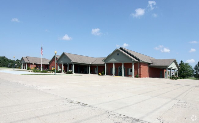
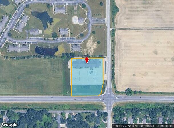
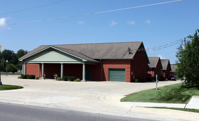
Property Record
229 S Rangeline Rd, Anderson, IN 46012
NEARBY LISTINGS FOR SALE OR LEASE
Property Detail
229 S Rangeline Rd
48-12-08-104-003.000-003
E2 NE PLAT 11-2 2.7500ACRES STR: 08198 SECTION: PLAT: 00 IN: OUT:
Funeralhome
Madison
X
Indiana
18095C0257D
2.75 AC
2024
Anderson/Madison Cnty
2025
Indianapolis
001300
Indianapolis-Carmel-Anderson, IN
19,130 SF
DEMOGRAPHICS near 229 S Rangeline Rd
1 Mile
3 Mile
5 Mile
2024 Total Population
4,745
34,260
70,762
2029 Population
4,831
35,525
73,053
Pop Growth 2024-2029
+ 1.81%
+ 3.69%
+ 3.24%
Average Age
44
41
41
2024 Total Households
2,154
14,444
30,138
HH Growth 2024-2029
+ 2.00%
+ 3.86%
+ 3.35%
Median Household Inc
$49,832
$46,688
$46,293
Avg Household Size
2.20
2.20
2.20
2024 Avg HH Vehicles
2.00
2.00
2.00
Median Home Value
$139,263
$113,195
$112,366
Median Year Built
1970
1959
1962
Nearby Places
Map Layers
Map Styles
 Street
 Aerial
- Restaurants
- Banks
- Shops
- Fitness
- Groceries
Nearby Properties
Address
Land Use
TOTAL SIZE
Lot Size
Zoning
Address
Land Use
TOTAL SIZE
Lot Size
Zoning
24,288 SF
19.39 AC
Address
Land Use
TOTAL SIZE
Lot Size
Zoning
28,980 SF
9 AC
Address
Land Use
TOTAL SIZE
Lot Size
Zoning
19,855 SF
10.64 AC
Address
Land Use
TOTAL SIZE
Lot Size
Zoning
6,162 SF
27.97 AC
Address
Land Use
TOTAL SIZE
Lot Size
Zoning
85,759 SF
11.11 AC
Address
Land Use
TOTAL SIZE
Lot Size
Zoning
119,012 SF
14.15 AC
Address
Land Use
TOTAL SIZE
Lot Size
Zoning
140,429 SF
18.58 AC
Address
Land Use
TOTAL SIZE
Lot Size
Zoning
70,286 SF
3.89 AC
Address
Land Use
TOTAL SIZE
Lot Size
Zoning
2,641 SF
24.33 AC
Address
Land Use
TOTAL SIZE
Lot Size
Zoning
70,860 SF
0.25 AC
Address
Land Use
TOTAL SIZE
Lot Size
Zoning
3,704 SF
10 AC
Address
Land Use
TOTAL SIZE
Lot Size
Zoning
79,422 SF
5.37 AC
Address
Land Use
TOTAL SIZE
Lot Size
Zoning
16,136 SF
9.39 AC
Address
Land Use
TOTAL SIZE
Lot Size
Zoning
74,538 SF
6.78 AC
Address
Land Use
TOTAL SIZE
Lot Size
Zoning
43,371 SF
4.60 AC
Address
Land Use
TOTAL SIZE
Lot Size
Zoning
72,158 SF
6 AC
Address
Land Use
TOTAL SIZE
Lot Size
Zoning
110,768 SF
0.17 AC
Address
Land Use
TOTAL SIZE
Lot Size
Zoning
31,214 SF
0.19 AC
Address
Land Use
TOTAL SIZE
Lot Size
Zoning
421,323 SF
8.13 AC
Address
Land Use
TOTAL SIZE
Lot Size
Zoning
336,662 SF
32.16 AC
Address
Land Use
TOTAL SIZE
Lot Size
Zoning
44,891 SF
Address
Land Use
TOTAL SIZE
Lot Size
Zoning
17,901 SF
4.20 AC
Address
Land Use
TOTAL SIZE
Lot Size
Zoning
31,562 SF
7.60 AC
Address
Land Use
TOTAL SIZE
Lot Size
Zoning
39,166 SF
7.50 AC
Address
Land Use
TOTAL SIZE
Lot Size
Zoning
49,536 SF
Address
Land Use
TOTAL SIZE
Lot Size
Zoning
131,853 SF
1.03 AC
Address
Land Use
TOTAL SIZE
Lot Size
Zoning
30,000 SF
2.09 AC
Address
Land Use
TOTAL SIZE
Lot Size
Zoning
31,680 SF
2.06 AC
Address
Land Use
TOTAL SIZE
Lot Size
Zoning
22,734 SF
1.52 AC
The World's #1 Commercial Real Estate Marketplace
Connect with us
© 2026 CoStar Group
The information above has been obtained from sources believed reliable. While we do not doubt its accuracy we have not verified it and make no guarantee, warranty or representation about it. It is your responsibility to independently confirm its accuracy and completeness. Any projections, opinions, assumptions, or estimates used are for example only and do not represent the current or future performance of the property. The value of this transaction to you depends on tax and other factors which should be evaluated by your tax, financial, and legal advisors. You and your advisors should conduct a careful, independent investigation of the property to determine to your satisfaction the suitability of the property for your needs.