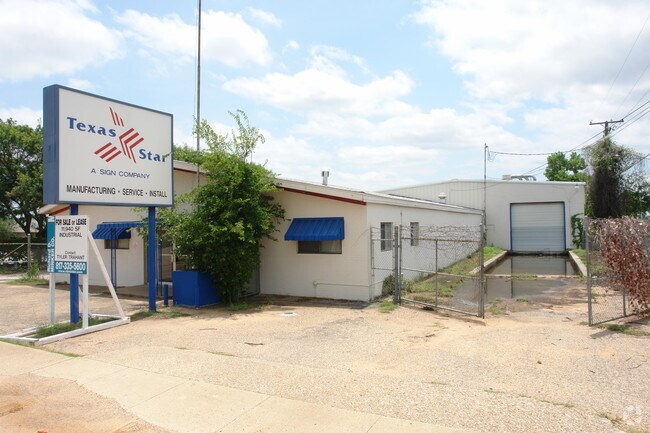
Property Record
229 W Hurst Blvd, Hurst, TX 76053


Property Detail
229 W Hurst Blvd
Dallas-Fort Worth-Arlington, TX
KELLY-MOORE SUBDIVISION LOT C1A & C1B
05657458
Tarrant
Commercialnec
Texas
B and X Area of moderate flood hazard, usually the area between the limits of the 100-year and 500-year floods.
s c1a
2024
0.84 AC
2025
W DFW Air/Grapevine
113408
Dallas/Ft Worth
11,800 SF
NEARBY LISTINGS FOR SALE OR LEASE
DEMOGRAPHICS near 229 W Hurst Blvd
1 mile
3 mile
5 mile
2025 Total Population
10,963
87,662
269,885
2030 Population
11,640
92,373
284,137
Pop Growth 2025-2030
+ 6.18%
+ 5.37%
+ 5.28%
Average Age
37
38
39
2025 Total Households
3,886
33,899
109,068
HH Growth 2025-2030
+ 6.18%
+ 5.48%
+ 5.45%
Median Household Inc
$78,760
$71,464
$74,024
Avg Household Size
2.70
2.50
2.40
2025 Avg HH Vehicles
2.00
2.00
2.00
Median Home Value
$265,893
$311,629
$336,907
Median Year Built
1971
1978
1982
Nearby Places
Map Layers
Map Styles
 Street
 Aerial
Transit
 Traffic
 Biking
Places
Listings with unknown addresses are not visible on the map
- Restaurants
- Banks
- Shops
- Fitness
- Groceries
PUBLIC TRANSPORTATION
COMMUTER RAIL
Drive
Walk
Distance
3 min
1.3 mi
Drive
Walk
Distance
7 min
2.8 mi
AIRPORT
Dallas-Fort Worth International
Drive
Walk
Distance
Dallas-Fort Worth International
22 min
13.2 mi
Dallas Love Field
Drive
Walk
Distance
Dallas Love Field
33 min
21.9 mi
Nearby Properties
Address
Land Use
TOTAL SIZE
Lot Size
Zoning
Address
Land Use
TOTAL SIZE
Lot Size
Zoning
1,300,314 SF
40.15 AC
Address
Land Use
TOTAL SIZE
Lot Size
Zoning
356,000 SF
39.44 AC
Address
Land Use
TOTAL SIZE
Lot Size
Zoning
521,150 SF
92.05 AC
Address
Land Use
TOTAL SIZE
Lot Size
Zoning
1,544,748 SF
76.25 AC
Address
Land Use
TOTAL SIZE
Lot Size
Zoning
174,596 SF
11.91 AC
Address
Land Use
TOTAL SIZE
Lot Size
Zoning
231,871 SF
17.08 AC
Address
Land Use
TOTAL SIZE
Lot Size
Zoning
260,590 SF
15.30 AC
Address
Land Use
TOTAL SIZE
Lot Size
Zoning
172,000 SF
6.34 AC
Address
Land Use
TOTAL SIZE
Lot Size
Zoning
318,602 SF
9.90 AC
Address
Land Use
TOTAL SIZE
Lot Size
Zoning
223,131 SF
12.50 AC
Address
Land Use
TOTAL SIZE
Lot Size
Zoning
236,701 SF
15.96 AC
Address
Land Use
TOTAL SIZE
Lot Size
Zoning
173,068 SF
15.55 AC
Address
Land Use
TOTAL SIZE
Lot Size
Zoning
232,295 SF
21.49 AC
Address
Land Use
TOTAL SIZE
Lot Size
Zoning
194,625 SF
15.07 AC
Address
Land Use
TOTAL SIZE
Lot Size
Zoning
220,650 SF
3.03 AC
Address
Land Use
TOTAL SIZE
Lot Size
Zoning
161,332 SF
8.56 AC
Address
Land Use
TOTAL SIZE
Lot Size
Zoning
445,900 SF
29.07 AC
Address
Land Use
TOTAL SIZE
Lot Size
Zoning
262,233 SF
16.13 AC
Address
Land Use
TOTAL SIZE
Lot Size
Zoning
192,482 SF
9.77 AC
Address
Land Use
TOTAL SIZE
Lot Size
Zoning
199,744 SF
9.99 AC
Address
Land Use
TOTAL SIZE
Lot Size
Zoning
165,762 SF
10.71 AC
Address
Land Use
TOTAL SIZE
Lot Size
Zoning
191,235 SF
10.93 AC
Address
Land Use
TOTAL SIZE
Lot Size
Zoning
270,576 SF
16.34 AC
Address
Land Use
TOTAL SIZE
Lot Size
Zoning
403,363 SF
24.03 AC
Address
Land Use
TOTAL SIZE
Lot Size
Zoning
139,440 SF
5.97 AC
Address
Land Use
TOTAL SIZE
Lot Size
Zoning
109,491 SF
10.01 AC
Address
Land Use
TOTAL SIZE
Lot Size
Zoning
162,898 SF
8.68 AC
Address
Land Use
TOTAL SIZE
Lot Size
Zoning
123,801 SF
10.44 AC
Address
Land Use
TOTAL SIZE
Lot Size
Zoning
161,346 SF
10.28 AC
Address
Land Use
TOTAL SIZE
Lot Size
Zoning
225,575 SF
16.61 AC
The World's #1 Commercial Real Estate Marketplace
Connect with us
© 2026 CoStar Group
The information above has been obtained from sources believed reliable. While we do not doubt its accuracy we have not verified it and make no guarantee, warranty or representation about it. It is your responsibility to independently confirm its accuracy and completeness. Any projections, opinions, assumptions, or estimates used are for example only and do not represent the current or future performance of the property. The value of this transaction to you depends on tax and other factors which should be evaluated by your tax, financial, and legal advisors. You and your advisors should conduct a careful, independent investigation of the property to determine to your satisfaction the suitability of the property for your needs.