Property Record
229 Walker St, Shafter, CA 93263
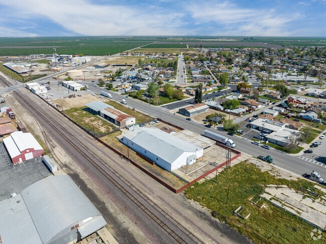


Property Detail
229 Walker St
027-070-13-00-4
CITY SHFTR , BLOCK 6 , LOT P
Lightindustrial
Kern
BP
California
B and X Area of moderate flood hazard, usually the area between the limits of the 100-year and 500-year floods.
p
2024
0.81 AC
2025
NW Outlying Kern County
004101
Bakersfield
11,010 SF
Bakersfield-Delano, CA
NEARBY LISTINGS FOR SALE OR LEASE
DEMOGRAPHICS near 229 Walker St
1 mile
3 mile
5 mile
2024 Total Population
17,486
22,850
23,565
2029 Population
17,643
22,966
23,663
Pop Growth 2024-2029
+ 0.90%
+ 0.51%
+ 0.42%
Average Age
32
32
33
2024 Total Households
4,816
5,978
6,094
HH Growth 2024-2029
+ 1.06%
+ 0.79%
+ 0.72%
Median Household Inc
$57,037
$58,186
$58,010
Avg Household Size
3.50
3.60
3.60
2024 Avg HH Vehicles
2.00
2.00
2.00
Median Home Value
$302,721
$294,694
$296,276
Median Year Built
1985
1989
1989
Nearby Places
Map Layers
Map Styles
 Street
 Aerial
Transit
 Traffic
 Biking
Places
Listings with unknown addresses are not visible on the map
- Restaurants
- Banks
- Shops
- Fitness
- Groceries
PUBLIC TRANSPORTATION
AIRPORT
Meadows Field
Drive
Walk
Distance
Meadows Field
25 min
15.3 mi
Freight Ports
The Port of Hueneme
Drive
Walk
Distance
The Port of Hueneme
173 min
139.9 mi
SALE & LEASE HISTORY
LISTING DATE
SALE/LEASE

Sep 25, 2016
For Lease
Sep 24, 2016
For Sale
Mar 31, 2023
For Sale
Jun 24, 2019
For Sale
Dec 28, 2017
For Lease
Aug 05, 2019
For Sale
Apr 07, 2023
For Lease
Nearby Properties
Address
Land Use
TOTAL SIZE
Lot Size
Zoning
Address
Land Use
TOTAL SIZE
Lot Size
Zoning
75,675 SF
8.43 AC
A
Address
Land Use
TOTAL SIZE
Lot Size
Zoning
8,340 SF
8.34 AC
R1
Address
Land Use
TOTAL SIZE
Lot Size
Zoning
92,011 SF
8.32 AC
Address
Land Use
TOTAL SIZE
Lot Size
Zoning
75,675 SF
8.43 AC
A
Address
Land Use
TOTAL SIZE
Lot Size
Zoning
1,415 SF
38.64 AC
A
Address
Land Use
TOTAL SIZE
Lot Size
Zoning
3,119 SF
153.42 AC
BP
Address
Land Use
TOTAL SIZE
Lot Size
Zoning
75.88 AC
Address
Land Use
TOTAL SIZE
Lot Size
Zoning
140.40 AC
A
Address
Land Use
TOTAL SIZE
Lot Size
Zoning
17,588 SF
1.66 AC
GC
Address
Land Use
TOTAL SIZE
Lot Size
Zoning
38.18 AC
A
Address
Land Use
TOTAL SIZE
Lot Size
Zoning
Address
Land Use
TOTAL SIZE
Lot Size
Zoning
14.49 AC
A
Address
Land Use
TOTAL SIZE
Lot Size
Zoning
7,437 SF
0.75 AC
GC
Address
Land Use
TOTAL SIZE
Lot Size
Zoning
318.18 AC
A
Address
Land Use
TOTAL SIZE
Lot Size
Zoning
5,200 SF
14.31 AC
Address
Land Use
TOTAL SIZE
Lot Size
Zoning
21,357 SF
1.38 AC
R1
Address
Land Use
TOTAL SIZE
Lot Size
Zoning
9,720 SF
7.87 AC
M-2
Address
Land Use
TOTAL SIZE
Lot Size
Zoning
9.14 AC
A
Address
Land Use
TOTAL SIZE
Lot Size
Zoning
159 AC
A
Address
Land Use
TOTAL SIZE
Lot Size
Zoning
1,200 SF
0.17 AC
R-2
Address
Land Use
TOTAL SIZE
Lot Size
Zoning
10,715 SF
1.45 AC
Address
Land Use
TOTAL SIZE
Lot Size
Zoning
2,100 SF
0.61 AC
GC
Address
Land Use
TOTAL SIZE
Lot Size
Zoning
12,361 SF
1.24 AC
Address
Land Use
TOTAL SIZE
Lot Size
Zoning
147 AC
A
Address
Land Use
TOTAL SIZE
Lot Size
Zoning
7,105 SF
0.95 AC
Address
Land Use
TOTAL SIZE
Lot Size
Zoning
254.17 AC
A
Address
Land Use
TOTAL SIZE
Lot Size
Zoning
4,100 SF
7.28 AC
M
Address
Land Use
TOTAL SIZE
Lot Size
Zoning
6,050 SF
4.73 AC
Address
Land Use
TOTAL SIZE
Lot Size
Zoning
8,000 SF
0.71 AC
DC
Address
Land Use
TOTAL SIZE
Lot Size
Zoning
33,708 SF
2.79 AC
The World's #1 Commercial Real Estate Marketplace
Connect with us
© 2026 CoStar Group
The information above has been obtained from sources believed reliable. While we do not doubt its accuracy we have not verified it and make no guarantee, warranty or representation about it. It is your responsibility to independently confirm its accuracy and completeness. Any projections, opinions, assumptions, or estimates used are for example only and do not represent the current or future performance of the property. The value of this transaction to you depends on tax and other factors which should be evaluated by your tax, financial, and legal advisors. You and your advisors should conduct a careful, independent investigation of the property to determine to your satisfaction the suitability of the property for your needs.