Property Record
2290 Old State Route 32, Batavia, OH 45103
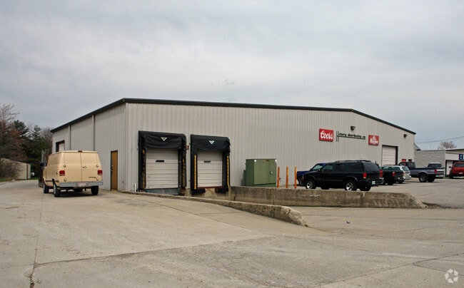

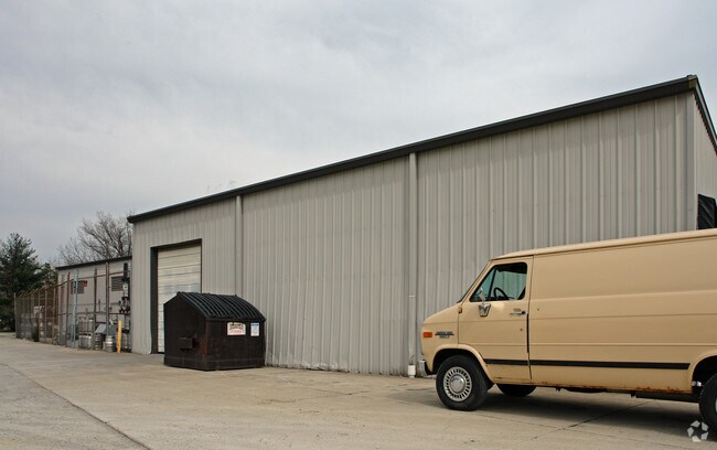
Property Detail
2290 Old State Route 32
01-20-11B-080
Clermont
Warehouse
Ohio
B and X Area of moderate flood hazard, usually the area between the limits of the 100-year and 500-year floods.
1.09 AC
2025
East
2025
Cincinnati/Dayton
041002
Cincinnati, OH-KY-IN
19,243 SF
NEARBY LISTINGS FOR SALE OR LEASE
DEMOGRAPHICS near 2290 Old State Route 32
1 mile
3 mile
5 mile
2025 Total Population
2,497
11,241
34,635
2030 Population
2,560
11,555
35,765
Pop Growth 2025-2030
+ 2.52%
+ 2.79%
+ 3.26%
Average Age
41
40
40
2025 Total Households
888
4,044
13,022
HH Growth 2025-2030
+ 2.48%
+ 2.89%
+ 3.32%
Median Household Inc
$99,553
$77,145
$75,912
Avg Household Size
2.70
2.60
2.60
2025 Avg HH Vehicles
2.00
2.00
2.00
Median Home Value
$296,566
$269,924
$287,631
Median Year Built
1992
1987
1992
Nearby Places
Map Layers
Map Styles
 Street
 Aerial
Layers
 Traffic
 Biking
Places
Listings with unknown addresses are not visible on the map
- Restaurants
- Banks
- Shops
- Fitness
- Groceries
PUBLIC TRANSPORTATION
AIRPORT
Cincinnati/Northern Kentucky International
Drive
Walk
Distance
Cincinnati/Northern Kentucky International
53 min
34.6 mi
Nearby Properties
Address
Land Use
TOTAL SIZE
Lot Size
Zoning
Address
Land Use
TOTAL SIZE
Lot Size
Zoning
Address
Land Use
TOTAL SIZE
Lot Size
Zoning
58.36 AC
Address
Land Use
TOTAL SIZE
Lot Size
Zoning
23,380 SF
91.85 AC
Address
Land Use
TOTAL SIZE
Lot Size
Zoning
11,636 SF
49.40 AC
Address
Land Use
TOTAL SIZE
Lot Size
Zoning
973,058 SF
61.50 AC
Address
Land Use
TOTAL SIZE
Lot Size
Zoning
11,215 SF
20.57 AC
Address
Land Use
TOTAL SIZE
Lot Size
Zoning
20,468 SF
143.20 AC
Address
Land Use
TOTAL SIZE
Lot Size
Zoning
Address
Land Use
TOTAL SIZE
Lot Size
Zoning
Address
Land Use
TOTAL SIZE
Lot Size
Zoning
617,760 SF
46.80 AC
Address
Land Use
TOTAL SIZE
Lot Size
Zoning
11,566 SF
28.70 AC
Address
Land Use
TOTAL SIZE
Lot Size
Zoning
26,263 SF
49.43 AC
Address
Land Use
TOTAL SIZE
Lot Size
Zoning
494,336 SF
65.71 AC
Address
Land Use
TOTAL SIZE
Lot Size
Zoning
6,987 SF
80.44 AC
Address
Land Use
TOTAL SIZE
Lot Size
Zoning
47,260 SF
44.88 AC
Address
Land Use
TOTAL SIZE
Lot Size
Zoning
17,253 SF
10.59 AC
Address
Land Use
TOTAL SIZE
Lot Size
Zoning
Address
Land Use
TOTAL SIZE
Lot Size
Zoning
30,540 SF
20.57 AC
Address
Land Use
TOTAL SIZE
Lot Size
Zoning
481,944 SF
23.27 AC
Address
Land Use
TOTAL SIZE
Lot Size
Zoning
35,046 SF
0.76 AC
Address
Land Use
TOTAL SIZE
Lot Size
Zoning
2,688 SF
16.09 AC
Address
Land Use
TOTAL SIZE
Lot Size
Zoning
8,144 SF
41.50 AC
Address
Land Use
TOTAL SIZE
Lot Size
Zoning
5,712 SF
10.76 AC
Address
Land Use
TOTAL SIZE
Lot Size
Zoning
4,812 SF
14.08 AC
Address
Land Use
TOTAL SIZE
Lot Size
Zoning
617,760 SF
46.80 AC
Address
Land Use
TOTAL SIZE
Lot Size
Zoning
158,700 SF
31.20 AC
Address
Land Use
TOTAL SIZE
Lot Size
Zoning
5,712 SF
10.76 AC
Address
Land Use
TOTAL SIZE
Lot Size
Zoning
2,856 SF
36.20 AC
Address
Land Use
TOTAL SIZE
Lot Size
Zoning
228,888 SF
20.10 AC
Address
Land Use
TOTAL SIZE
Lot Size
Zoning
81,672 SF
10.57 AC
The World's #1 Commercial Real Estate Marketplace
Connect with us
© 2026 CoStar Group
The information above has been obtained from sources believed reliable. While we do not doubt its accuracy we have not verified it and make no guarantee, warranty or representation about it. It is your responsibility to independently confirm its accuracy and completeness. Any projections, opinions, assumptions, or estimates used are for example only and do not represent the current or future performance of the property. The value of this transaction to you depends on tax and other factors which should be evaluated by your tax, financial, and legal advisors. You and your advisors should conduct a careful, independent investigation of the property to determine to your satisfaction the suitability of the property for your needs.