Property Record
22901 W 83Rd St, Lenexa, KS 66227
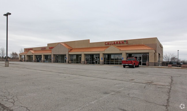

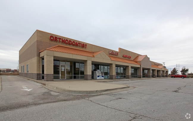
Property Detail
22901 W 83Rd St
IP22780000-0001
83RD STREET EQUITIES LT 1 LEC 478 4B 1
Regionalshoppingcenterormallwithanchorstore
JOHNSON
CP2
Kansas
B and X Area of moderate flood hazard, usually the area between the limits of the 100-year and 500-year floods.
1
2024
2.45 AC
2025
Northwest Johnson County
052608
Kansas City
11,280 SF
Kansas City, MO-KS
NEARBY LISTINGS FOR SALE OR LEASE
DEMOGRAPHICS near 22901 W 83Rd St
1 mile
3 mile
5 mile
2025 Total Population
2,784
25,343
79,968
2030 Population
2,958
26,672
83,266
Pop Growth 2025-2030
+ 6.25%
+ 5.24%
+ 4.12%
Average Age
41
40
40
2025 Total Households
984
8,838
29,321
HH Growth 2025-2030
+ 6.30%
+ 5.39%
+ 4.23%
Median Household Inc
$145,039
$153,078
$137,937
Avg Household Size
2.80
2.80
2.70
2025 Avg HH Vehicles
2.00
2.00
2.00
Median Home Value
$464,464
$504,185
$458,725
Median Year Built
2008
2006
2003
Nearby Places
Map Layers
Map Styles
 Street
 Aerial
Transit
 Traffic
 Biking
Places
Listings with unknown addresses are not visible on the map
- Restaurants
- Banks
- Shops
- Fitness
- Groceries
PUBLIC TRANSPORTATION
AIRPORT
Kansas City International
Drive
Walk
Distance
Kansas City International
45 min
36.4 mi
SALE & LEASE HISTORY
LISTING DATE
SALE/LEASE

Sep 25, 2016
For Lease
Sep 25, 2016
For Lease
Oct 23, 2024
For Lease
Mar 07, 2024
For Sale
Feb 05, 2021
For Lease
Nearby Properties
Address
Land Use
TOTAL SIZE
Lot Size
Zoning
Address
Land Use
TOTAL SIZE
Lot Size
Zoning
39,668 SF
6.02 AC
Address
Land Use
TOTAL SIZE
Lot Size
Zoning
163,515 SF
70.39 AC
R1
Address
Land Use
TOTAL SIZE
Lot Size
Zoning
106,283 SF
11.79 AC
R1
Address
Land Use
TOTAL SIZE
Lot Size
Zoning
146,926 SF
29.23 AC
R-1
Address
Land Use
TOTAL SIZE
Lot Size
Zoning
91,639 SF
19.51 AC
R1
Address
Land Use
TOTAL SIZE
Lot Size
Zoning
192,548 SF
20.09 AC
BP
Address
Land Use
TOTAL SIZE
Lot Size
Zoning
69,675 SF
11.85 AC
R1
Address
Land Use
TOTAL SIZE
Lot Size
Zoning
32,186 SF
2.80 AC
CH
Address
Land Use
TOTAL SIZE
Lot Size
Zoning
138,758 SF
36.62 AC
BP
Address
Land Use
TOTAL SIZE
Lot Size
Zoning
67,008 SF
26.85 AC
AG
Address
Land Use
TOTAL SIZE
Lot Size
Zoning
100,591 SF
33.88 AC
AG
Address
Land Use
TOTAL SIZE
Lot Size
Zoning
99,600 SF
7.77 AC
PI
Address
Land Use
TOTAL SIZE
Lot Size
Zoning
75,626 SF
17.48 AC
AG
Address
Land Use
TOTAL SIZE
Lot Size
Zoning
42,261 SF
9.58 AC
R1
Address
Land Use
TOTAL SIZE
Lot Size
Zoning
74,420 SF
20.04 AC
AG
Address
Land Use
TOTAL SIZE
Lot Size
Zoning
73,003 SF
15.62 AC
R1
Address
Land Use
TOTAL SIZE
Lot Size
Zoning
30,751 SF
9.73 AC
R1
Address
Land Use
TOTAL SIZE
Lot Size
Zoning
515,334 SF
58.88 AC
BP
Address
Land Use
TOTAL SIZE
Lot Size
Zoning
30.82 AC
BP
Address
Land Use
TOTAL SIZE
Lot Size
Zoning
52,710 SF
29.55 AC
AG
Address
Land Use
TOTAL SIZE
Lot Size
Zoning
24,208 SF
8.13 AC
CPO
Address
Land Use
TOTAL SIZE
Lot Size
Zoning
28,707 SF
11.92 AC
R1
Address
Land Use
TOTAL SIZE
Lot Size
Zoning
483,724 SF
50.52 AC
BP
Address
Land Use
TOTAL SIZE
Lot Size
Zoning
4.93 AC
CTY RUR
Address
Land Use
TOTAL SIZE
Lot Size
Zoning
32,412 SF
19.93 AC
BP
Address
Land Use
TOTAL SIZE
Lot Size
Zoning
13,500 SF
10.92 AC
R1
Address
Land Use
TOTAL SIZE
Lot Size
Zoning
24,478 SF
3.10 AC
R1
Address
Land Use
TOTAL SIZE
Lot Size
Zoning
20,832 SF
19.85 AC
AG
Address
Land Use
TOTAL SIZE
Lot Size
Zoning
40,568 SF
9.85 AC
AG
Address
Land Use
TOTAL SIZE
Lot Size
Zoning
12,746 SF
8.99 AC
AG
The World's #1 Commercial Real Estate Marketplace
Connect with us
© 2026 CoStar Group
The information above has been obtained from sources believed reliable. While we do not doubt its accuracy we have not verified it and make no guarantee, warranty or representation about it. It is your responsibility to independently confirm its accuracy and completeness. Any projections, opinions, assumptions, or estimates used are for example only and do not represent the current or future performance of the property. The value of this transaction to you depends on tax and other factors which should be evaluated by your tax, financial, and legal advisors. You and your advisors should conduct a careful, independent investigation of the property to determine to your satisfaction the suitability of the property for your needs.