No Photo
Property Record
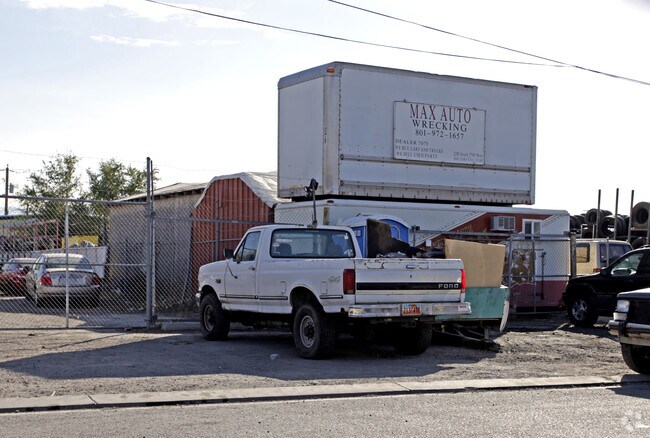
2291 S 5700 W, West Valley City, UT 84128

NEARBY LISTINGS FOR SALE OR LEASE
Property Detail
2291 S 5700 W
Salt Lake City, UT
Haynes Addn
14-23-278-024-0000
LOTS 17 TO 24, INCL BLK 7, HAYNES ADD PLAT E. TOGETHER WITH 1/2 VACATED ALLEY ABUTTING ON W. 6582-2933 6584-0001 9075-9096 10393-9338
Industrialacreage
Salt Lake
X
Utah
49035C0275G
17-24
2024
0.36 AC
2025
West Valley/Lake Park
113415
Salt Lake City
DEMOGRAPHICS near 2291 S 5700 W
1 Mile
3 Mile
5 Mile
2024 Total Population
2,791
62,952
172,725
2029 Population
2,813
63,166
173,610
Pop Growth 2024-2029
+ 0.79%
+ 0.34%
+ 0.51%
Average Age
33
35
35
2024 Total Households
813
17,280
49,326
HH Growth 2024-2029
+ 0.74%
+ 0.20%
+ 0.44%
Median Household Inc
$79,378
$80,878
$73,689
Avg Household Size
3.40
3.50
3.40
2024 Avg HH Vehicles
2.00
2.00
2.00
Median Home Value
$371,428
$342,542
$330,406
Median Year Built
2001
1983
1978
Nearby Places
Map Layers
Map Styles
 Street
 Aerial
- Restaurants
- Banks
- Shops
- Fitness
- Groceries
PUBLIC TRANSPORTATION
AIRPORT
Salt Lake City International
DRIVE
WALK
Distance
Salt Lake City International
11 min
6.7 mi
Freight Ports
Port of Stockton
DRIVE
WALK
Distance
Port of Stockton
708 min
691.1 mi
Nearby Properties
Address
Land Use
TOTAL SIZE
Lot Size
Zoning
Address
Land Use
TOTAL SIZE
Lot Size
Zoning
906,418 SF
46.97 AC
IP-M-1
Address
Land Use
TOTAL SIZE
Lot Size
Zoning
329,306 SF
14.67 AC
5005
Address
Land Use
TOTAL SIZE
Lot Size
Zoning
867,303 SF
49 AC
IP-M-1
Address
Land Use
TOTAL SIZE
Lot Size
Zoning
690,542 SF
35.75 AC
M-1
Address
Land Use
TOTAL SIZE
Lot Size
Zoning
554,622 SF
35.88 AC
M-1
Address
Land Use
TOTAL SIZE
Lot Size
Zoning
432,730 SF
13.03 AC
R-M
Address
Land Use
TOTAL SIZE
Lot Size
Zoning
475,627 SF
61.96 AC
M-1
Address
Land Use
TOTAL SIZE
Lot Size
Zoning
10,353 SF
143.39 AC
IP-CG
Address
Land Use
TOTAL SIZE
Lot Size
Zoning
544,602 SF
34.39 AC
M1
Address
Land Use
TOTAL SIZE
Lot Size
Zoning
429,554 SF
24.49 AC
M1
Address
Land Use
TOTAL SIZE
Lot Size
Zoning
634,402 SF
32.29 AC
IP-M
Address
Land Use
TOTAL SIZE
Lot Size
Zoning
505,079 SF
30.07 AC
M-1
Address
Land Use
TOTAL SIZE
Lot Size
Zoning
529,870 SF
13.35 AC
R-M
Address
Land Use
TOTAL SIZE
Lot Size
Zoning
467,592 SF
22.56 AC
IP-M-1
Address
Land Use
TOTAL SIZE
Lot Size
Zoning
482,870 SF
31.13 AC
M-1
Address
Land Use
TOTAL SIZE
Lot Size
Zoning
475,592 SF
24.09 AC
M-1
Address
Land Use
TOTAL SIZE
Lot Size
Zoning
505,079 SF
25.87 AC
M-1
Address
Land Use
TOTAL SIZE
Lot Size
Zoning
832,383 SF
19.61 AC
IP-M
Address
Land Use
TOTAL SIZE
Lot Size
Zoning
426,280 SF
19.84 AC
M1
Address
Land Use
TOTAL SIZE
Lot Size
Zoning
491,507 SF
28.48 AC
M-1
Address
Land Use
TOTAL SIZE
Lot Size
Zoning
491,507 SF
28.28 AC
M-1
Address
Land Use
TOTAL SIZE
Lot Size
Zoning
436,903 SF
27.09 AC
M-1
Address
Land Use
TOTAL SIZE
Lot Size
Zoning
480,159 SF
56.52 AC
M-1
Address
Land Use
TOTAL SIZE
Lot Size
Zoning
431,400 SF
23.99 AC
IP-M-1
Address
Land Use
TOTAL SIZE
Lot Size
Zoning
5,953 SF
225.72 AC
M-1
Address
Land Use
TOTAL SIZE
Lot Size
Zoning
384,529 SF
22.92 AC
IP-M-1
Address
Land Use
TOTAL SIZE
Lot Size
Zoning
482,768 SF
22.90 AC
M-1
Address
Land Use
TOTAL SIZE
Lot Size
Zoning
98,479 SF
49.57 AC
M-1
Address
Land Use
TOTAL SIZE
Lot Size
Zoning
270,383 SF
37.71 AC
IP-M-1
Address
Land Use
TOTAL SIZE
Lot Size
Zoning
387,633 SF
24 AC
M-1
The World's #1 Commercial Real Estate Marketplace
Connect with us
© 2026 CoStar Group
The information above has been obtained from sources believed reliable. While we do not doubt its accuracy we have not verified it and make no guarantee, warranty or representation about it. It is your responsibility to independently confirm its accuracy and completeness. Any projections, opinions, assumptions, or estimates used are for example only and do not represent the current or future performance of the property. The value of this transaction to you depends on tax and other factors which should be evaluated by your tax, financial, and legal advisors. You and your advisors should conduct a careful, independent investigation of the property to determine to your satisfaction the suitability of the property for your needs.