Property Record
2292 Mayport Rd, Jacksonville, FL 32233


Save to a Folder
{{folder.Name}}
{{folder.ListingIds.length}} Properties
{{folder.ListingIds.length}} Property
Create a New Folder
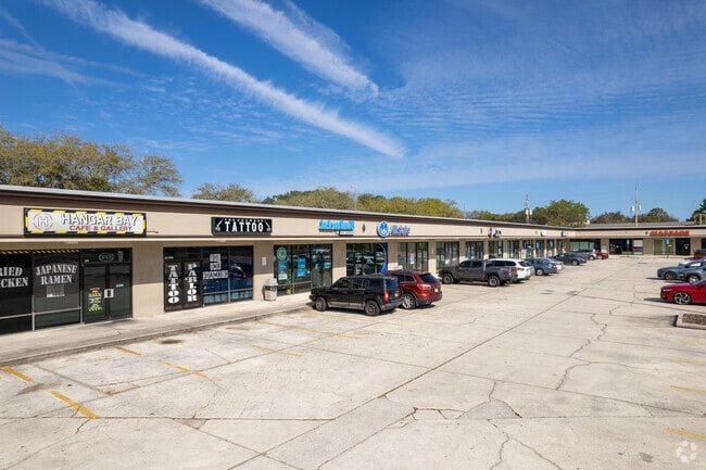
Property Detail
2292 Mayport Rd
169404-0600
08-2S-29E PT GOVT LOTS 3,6 RECD O/R BK 6047-2028 BEING PARCELS A & B
Regionalshoppingcenterormallwithanchorstore
Duval
CCG-1
Florida
B and X Area of moderate flood hazard, usually the area between the limits of the 100-year and 500-year floods.
3,6
2025
5.96 AC
2026
Beaches
013901
Jacksonville (Florida)
64,960 SF
Jacksonville, FL
NEARBY LISTINGS FOR SALE OR LEASE
DEMOGRAPHICS near 2292 Mayport Rd
1 mile
3 mile
5 mile
2025 Total Population
11,864
43,563
105,794
2030 Population
12,622
46,239
111,483
Pop Growth 2025-2030
+ 6.39%
+ 6.14%
+ 5.38%
Average Age
43
42
41
2025 Total Households
5,187
17,548
42,705
HH Growth 2025-2030
+ 6.73%
+ 6.42%
+ 5.75%
Median Household Inc
$80,859
$95,467
$101,209
Avg Household Size
2.20
2.30
2.40
2025 Avg HH Vehicles
2.00
2.00
2.00
Median Home Value
$422,368
$545,911
$450,286
Median Year Built
1987
1985
1990
Nearby Places
Map Layers
Map Styles
 Street
 Aerial
Layers
 Traffic
 Biking
Places
Listings with unknown addresses are not visible on the map
- Restaurants
- Banks
- Shops
- Fitness
- Groceries
PUBLIC TRANSPORTATION
AIRPORT
Jacksonville International
Drive
Walk
Distance
Jacksonville International
39 min
25.0 mi
Freight Ports
Jacksonville Port
Drive
Walk
Distance
Jacksonville Port
32 min
17.9 mi
SALE & LEASE HISTORY
LISTING DATE
SALE/LEASE

Sep 25, 2016
For Lease
Nearby Properties
Address
Land Use
TOTAL SIZE
Lot Size
Zoning
Address
Land Use
TOTAL SIZE
Lot Size
Zoning
1 SF
1,309.30 AC
PBF-1
Address
Land Use
TOTAL SIZE
Lot Size
Zoning
240,363 SF
24.71 AC
PUD
Address
Land Use
TOTAL SIZE
Lot Size
Zoning
178,884 SF
12.54 AC
PUD
Address
Land Use
TOTAL SIZE
Lot Size
Zoning
675,298 SF
70.05 AC
APUD
Address
Land Use
TOTAL SIZE
Lot Size
Zoning
194,953 SF
22.43 AC
PUD
Address
Land Use
TOTAL SIZE
Lot Size
Zoning
34,612 SF
446.76 AC
PBF-1
Address
Land Use
TOTAL SIZE
Lot Size
Zoning
265,386 SF
29.35 AC
RMD-C
Address
Land Use
TOTAL SIZE
Lot Size
Zoning
65,384 SF
2.33 AC
ACG
Address
Land Use
TOTAL SIZE
Lot Size
Zoning
244,454 SF
14.76 AC
NR-5
Address
Land Use
TOTAL SIZE
Lot Size
Zoning
206,990 SF
15.79 AC
RMD-D
Address
Land Use
TOTAL SIZE
Lot Size
Zoning
185,402 SF
14.03 AC
RMD-C
Address
Land Use
TOTAL SIZE
Lot Size
Zoning
171,440 SF
11.14 AC
PUD
Address
Land Use
TOTAL SIZE
Lot Size
Zoning
157,942 SF
15.55 AC
PUD
Address
Land Use
TOTAL SIZE
Lot Size
Zoning
219,659 SF
21.37 AC
NR-1
Address
Land Use
TOTAL SIZE
Lot Size
Zoning
167,476 SF
12.89 AC
RMD-C
Address
Land Use
TOTAL SIZE
Lot Size
Zoning
120,233 SF
14.08 AC
ACG
Address
Land Use
TOTAL SIZE
Lot Size
Zoning
248,601 SF
43.01 AC
PBF-1
Address
Land Use
TOTAL SIZE
Lot Size
Zoning
151,117 SF
10.04 AC
RMD-C
Address
Land Use
TOTAL SIZE
Lot Size
Zoning
95,879 SF
14.46 AC
PUD
Address
Land Use
TOTAL SIZE
Lot Size
Zoning
100,039 SF
6.30 AC
ARG-M
Address
Land Use
TOTAL SIZE
Lot Size
Zoning
110,902 SF
8.15 AC
RMD-C
Address
Land Use
TOTAL SIZE
Lot Size
Zoning
55,659 SF
6.91 AC
PUD
Address
Land Use
TOTAL SIZE
Lot Size
Zoning
80,746 SF
11.68 AC
NC-3
Address
Land Use
TOTAL SIZE
Lot Size
Zoning
123,803 SF
11.87 AC
PUD
Address
Land Use
TOTAL SIZE
Lot Size
Zoning
98,393 SF
6.50 AC
RMD-C
Address
Land Use
TOTAL SIZE
Lot Size
Zoning
119,618 SF
4.65 AC
ACG
Address
Land Use
TOTAL SIZE
Lot Size
Zoning
57,024 SF
1.49 AC
CCG-1
Address
Land Use
TOTAL SIZE
Lot Size
Zoning
6,863 SF
44.04 AC
PUD
Address
Land Use
TOTAL SIZE
Lot Size
Zoning
62,151 SF
7.99 AC
NC-3
Address
Land Use
TOTAL SIZE
Lot Size
Zoning
123,999 SF
76.43 AC
PBF-2
The World's #1 Commercial Real Estate Marketplace
Connect with us
© 2026 CoStar Group
The information above has been obtained from sources believed reliable. While we do not doubt its accuracy we have not verified it and make no guarantee, warranty or representation about it. It is your responsibility to independently confirm its accuracy and completeness. Any projections, opinions, assumptions, or estimates used are for example only and do not represent the current or future performance of the property. The value of this transaction to you depends on tax and other factors which should be evaluated by your tax, financial, and legal advisors. You and your advisors should conduct a careful, independent investigation of the property to determine to your satisfaction the suitability of the property for your needs.