Property Record
2295 Etting Rd, Oxnard, CA 93033
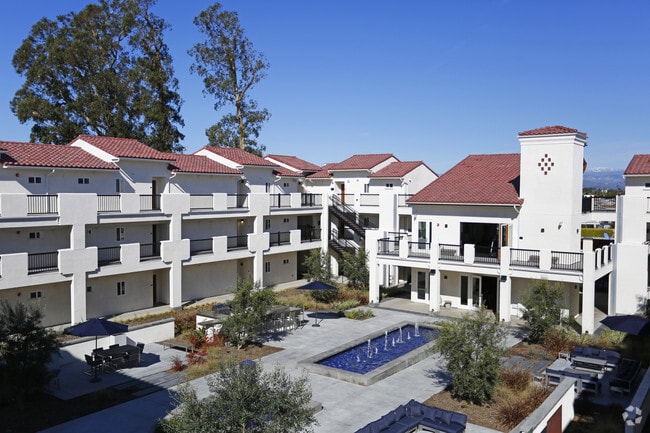


Property Detail
2295 Etting Rd
225-0-014-250
PR APN 2250014190
Apartment
Ventura
B and X Area of moderate flood hazard, usually the area between the limits of the 100-year and 500-year floods.
California
2024
4.54 AC
2025
Mar Vista Oxnard
004715
Los Angeles
79,556 SF
Oxnard-Thousand Oaks-Ventura, CA
NEARBY LISTINGS FOR SALE OR LEASE
DEMOGRAPHICS near 2295 Etting Rd
1 mile
3 mile
5 mile
2025 Total Population
15,238
99,251
205,984
2030 Population
15,053
98,139
204,637
Pop Growth 2025-2030
(1.21%)
(1.12%)
(0.65%)
Average Age
37
36
37
2025 Total Households
3,541
22,962
55,076
HH Growth 2025-2030
(1.33%)
(1.17%)
(0.46%)
Median Household Inc
$94,610
$82,132
$88,587
Avg Household Size
4.00
4.00
3.50
2025 Avg HH Vehicles
3.00
2.00
2.00
Median Home Value
$538,397
$621,850
$690,736
Median Year Built
1974
1968
1973
Nearby Places
Map Layers
Map Styles
 Street
 Aerial
Layers
 Traffic
 Biking
Places
Listings with unknown addresses are not visible on the map
- Restaurants
- Banks
- Shops
- Fitness
- Groceries
PUBLIC TRANSPORTATION
COMMUTER RAIL
Oxnard (Ventura County Line - Southern California Regional Rail Authority (Metrolink))
Drive
Walk
Distance
Oxnard (Ventura County Line - Southern California Regional Rail Authority (Metrolink))
7 min
4.0 mi
East Ventura Metrolink Station (Metrolink Ventura County Line - Metrolink Trains)
Drive
Walk
Distance
East Ventura Metrolink Station (Metrolink Ventura County Line - Metrolink Trains)
14 min
9.3 mi
Freight Ports
The Port of Hueneme
Drive
Walk
Distance
The Port of Hueneme
7 min
3.4 mi
Nearby Properties
Address
Land Use
TOTAL SIZE
Lot Size
Zoning
Address
Land Use
TOTAL SIZE
Lot Size
Zoning
90,086 SF
10.48 AC
CDI
Address
Land Use
TOTAL SIZE
Lot Size
Zoning
11.28 AC
CMPD
Address
Land Use
TOTAL SIZE
Lot Size
Zoning
30,800 SF
32.79 AC
M-1-
Address
Land Use
TOTAL SIZE
Lot Size
Zoning
8,398 SF
45.88 AC
M1PD
Address
Land Use
TOTAL SIZE
Lot Size
Zoning
129,018 SF
5.09 AC
R3PD
Address
Land Use
TOTAL SIZE
Lot Size
Zoning
133,174 SF
5.94 AC
R3PD
Address
Land Use
TOTAL SIZE
Lot Size
Zoning
770 SF
9.80 AC
M1
Address
Land Use
TOTAL SIZE
Lot Size
Zoning
157,108 SF
21.40 AC
MULT
Address
Land Use
TOTAL SIZE
Lot Size
Zoning
20,349 SF
9.65 AC
C2
Address
Land Use
TOTAL SIZE
Lot Size
Zoning
72,335 SF
10.67 AC
Address
Land Use
TOTAL SIZE
Lot Size
Zoning
7.95 AC
M2
Address
Land Use
TOTAL SIZE
Lot Size
Zoning
81,233 SF
3.29 AC
R3PD
Address
Land Use
TOTAL SIZE
Lot Size
Zoning
79,117 SF
3.25 AC
R3PD
Address
Land Use
TOTAL SIZE
Lot Size
Zoning
6,279 SF
5.53 AC
M2PD
Address
Land Use
TOTAL SIZE
Lot Size
Zoning
51,694 SF
2.75 AC
Address
Land Use
TOTAL SIZE
Lot Size
Zoning
1,800 SF
8.84 AC
M1
Address
Land Use
TOTAL SIZE
Lot Size
Zoning
14,931 SF
14.08 AC
Address
Land Use
TOTAL SIZE
Lot Size
Zoning
2,320 SF
12.02 AC
M1
Address
Land Use
TOTAL SIZE
Lot Size
Zoning
44,806 SF
17.71 AC
Address
Land Use
TOTAL SIZE
Lot Size
Zoning
2,264 SF
13.03 AC
M1
Address
Land Use
TOTAL SIZE
Lot Size
Zoning
117,030 SF
17.35 AC
M1PD
Address
Land Use
TOTAL SIZE
Lot Size
Zoning
118,518 SF
7.47 AC
Address
Land Use
TOTAL SIZE
Lot Size
Zoning
200.55 AC
AE-40
Address
Land Use
TOTAL SIZE
Lot Size
Zoning
80,002 SF
3.16 AC
MLPD
Address
Land Use
TOTAL SIZE
Lot Size
Zoning
81,743 SF
3.38 AC
Address
Land Use
TOTAL SIZE
Lot Size
Zoning
81,052 SF
11.23 AC
M1PD
Address
Land Use
TOTAL SIZE
Lot Size
Zoning
108,430 SF
5.90 AC
Address
Land Use
TOTAL SIZE
Lot Size
Zoning
48,720 SF
2.76 AC
R2PD
Address
Land Use
TOTAL SIZE
Lot Size
Zoning
32,410 SF
1.40 AC
MLPD
The World's #1 Commercial Real Estate Marketplace
Connect with us
© 2026 CoStar Group
The information above has been obtained from sources believed reliable. While we do not doubt its accuracy we have not verified it and make no guarantee, warranty or representation about it. It is your responsibility to independently confirm its accuracy and completeness. Any projections, opinions, assumptions, or estimates used are for example only and do not represent the current or future performance of the property. The value of this transaction to you depends on tax and other factors which should be evaluated by your tax, financial, and legal advisors. You and your advisors should conduct a careful, independent investigation of the property to determine to your satisfaction the suitability of the property for your needs.