Property Record
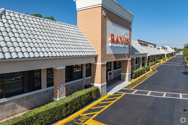
22973 State Road 7, Boca Raton, FL 33428

NEARBY LISTINGS FOR SALE OR LEASE
Property Detail
22973 State Road 7
West Palm Beach-Boca Raton-Delray Beach, FL
Fla Fruit Lands Co In
00-41-47-25-01-055-0020
36-47-41~ WLY 394.93 FT OF ELY543.58 FT OF N 420 FT OF NE 1/4 IN OR2298P500 (LESS E 99 FT)
Regionalshoppingcenterormallwithanchorstore
Palm Beach
2024
Florida
2025
4.43 AC
007732
Palm Bch Cty Outlying
41,130 SF
South Florida
DEMOGRAPHICS near 22973 State Road 7
1 Mile
3 Mile
5 Mile
2024 Total Population
21,906
102,202
281,326
2029 Population
22,439
103,414
284,884
Pop Growth 2024-2029
+ 2.43%
+ 1.19%
+ 1.26%
Average Age
39
41
44
2024 Total Households
7,760
37,062
112,983
HH Growth 2024-2029
+ 2.10%
+ 0.81%
+ 1.34%
Median Household Inc
$63,515
$85,479
$73,672
Avg Household Size
2.70
2.60
2.40
2024 Avg HH Vehicles
2.00
2.00
2.00
Median Home Value
$320,473
$406,146
$365,347
Median Year Built
1985
1988
1986
Nearby Places
Map Layers
Map Styles
 Street
 Aerial
- Restaurants
- Banks
- Shops
- Fitness
- Groceries
PUBLIC TRANSPORTATION
COMMUTER RAIL
Deerfield Beach (Tri-County Commuter - South Florida Regional Transportation Authority (Tri-Rail))
DRIVE
WALK
Distance
Deerfield Beach (Tri-County Commuter - South Florida Regional Transportation Authority (Tri-Rail))
12 min
6.3 mi
Pompano Beach (Tri-County Commuter - South Florida Regional Transportation Authority (Tri-Rail))
DRIVE
WALK
Distance
Pompano Beach (Tri-County Commuter - South Florida Regional Transportation Authority (Tri-Rail))
16 min
9.3 mi
AIRPORT
Fort Lauderdale/Hollywood International
DRIVE
WALK
Distance
Fort Lauderdale/Hollywood International
38 min
26.9 mi
Palm Beach International
DRIVE
WALK
Distance
Palm Beach International
42 min
31.0 mi
Freight Ports
Port Everglades
DRIVE
WALK
Distance
Port Everglades
37 min
25.6 mi
SALE & LEASE HISTORY
LISTING DATE
SALE/LEASE

Sep 30, 2019
For Lease
Sep 17, 2018
For Lease
Aug 20, 2019
For Lease
Nearby Properties
Address
Land Use
TOTAL SIZE
Lot Size
Zoning
Address
Land Use
TOTAL SIZE
Lot Size
Zoning
642,666 SF
16.33 AC
MXPD
Address
Land Use
TOTAL SIZE
Lot Size
Zoning
743,452 SF
25.24 AC
RTS
Address
Land Use
TOTAL SIZE
Lot Size
Zoning
600,712 SF
19.01 AC
AR
Address
Land Use
TOTAL SIZE
Lot Size
Zoning
393,810 SF
26.39 AC
RH
Address
Land Use
TOTAL SIZE
Lot Size
Zoning
421,779 SF
23.07 AC
PUD
Address
Land Use
TOTAL SIZE
Lot Size
Zoning
382,471 SF
32.64 AC
PUD
Address
Land Use
TOTAL SIZE
Lot Size
Zoning
405,715 SF
20.11 AC
PUD
Address
Land Use
TOTAL SIZE
Lot Size
Zoning
477,479 SF
26.73 AC
RTS
Address
Land Use
TOTAL SIZE
Lot Size
Zoning
396,020 SF
70.57 AC
A-1
Address
Land Use
TOTAL SIZE
Lot Size
Zoning
360,216 SF
17.35 AC
PUD
Address
Land Use
TOTAL SIZE
Lot Size
Zoning
377,588 SF
44.94 AC
RM-10
Address
Land Use
TOTAL SIZE
Lot Size
Zoning
400,709 SF
29.62 AC
RH
Address
Land Use
TOTAL SIZE
Lot Size
Zoning
390,795 SF
16.83 AC
PUD
Address
Land Use
TOTAL SIZE
Lot Size
Zoning
353,440 SF
9.80 AC
PUD
Address
Land Use
TOTAL SIZE
Lot Size
Zoning
8,925 SF
108.70 AC
PUD
Address
Land Use
TOTAL SIZE
Lot Size
Zoning
311,680 SF
15.84 AC
PUD
Address
Land Use
TOTAL SIZE
Lot Size
Zoning
237,919 SF
23.46 AC
CG
Address
Land Use
TOTAL SIZE
Lot Size
Zoning
205,022 SF
19.03 AC
MXPD
Address
Land Use
TOTAL SIZE
Lot Size
Zoning
201,834 SF
22.09 AC
CG
Address
Land Use
TOTAL SIZE
Lot Size
Zoning
177,218 SF
17.79 AC
CG
Address
Land Use
TOTAL SIZE
Lot Size
Zoning
146,565 SF
17.06 AC
CG
Address
Land Use
TOTAL SIZE
Lot Size
Zoning
206,194 SF
20.06 AC
RM-10
Address
Land Use
TOTAL SIZE
Lot Size
Zoning
199,177 SF
11.07 AC
PUD
Address
Land Use
TOTAL SIZE
Lot Size
Zoning
204,153 SF
17.19 AC
PUD
Address
Land Use
TOTAL SIZE
Lot Size
Zoning
130,440 SF
5.99 AC
RE
Address
Land Use
TOTAL SIZE
Lot Size
Zoning
188,849 SF
14.70 AC
CSH
Address
Land Use
TOTAL SIZE
Lot Size
Zoning
173,197 SF
19.28 AC
CG
Address
Land Use
TOTAL SIZE
Lot Size
Zoning
219,676 SF
5.78 AC
RH
Address
Land Use
TOTAL SIZE
Lot Size
Zoning
184,102 SF
18.46 AC
PUD
Address
Land Use
TOTAL SIZE
Lot Size
Zoning
255,444 SF
8.45 AC
IL
The World's #1 Commercial Real Estate Marketplace
Connect with us
© 2025 CoStar Group
The information above has been obtained from sources believed reliable. While we do not doubt its accuracy we have not verified it and make no guarantee, warranty or representation about it. It is your responsibility to independently confirm its accuracy and completeness. Any projections, opinions, assumptions, or estimates used are for example only and do not represent the current or future performance of the property. The value of this transaction to you depends on tax and other factors which should be evaluated by your tax, financial, and legal advisors. You and your advisors should conduct a careful, independent investigation of the property to determine to your satisfaction the suitability of the property for your needs.