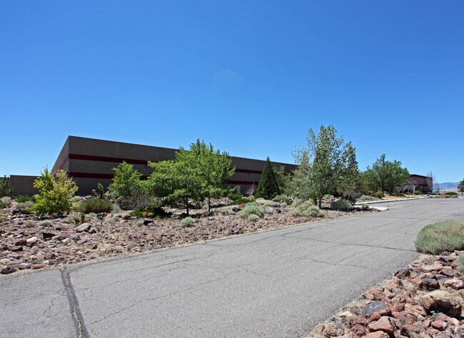
Property Record
23 Airpark Vista Blvd, Dayton, NV 89403


NEARBY LISTINGS FOR SALE OR LEASE
Property Detail
23 Airpark Vista Blvd
Fernley, NV
Parcel Rec John Lawrence
016-364-29
PAR 2A
Lightindustrial
Lyon
X
Nevada
3200010150E
4
2026
10 AC
2025
S Lyon County
960303
Reno/Sparks
104,928 SF
DEMOGRAPHICS near 23 Airpark Vista Blvd
1 Mile
3 Mile
5 Mile
2024 Total Population
951
7,331
12,879
2029 Population
1,040
7,959
14,019
Pop Growth 2024-2029
+ 9.36%
+ 8.57%
+ 8.85%
Average Age
49
45
44
2024 Total Households
418
2,994
5,058
HH Growth 2024-2029
+ 9.33%
+ 8.58%
+ 8.84%
Median Household Inc
$67,761
$77,173
$80,408
Avg Household Size
2.30
2.40
2.50
2024 Avg HH Vehicles
2.00
2.00
2.00
Median Home Value
$447,520
$403,106
$366,277
Median Year Built
2002
1998
1999
Nearby Places
Map Layers
Map Styles
 Street
 Aerial
- Restaurants
- Banks
- Shops
- Fitness
- Groceries
PUBLIC TRANSPORTATION
AIRPORT
Reno/Tahoe International
DRIVE
WALK
Distance
Reno/Tahoe International
60 min
40.9 mi
Nearby Properties
Address
Land Use
TOTAL SIZE
Lot Size
Zoning
Address
Land Use
TOTAL SIZE
Lot Size
Zoning
619,375 SF
42.46 AC
ME
Address
Land Use
TOTAL SIZE
Lot Size
Zoning
350,286 SF
14.77 AC
ME
Address
Land Use
TOTAL SIZE
Lot Size
Zoning
32,460 SF
37.48 AC
RR5
Address
Land Use
TOTAL SIZE
Lot Size
Zoning
9,804 SF
3.31 AC
MFR
Address
Land Use
TOTAL SIZE
Lot Size
Zoning
184,000 SF
16.63 AC
ME
Address
Land Use
TOTAL SIZE
Lot Size
Zoning
64,532 SF
7 AC
C2
Address
Land Use
TOTAL SIZE
Lot Size
Zoning
144,761 SF
11.73 AC
ME
Address
Land Use
TOTAL SIZE
Lot Size
Zoning
38,576 SF
80.45 AC
RR5
Address
Land Use
TOTAL SIZE
Lot Size
Zoning
1,579 SF
6.73 AC
C2
Address
Land Use
TOTAL SIZE
Lot Size
Zoning
19,934 SF
2.18 AC
C2
Address
Land Use
TOTAL SIZE
Lot Size
Zoning
105,645 SF
6.33 AC
ME
Address
Land Use
TOTAL SIZE
Lot Size
Zoning
20,100 SF
6.58 AC
C1
Address
Land Use
TOTAL SIZE
Lot Size
Zoning
21,119 SF
3.10 AC
C2
Address
Land Use
TOTAL SIZE
Lot Size
Zoning
2,989 SF
3.21 AC
C2
Address
Land Use
TOTAL SIZE
Lot Size
Zoning
15,264 SF
1.60 AC
C2
Address
Land Use
TOTAL SIZE
Lot Size
Zoning
60,610 SF
6 AC
ME
Address
Land Use
TOTAL SIZE
Lot Size
Zoning
9,880 SF
2.31 AC
NR2
Address
Land Use
TOTAL SIZE
Lot Size
Zoning
3,600 SF
56.13 AC
MULT
Address
Land Use
TOTAL SIZE
Lot Size
Zoning
358.71 AC
CR
Address
Land Use
TOTAL SIZE
Lot Size
Zoning
37,992 SF
5.03 AC
ME
Address
Land Use
TOTAL SIZE
Lot Size
Zoning
21,349 SF
1.82 AC
C2
Address
Land Use
TOTAL SIZE
Lot Size
Zoning
672 SF
5.37 AC
C2
Address
Land Use
TOTAL SIZE
Lot Size
Zoning
42.04 AC
C2
Address
Land Use
TOTAL SIZE
Lot Size
Zoning
15,773 SF
1.80 AC
NR1
Address
Land Use
TOTAL SIZE
Lot Size
Zoning
18,456 SF
1.35 AC
C2
Address
Land Use
TOTAL SIZE
Lot Size
Zoning
15,543 SF
1.44 AC
C2
Address
Land Use
TOTAL SIZE
Lot Size
Zoning
47,273 SF
6.26 AC
ME
Address
Land Use
TOTAL SIZE
Lot Size
Zoning
12,644 SF
0.37 AC
C2
The World's #1 Commercial Real Estate Marketplace
Connect with us
© 2026 CoStar Group
The information above has been obtained from sources believed reliable. While we do not doubt its accuracy we have not verified it and make no guarantee, warranty or representation about it. It is your responsibility to independently confirm its accuracy and completeness. Any projections, opinions, assumptions, or estimates used are for example only and do not represent the current or future performance of the property. The value of this transaction to you depends on tax and other factors which should be evaluated by your tax, financial, and legal advisors. You and your advisors should conduct a careful, independent investigation of the property to determine to your satisfaction the suitability of the property for your needs.