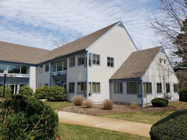
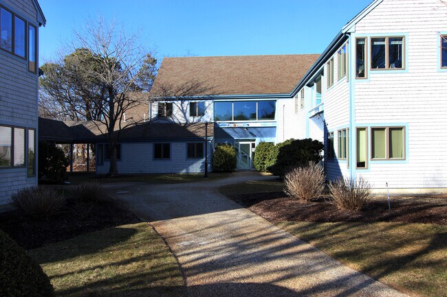
Property Record
23 Bay State Ct, Brewster, MA 02631
NEARBY LISTINGS FOR SALE OR LEASE
-
-
View all Brewster listings for sale on LoopNet.com
Property Detail
23 Bay State Ct
BREW-000138-000047-004918
Bay State Ct
Commercialcondominium
Barnstable
X
Massachusetts
25001C0419J
4918
2025
Cape Cod
2025
Other Market Areas
010900
Barnstable Town, MA
1,847 SF
DEMOGRAPHICS near 23 Bay State Ct
1 mile
3 mile
5 mile
2024 Total Population
1,674
10,260
21,254
2029 Population
1,693
10,517
21,937
Pop Growth 2024-2029
+ 1.14%
+ 2.50%
+ 3.21%
Average Age
53
54
53
2024 Total Households
802
4,854
9,976
HH Growth 2024-2029
+ 0.62%
+ 2.22%
+ 3.01%
Median Household Inc
$74,926
$94,671
$91,908
Avg Household Size
2.00
2.00
2.10
2024 Avg HH Vehicles
2.00
2.00
2.00
Median Home Value
$516,854
$626,582
$649,040
Median Year Built
1979
1980
1979
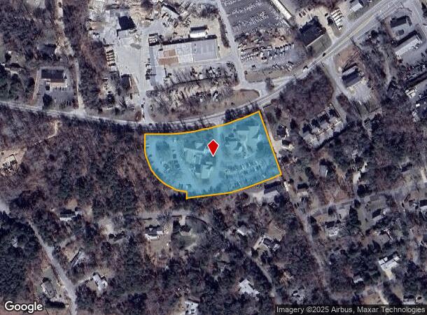
Nearby Places
Map Layers
Map Styles
 Street
 Aerial
Transit
 Traffic
 Biking
Places
Listings with unknown addresses are not visible on the map
- Restaurants
- Banks
- Shops
- Fitness
- Groceries
SALE & LEASE HISTORY
LISTING DATE
SALE/LEASE

Mar 01, 2023
For Sale
Feb 14, 2022
For Sale
Apr 17, 2019
For Sale
Nearby Properties
Address
Land Use
TOTAL SIZE
Lot Size
Zoning
Address
Land Use
TOTAL SIZE
Lot Size
Zoning
4,752 SF
54.92 AC
RESD.
Address
Land Use
TOTAL SIZE
Lot Size
Zoning
71,466 SF
12.15 AC
GB
Address
Land Use
TOTAL SIZE
Lot Size
Zoning
90,545 SF
30 AC
R
Address
Land Use
TOTAL SIZE
Lot Size
Zoning
2,661 SF
45.06 AC
RESD.
Address
Land Use
TOTAL SIZE
Lot Size
Zoning
2,872 SF
13.74 AC
R
Address
Land Use
TOTAL SIZE
Lot Size
Zoning
37,957 SF
8.40 AC
RESD.
Address
Land Use
TOTAL SIZE
Lot Size
Zoning
99,086 SF
10.69 AC
GB
Address
Land Use
TOTAL SIZE
Lot Size
Zoning
5,482 SF
450 AC
R
Address
Land Use
TOTAL SIZE
Lot Size
Zoning
54,328 SF
23 AC
R
Address
Land Use
TOTAL SIZE
Lot Size
Zoning
65,651 SF
13.03 AC
RESD.
Address
Land Use
TOTAL SIZE
Lot Size
Zoning
30,248 SF
9.48 AC
VILLAG
Address
Land Use
TOTAL SIZE
Lot Size
Zoning
70,653 SF
12.61 AC
RESD.
Address
Land Use
TOTAL SIZE
Lot Size
Zoning
7,384 SF
8.10 AC
R
Address
Land Use
TOTAL SIZE
Lot Size
Zoning
5,412 SF
128.90 AC
RESD.
Address
Land Use
TOTAL SIZE
Lot Size
Zoning
6,420 SF
4.40 AC
R
Address
Land Use
TOTAL SIZE
Lot Size
Zoning
14,406 SF
14.18 AC
GB
Address
Land Use
TOTAL SIZE
Lot Size
Zoning
7,247 SF
2.50 AC
R
Address
Land Use
TOTAL SIZE
Lot Size
Zoning
2,492 SF
167.50 AC
RESD.
Address
Land Use
TOTAL SIZE
Lot Size
Zoning
960 SF
14.20 AC
RESD.
Address
Land Use
TOTAL SIZE
Lot Size
Zoning
9,540 SF
51.23 AC
Address
Land Use
TOTAL SIZE
Lot Size
Zoning
11,952 SF
26.20 AC
RESD.
Address
Land Use
TOTAL SIZE
Lot Size
Zoning
600 SF
6 AC
RESD.
Address
Land Use
TOTAL SIZE
Lot Size
Zoning
5,933 SF
1.90 AC
R
Address
Land Use
TOTAL SIZE
Lot Size
Zoning
5,342 SF
2.50 AC
R
Address
Land Use
TOTAL SIZE
Lot Size
Zoning
5,074 SF
1.92 AC
R
Address
Land Use
TOTAL SIZE
Lot Size
Zoning
2,342 SF
18.70 AC
RESD.
Address
Land Use
TOTAL SIZE
Lot Size
Zoning
4,208 SF
2.86 AC
RESD.
Address
Land Use
TOTAL SIZE
Lot Size
Zoning
2,512 SF
6.55 AC
RESD.
Address
Land Use
TOTAL SIZE
Lot Size
Zoning
15,602 SF
1.32 AC
R
Address
Land Use
TOTAL SIZE
Lot Size
Zoning
33,188 SF
9.97 AC
VILLAG
The World's #1 Commercial Real Estate Marketplace
Connect with us
© 2026 CoStar Group
The information above has been obtained from sources believed reliable. While we do not doubt its accuracy we have not verified it and make no guarantee, warranty or representation about it. It is your responsibility to independently confirm its accuracy and completeness. Any projections, opinions, assumptions, or estimates used are for example only and do not represent the current or future performance of the property. The value of this transaction to you depends on tax and other factors which should be evaluated by your tax, financial, and legal advisors. You and your advisors should conduct a careful, independent investigation of the property to determine to your satisfaction the suitability of the property for your needs.