Property Record
23 Beach Rd, Salisbury, MA 01952
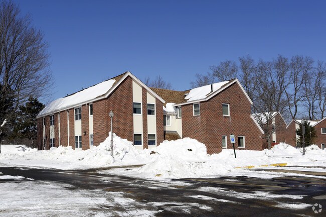

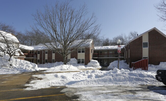
Property Detail
23 Beach Rd
Governmentalpublicusegeneral
Essex
C
Massachusetts
AE The base floodplain where base flood elevations are provided. AE Zones are now used on new format FIRMs instead of A1-A30 Zones.
5.61 AC
0
Salisbury
2025
Boston
267104
Boston-Cambridge-Newton, MA-NH
52,767 SF
SALI-000005-000000-000039
NEARBY LISTINGS FOR SALE OR LEASE
-
-
View all Salisbury listings for sale on LoopNet.com
DEMOGRAPHICS near 23 Beach Rd
1 mile
3 mile
5 mile
2025 Total Population
3,186
28,986
60,929
2030 Population
3,225
29,998
63,206
Pop Growth 2025-2030
+ 1.22%
+ 3.49%
+ 3.74%
Average Age
47
48
46
2025 Total Households
1,450
13,154
26,923
HH Growth 2025-2030
+ 0.97%
+ 3.57%
+ 3.78%
Median Household Inc
$94,791
$110,421
$106,801
Avg Household Size
2.20
2.10
2.20
2025 Avg HH Vehicles
2.00
2.00
2.00
Median Home Value
$454,732
$714,076
$685,353
Median Year Built
1981
1964
1970
Nearby Places
Map Layers
Map Styles
 Street
 Aerial
Transit
 Traffic
 Biking
Places
Listings with unknown addresses are not visible on the map
- Restaurants
- Banks
- Shops
- Fitness
- Groceries
PUBLIC TRANSPORTATION
COMMUTER RAIL
Newburyport (Newburyport/Rockport Line - Massachusetts Bay Transportation Authority Commuter Rail (Purple Line))
Drive
Walk
Distance
Newburyport (Newburyport/Rockport Line - Massachusetts Bay Transportation Authority Commuter Rail (Purple Line))
10 min
3.8 mi
AIRPORT
Portsmouth International at Pease
Drive
Walk
Distance
Portsmouth International at Pease
29 min
19.5 mi
Freight Ports
Port of Boston
Drive
Walk
Distance
Port of Boston
60 min
43.2 mi
Nearby Properties
Address
Land Use
TOTAL SIZE
Lot Size
Zoning
Address
Land Use
TOTAL SIZE
Lot Size
Zoning
207,982 SF
14.58 AC
Address
Land Use
TOTAL SIZE
Lot Size
Zoning
267,857 SF
13.10 AC
BC
Address
Land Use
TOTAL SIZE
Lot Size
Zoning
107,053 SF
17.51 AC
Address
Land Use
TOTAL SIZE
Lot Size
Zoning
170,444 SF
13.30 AC
Address
Land Use
TOTAL SIZE
Lot Size
Zoning
163,948 SF
20.31 AC
Address
Land Use
TOTAL SIZE
Lot Size
Zoning
441.30 AC
BC
Address
Land Use
TOTAL SIZE
Lot Size
Zoning
112,708 SF
40 AC
50
Address
Land Use
TOTAL SIZE
Lot Size
Zoning
Address
Land Use
TOTAL SIZE
Lot Size
Zoning
94,943 SF
15.52 AC
RCZD
Address
Land Use
TOTAL SIZE
Lot Size
Zoning
191,775 SF
23.50 AC
C
Address
Land Use
TOTAL SIZE
Lot Size
Zoning
116,650 SF
21.07 AC
LA4
Address
Land Use
TOTAL SIZE
Lot Size
Zoning
3,820 SF
9.15 AC
40
Address
Land Use
TOTAL SIZE
Lot Size
Zoning
7,768 SF
3.98 AC
Address
Land Use
TOTAL SIZE
Lot Size
Zoning
274,050 SF
29.02 AC
I
Address
Land Use
TOTAL SIZE
Lot Size
Zoning
44,661 SF
4.47 AC
Address
Land Use
TOTAL SIZE
Lot Size
Zoning
106,787 SF
22.25 AC
C
Address
Land Use
TOTAL SIZE
Lot Size
Zoning
20,518 SF
6.05 AC
BC
Address
Land Use
TOTAL SIZE
Lot Size
Zoning
95,903 SF
1.64 AC
Address
Land Use
TOTAL SIZE
Lot Size
Zoning
93,090 SF
87 SF
Address
Land Use
TOTAL SIZE
Lot Size
Zoning
139,877 SF
11.09 AC
LA4
Address
Land Use
TOTAL SIZE
Lot Size
Zoning
112,559 SF
11.27 AC
Address
Land Use
TOTAL SIZE
Lot Size
Zoning
57,754 SF
5.27 AC
Address
Land Use
TOTAL SIZE
Lot Size
Zoning
118,008 SF
11.04 AC
Address
Land Use
TOTAL SIZE
Lot Size
Zoning
148,744 SF
4.10 AC
Address
Land Use
TOTAL SIZE
Lot Size
Zoning
Address
Land Use
TOTAL SIZE
Lot Size
Zoning
65,124 SF
0.79 AC
Address
Land Use
TOTAL SIZE
Lot Size
Zoning
21,375 SF
11.80 AC
LA4
Address
Land Use
TOTAL SIZE
Lot Size
Zoning
31,428 SF
10.61 AC
Address
Land Use
TOTAL SIZE
Lot Size
Zoning
126,144 SF
5.41 AC
I
Address
Land Use
TOTAL SIZE
Lot Size
Zoning
92,907 SF
5.76 AC
The World's #1 Commercial Real Estate Marketplace
Connect with us
© 2026 CoStar Group
The information above has been obtained from sources believed reliable. While we do not doubt its accuracy we have not verified it and make no guarantee, warranty or representation about it. It is your responsibility to independently confirm its accuracy and completeness. Any projections, opinions, assumptions, or estimates used are for example only and do not represent the current or future performance of the property. The value of this transaction to you depends on tax and other factors which should be evaluated by your tax, financial, and legal advisors. You and your advisors should conduct a careful, independent investigation of the property to determine to your satisfaction the suitability of the property for your needs.