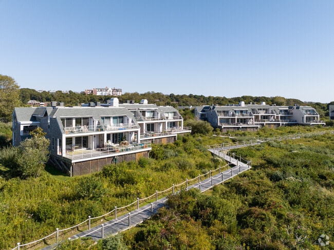
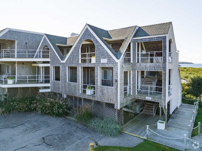
Property Record
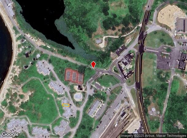
23 Fort Pond Rd, Montauk, NY 11954
NEARBY LISTINGS FOR SALE OR LEASE
-
-
View all Montauk listings for sale on LoopNet.com
Property Detail
23 Fort Pond Rd
Nassau County-Suffolk County, NY
Rough Ridgers Lndg
0300-027-01-01-00-027-000
BLK LOT 27
Apartment
Suffolk
AE
New York
36103C0262H
27
2024
17.10 AC
2024
Outlying Eastern Suffolk
201008
Long Island (New York)
DEMOGRAPHICS near 23 Fort Pond Rd
1 Mile
3 Mile
5 Mile
2024 Total Population
1,851
7,256
7,411
2029 Population
1,928
7,769
7,936
Pop Growth 2024-2029
+ 4.16%
+ 7.07%
+ 7.08%
Average Age
46
46
46
2024 Total Households
762
3,009
3,074
HH Growth 2024-2029
+ 3.94%
+ 7.05%
+ 7.06%
Median Household Inc
$140,301
$133,895
$134,431
Avg Household Size
2.30
2.40
2.40
2024 Avg HH Vehicles
2.00
2.00
2.00
Median Home Value
$931,587
$1,012,678
$1,012,990
Median Year Built
1977
1979
1979
Nearby Places
- Restaurants
- Banks
- Shops
- Fitness
- Groceries
PUBLIC TRANSPORTATION
COMMUTER RAIL
Montauk Station (Montauk Branch - Long Island Rail Road)
DRIVE
WALK
Distance
Montauk Station (Montauk Branch - Long Island Rail Road)
0 min
5 min
0.2 mi
Freight Ports
Port of Davisville, RI
DRIVE
WALK
Distance
Port of Davisville, RI
262 min
109.9 mi
Nearby Properties
Address
Land Use
TOTAL SIZE
Lot Size
Zoning
Address
Land Use
TOTAL SIZE
Lot Size
Zoning
232.10 AC
Address
Land Use
TOTAL SIZE
Lot Size
Zoning
10.61 AC
Address
Land Use
TOTAL SIZE
Lot Size
Zoning
777.30 AC
Address
Land Use
TOTAL SIZE
Lot Size
Zoning
11.18 AC
CR120
Address
Land Use
TOTAL SIZE
Lot Size
Zoning
776.30 AC
Address
Land Use
TOTAL SIZE
Lot Size
Zoning
0.95 AC
Address
Land Use
TOTAL SIZE
Lot Size
Zoning
10.30 AC
Address
Land Use
TOTAL SIZE
Lot Size
Zoning
262.94 AC
Address
Land Use
TOTAL SIZE
Lot Size
Zoning
17.99 AC
CR120
Address
Land Use
TOTAL SIZE
Lot Size
Zoning
317 AC
Address
Land Use
TOTAL SIZE
Lot Size
Zoning
0.41 AC
Address
Land Use
TOTAL SIZE
Lot Size
Zoning
2.32 AC
Address
Land Use
TOTAL SIZE
Lot Size
Zoning
1.90 AC
Address
Land Use
TOTAL SIZE
Lot Size
Zoning
76.90 AC
Address
Land Use
TOTAL SIZE
Lot Size
Zoning
2.20 AC
Address
Land Use
TOTAL SIZE
Lot Size
Zoning
121.90 AC
Address
Land Use
TOTAL SIZE
Lot Size
Zoning
1.41 AC
Address
Land Use
TOTAL SIZE
Lot Size
Zoning
1.90 AC
Address
Land Use
TOTAL SIZE
Lot Size
Zoning
138.50 AC
Address
Land Use
TOTAL SIZE
Lot Size
Zoning
10.50 AC
Address
Land Use
TOTAL SIZE
Lot Size
Zoning
Address
Land Use
TOTAL SIZE
Lot Size
Zoning
Address
Land Use
TOTAL SIZE
Lot Size
Zoning
Address
Land Use
TOTAL SIZE
Lot Size
Zoning
1.18 AC
Address
Land Use
TOTAL SIZE
Lot Size
Zoning
22.32 AC
Address
Land Use
TOTAL SIZE
Lot Size
Zoning
Address
Land Use
TOTAL SIZE
Lot Size
Zoning
26.40 AC
Address
Land Use
TOTAL SIZE
Lot Size
Zoning
2.70 AC
Address
Land Use
TOTAL SIZE
Lot Size
Zoning
6.10 AC
Address
Land Use
TOTAL SIZE
Lot Size
Zoning
The World's #1 Commercial Real Estate Marketplace
Connect with us
© 2025 CoStar Group
The information above has been obtained from sources believed reliable. While we do not doubt its accuracy we have not verified it and make no guarantee, warranty or representation about it. It is your responsibility to independently confirm its accuracy and completeness. Any projections, opinions, assumptions, or estimates used are for example only and do not represent the current or future performance of the property. The value of this transaction to you depends on tax and other factors which should be evaluated by your tax, financial, and legal advisors. You and your advisors should conduct a careful, independent investigation of the property to determine to your satisfaction the suitability of the property for your needs.