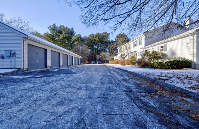
Property Record
23 Pine Crest Rdg, Woodstock, CT 06281
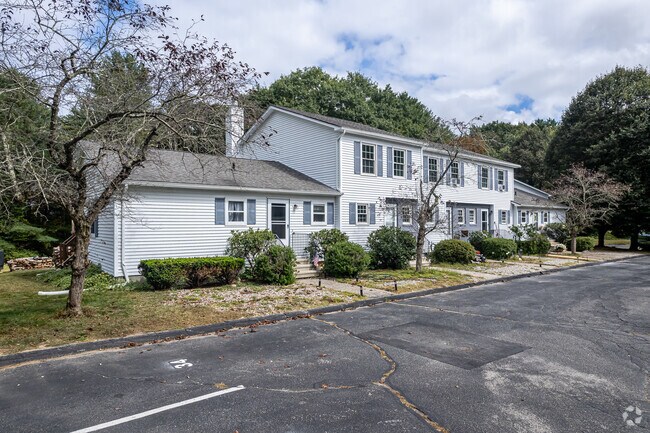
This Property Is For Sale
NEARBY LISTINGS FOR SALE OR LEASE
Property Detail
23 Pine Crest Rdg
Worcester, MA-CT
Windham
WOOD-006397-000058-000002A-A000000-23
Connecticut
Commercialnec
2a-a
2024
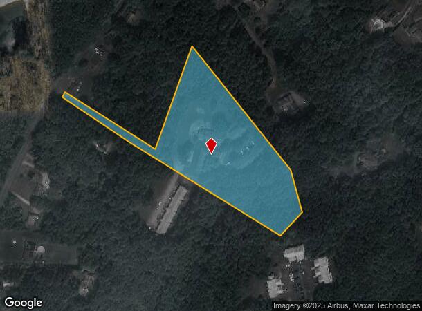
5.55 AC
2025
Windham County
901102
Hartford
DEMOGRAPHICS near 23 Pine Crest Rdg
1 Mile
3 Mile
5 Mile
2024 Total Population
2,059
12,069
20,891
2029 Population
2,069
12,057
20,870
Pop Growth 2024-2029
+ 0.49%
(0.10%)
(0.10%)
Average Age
43
41
42
2024 Total Households
904
5,083
8,572
HH Growth 2024-2029
+ 0.66%
(0.02%)
(0.03%)
Median Household Inc
$79,294
$74,222
$77,611
Avg Household Size
2.20
2.30
2.30
2024 Avg HH Vehicles
2.00
2.00
2.00
Median Home Value
$256,481
$227,409
$254,302
Median Year Built
1968
1963
1965
Nearby Places
Map Layers
Map Styles
 Street
 Aerial
- Restaurants
- Banks
- Shops
- Fitness
- Groceries
PUBLIC TRANSPORTATION
AIRPORT
Worcester Regional
DRIVE
WALK
Distance
Worcester Regional
47 min
30.7 mi
Rhode Island Tf Green International
DRIVE
WALK
Distance
Rhode Island Tf Green International
59 min
42.9 mi
Freight Ports
Port of Davisville, RI
DRIVE
WALK
Distance
Port of Davisville, RI
71 min
52.1 mi
Nearby Properties
Address
Land Use
TOTAL SIZE
Lot Size
Zoning
Address
Land Use
TOTAL SIZE
Lot Size
Zoning
13.76 AC
M/OD
Address
Land Use
TOTAL SIZE
Lot Size
Zoning
199,059 SF
31.65 AC
R-10
Address
Land Use
TOTAL SIZE
Lot Size
Zoning
16,392 SF
101.85 AC
PSR
Address
Land Use
TOTAL SIZE
Lot Size
Zoning
104,330 SF
15 AC
R-10
Address
Land Use
TOTAL SIZE
Lot Size
Zoning
119.01 AC
Address
Land Use
TOTAL SIZE
Lot Size
Zoning
37,203 SF
7.21 AC
P
Address
Land Use
TOTAL SIZE
Lot Size
Zoning
17.41 AC
GC
Address
Land Use
TOTAL SIZE
Lot Size
Zoning
142,599 SF
17.59 AC
HC
Address
Land Use
TOTAL SIZE
Lot Size
Zoning
4,212 SF
8.25 AC
R-10
Address
Land Use
TOTAL SIZE
Lot Size
Zoning
92,080 SF
7.10 AC
I
Address
Land Use
TOTAL SIZE
Lot Size
Zoning
7,009 SF
15.70 AC
TCDD
Address
Land Use
TOTAL SIZE
Lot Size
Zoning
55,340 SF
4 AC
0
Address
Land Use
TOTAL SIZE
Lot Size
Zoning
49,195 SF
8.57 AC
AG-2
Address
Land Use
TOTAL SIZE
Lot Size
Zoning
10.08 AC
R-10
Address
Land Use
TOTAL SIZE
Lot Size
Zoning
70,608 SF
5.70 AC
HC
Address
Land Use
TOTAL SIZE
Lot Size
Zoning
101,136 SF
15.07 AC
HC
Address
Land Use
TOTAL SIZE
Lot Size
Zoning
62,370 SF
46.40 AC
0
Address
Land Use
TOTAL SIZE
Lot Size
Zoning
38.20 AC
RRAD
Address
Land Use
TOTAL SIZE
Lot Size
Zoning
68,754 SF
9.10 AC
I
Address
Land Use
TOTAL SIZE
Lot Size
Zoning
80,010 SF
9 AC
I
Address
Land Use
TOTAL SIZE
Lot Size
Zoning
72,281 SF
2.84 AC
R-10
Address
Land Use
TOTAL SIZE
Lot Size
Zoning
13.06 AC
I
Address
Land Use
TOTAL SIZE
Lot Size
Zoning
64,209 SF
4.91 AC
R-7
Address
Land Use
TOTAL SIZE
Lot Size
Zoning
3.03 AC
M/OD
Address
Land Use
TOTAL SIZE
Lot Size
Zoning
62,624 SF
14.25 AC
I
Address
Land Use
TOTAL SIZE
Lot Size
Zoning
41,730 SF
21.30 AC
RR
Address
Land Use
TOTAL SIZE
Lot Size
Zoning
135,012 SF
31.12 AC
0
Address
Land Use
TOTAL SIZE
Lot Size
Zoning
13.20 AC
R-40
Address
Land Use
TOTAL SIZE
Lot Size
Zoning
16.40 AC
PSR
Address
Land Use
TOTAL SIZE
Lot Size
Zoning
52,724 SF
6.46 AC
SZD
The World's #1 Commercial Real Estate Marketplace
Connect with us
© 2026 CoStar Group
The information above has been obtained from sources believed reliable. While we do not doubt its accuracy we have not verified it and make no guarantee, warranty or representation about it. It is your responsibility to independently confirm its accuracy and completeness. Any projections, opinions, assumptions, or estimates used are for example only and do not represent the current or future performance of the property. The value of this transaction to you depends on tax and other factors which should be evaluated by your tax, financial, and legal advisors. You and your advisors should conduct a careful, independent investigation of the property to determine to your satisfaction the suitability of the property for your needs.