Property Record
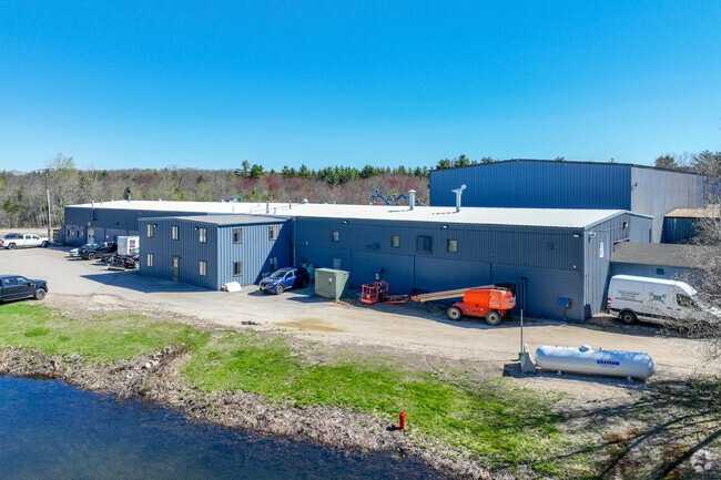
23 Plank Industrial Dr, Farmington, NH 03835


NEARBY LISTINGS FOR SALE OR LEASE
Property Detail
23 Plank Industrial Dr
FRMN-000003R-000000-000001-000001
Strafford
Industrialgeneral
New Hampshire
AE
1 s:1-0
33017C0182D
5.05 AC
2024
Strafford County
2024
Boston
087002
Boston-Cambridge-Newton, MA-NH
38,315 SF
DEMOGRAPHICS near 23 Plank Industrial Dr
1 Mile
3 Mile
5 Mile
2024 Total Population
88
7,339
30,914
2029 Population
92
7,644
32,100
Pop Growth 2024-2029
+ 4.55%
+ 4.16%
+ 3.84%
Average Age
44
45
42
2024 Total Households
35
3,108
12,914
HH Growth 2024-2029
+ 5.71%
+ 4.05%
+ 3.78%
Median Household Inc
$103,125
$96,305
$82,898
Avg Household Size
2.40
2.40
2.30
2024 Avg HH Vehicles
2.00
2.00
2.00
Median Home Value
$374,999
$258,475
$249,704
Median Year Built
1994
1984
1974
Nearby Places
Map Layers
Map Styles
 Street
 Aerial
- Restaurants
- Banks
- Shops
- Fitness
- Groceries
PUBLIC TRANSPORTATION
AIRPORT
Portsmouth International at Pease
DRIVE
WALK
Distance
Portsmouth International at Pease
35 min
23.7 mi
Freight Ports
Portland, ME
DRIVE
WALK
Distance
Portland, ME
76 min
53.6 mi
Nearby Properties
Address
Land Use
TOTAL SIZE
Lot Size
Zoning
Address
Land Use
TOTAL SIZE
Lot Size
Zoning
274,144 SF
73.08 AC
GRD
Address
Land Use
TOTAL SIZE
Lot Size
Zoning
224,153 SF
34.36 AC
GRD
Address
Land Use
TOTAL SIZE
Lot Size
Zoning
59,235 SF
22.08 AC
A
Address
Land Use
TOTAL SIZE
Lot Size
Zoning
111,807 SF
31.93 AC
HC
Address
Land Use
TOTAL SIZE
Lot Size
Zoning
221,995 SF
35.47 AC
IND
Address
Land Use
TOTAL SIZE
Lot Size
Zoning
84,700 SF
5.76 AC
GRD
Address
Land Use
TOTAL SIZE
Lot Size
Zoning
16,444 SF
6.41 AC
GRD
Address
Land Use
TOTAL SIZE
Lot Size
Zoning
4,000 SF
68 AC
GRD
Address
Land Use
TOTAL SIZE
Lot Size
Zoning
87.64 AC
A
Address
Land Use
TOTAL SIZE
Lot Size
Zoning
32,506 SF
12.36 AC
GRD
Address
Land Use
TOTAL SIZE
Lot Size
Zoning
21,784 SF
6.09 AC
GRD
Address
Land Use
TOTAL SIZE
Lot Size
Zoning
172,966 SF
36.48 AC
IND
Address
Land Use
TOTAL SIZE
Lot Size
Zoning
41,846 SF
3.60 AC
GRD
Address
Land Use
TOTAL SIZE
Lot Size
Zoning
66,994 SF
38.56 AC
IB IND
Address
Land Use
TOTAL SIZE
Lot Size
Zoning
1,288 SF
72 AC
A
Address
Land Use
TOTAL SIZE
Lot Size
Zoning
16,080 SF
6.41 AC
IND
Address
Land Use
TOTAL SIZE
Lot Size
Zoning
24,594 SF
3.81 AC
GRD
Address
Land Use
TOTAL SIZE
Lot Size
Zoning
5,048 SF
165.49 AC
A
Address
Land Use
TOTAL SIZE
Lot Size
Zoning
15,085 SF
83.25 AC
SR SUB
Address
Land Use
TOTAL SIZE
Lot Size
Zoning
17,240 SF
4.01 AC
GRD
Address
Land Use
TOTAL SIZE
Lot Size
Zoning
10,172 SF
92.55 AC
A
Address
Land Use
TOTAL SIZE
Lot Size
Zoning
39 AC
A
Address
Land Use
TOTAL SIZE
Lot Size
Zoning
1,800 SF
5.50 AC
CIBO C
Address
Land Use
TOTAL SIZE
Lot Size
Zoning
24,000 SF
6.67 AC
GRD
Address
Land Use
TOTAL SIZE
Lot Size
Zoning
3,472 SF
4.65 AC
CB COM
Address
Land Use
TOTAL SIZE
Lot Size
Zoning
48 AC
SR SUB
Address
Land Use
TOTAL SIZE
Lot Size
Zoning
6,006 SF
3.50 AC
GRD
Address
Land Use
TOTAL SIZE
Lot Size
Zoning
3,332 SF
3 AC
AR AGR
Address
Land Use
TOTAL SIZE
Lot Size
Zoning
1,679 SF
39.34 AC
A
Address
Land Use
TOTAL SIZE
Lot Size
Zoning
4,756 SF
1.27 AC
HC
The World's #1 Commercial Real Estate Marketplace
Connect with us
© 2026 CoStar Group
The information above has been obtained from sources believed reliable. While we do not doubt its accuracy we have not verified it and make no guarantee, warranty or representation about it. It is your responsibility to independently confirm its accuracy and completeness. Any projections, opinions, assumptions, or estimates used are for example only and do not represent the current or future performance of the property. The value of this transaction to you depends on tax and other factors which should be evaluated by your tax, financial, and legal advisors. You and your advisors should conduct a careful, independent investigation of the property to determine to your satisfaction the suitability of the property for your needs.