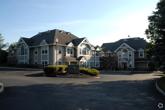
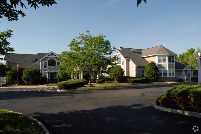
Property Record
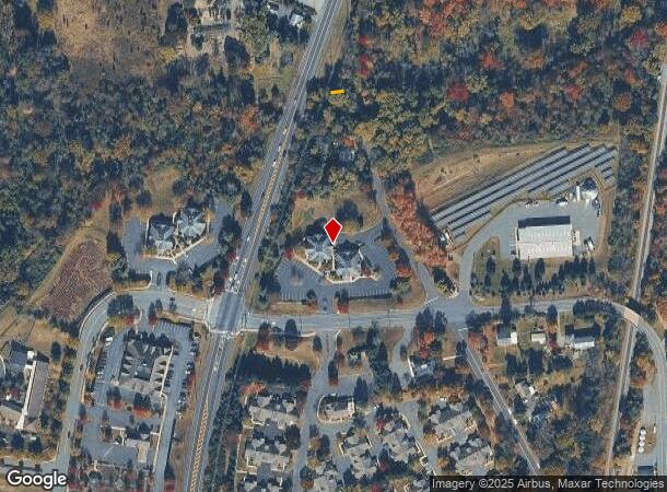
23 Route 31 N, Pennington, NJ 08534

Current Lease Availabilities
NEARBY LISTINGS FOR SALE OR LEASE
Property Detail
23 Route 31 N
06-00047-0000-00001
Mercer
Commercialnec
New Jersey
X
1
34021C0108F
2.97 AC
2024
Trenton
2025
Northern New Jersey
003905
Trenton, NJ
14,740 SF
DEMOGRAPHICS near 23 Route 31 N
1 Mile
3 Mile
5 Mile
2024 Total Population
2,614
11,369
43,849
2029 Population
2,594
11,203
43,292
Pop Growth 2024-2029
(0.77%)
(1.46%)
(1.27%)
Average Age
45
44
43
2024 Total Households
1,026
4,211
16,112
HH Growth 2024-2029
(0.49%)
(1.50%)
(1.43%)
Median Household Inc
$125,528
$140,222
$128,953
Avg Household Size
2.50
2.60
2.50
2024 Avg HH Vehicles
2.00
2.00
2.00
Median Home Value
$559,759
$529,617
$428,714
Median Year Built
1968
1975
1977
Nearby Places
Map Layers
Map Styles
 Street
 Aerial
- Restaurants
- Banks
- Shops
- Fitness
- Groceries
PUBLIC TRANSPORTATION
COMMUTER RAIL
West Trenton (R3 - Southeastern Pennsylvania Transportation Authority Regional Rail (SEPTA Regional Rail))
DRIVE
WALK
Distance
West Trenton (R3 - Southeastern Pennsylvania Transportation Authority Regional Rail (SEPTA Regional Rail))
15 min
8.0 mi
Princeton (Princeton Branch - NJ Transit Commuter Rail (NJ Transit))
DRIVE
WALK
Distance
Princeton (Princeton Branch - NJ Transit Commuter Rail (NJ Transit))
20 min
9.0 mi
AIRPORT
Trenton Mercer
DRIVE
WALK
Distance
Trenton Mercer
13 min
5.8 mi
Philadelphia International
DRIVE
WALK
Distance
Philadelphia International
71 min
48.8 mi
Freight Ports
Port of Philadelphia
DRIVE
WALK
Distance
Port of Philadelphia
51 min
35.1 mi
Nearby Properties
Address
Land Use
TOTAL SIZE
Lot Size
Zoning
Address
Land Use
TOTAL SIZE
Lot Size
Zoning
42 AC
R03
Address
Land Use
TOTAL SIZE
Lot Size
Zoning
13.86 AC
OP
Address
Land Use
TOTAL SIZE
Lot Size
Zoning
156.92 AC
R03
Address
Land Use
TOTAL SIZE
Lot Size
Zoning
42 AC
R03
Address
Land Use
TOTAL SIZE
Lot Size
Zoning
13.36 AC
OP
Address
Land Use
TOTAL SIZE
Lot Size
Zoning
7.85 AC
OP
Address
Land Use
TOTAL SIZE
Lot Size
Zoning
6.09 AC
OP
Address
Land Use
TOTAL SIZE
Lot Size
Zoning
8.73 AC
OP
Address
Land Use
TOTAL SIZE
Lot Size
Zoning
Address
Land Use
TOTAL SIZE
Lot Size
Zoning
38.82 AC
R100
Address
Land Use
TOTAL SIZE
Lot Size
Zoning
6.37 AC
OP
Address
Land Use
TOTAL SIZE
Lot Size
Zoning
8.35 AC
OP
Address
Land Use
TOTAL SIZE
Lot Size
Zoning
6.01 AC
OP
Address
Land Use
TOTAL SIZE
Lot Size
Zoning
20.93 AC
HBO
Address
Land Use
TOTAL SIZE
Lot Size
Zoning
9.87 AC
R-5
Address
Land Use
TOTAL SIZE
Lot Size
Zoning
221.99 AC
2ZON
Address
Land Use
TOTAL SIZE
Lot Size
Zoning
17,000 SF
32.87 AC
R-80
Address
Land Use
TOTAL SIZE
Lot Size
Zoning
16.34 AC
SC
Address
Land Use
TOTAL SIZE
Lot Size
Zoning
22.37 AC
2ZON
Address
Land Use
TOTAL SIZE
Lot Size
Zoning
7.39 AC
R100
Address
Land Use
TOTAL SIZE
Lot Size
Zoning
495.30 AC
OS
Address
Land Use
TOTAL SIZE
Lot Size
Zoning
43.08 AC
R100
Address
Land Use
TOTAL SIZE
Lot Size
Zoning
Address
Land Use
TOTAL SIZE
Lot Size
Zoning
327 AC
VRC
Address
Land Use
TOTAL SIZE
Lot Size
Zoning
12.74 AC
R-5
Address
Land Use
TOTAL SIZE
Lot Size
Zoning
Address
Land Use
TOTAL SIZE
Lot Size
Zoning
6.28 AC
OP
Address
Land Use
TOTAL SIZE
Lot Size
Zoning
3,101 SF
250.13 AC
VRC
Address
Land Use
TOTAL SIZE
Lot Size
Zoning
8,901 SF
6.04 AC
R-80
Address
Land Use
TOTAL SIZE
Lot Size
Zoning
5,325 SF
11.17 AC
R-A
The World's #1 Commercial Real Estate Marketplace
Connect with us
© 2025 CoStar Group
The information above has been obtained from sources believed reliable. While we do not doubt its accuracy we have not verified it and make no guarantee, warranty or representation about it. It is your responsibility to independently confirm its accuracy and completeness. Any projections, opinions, assumptions, or estimates used are for example only and do not represent the current or future performance of the property. The value of this transaction to you depends on tax and other factors which should be evaluated by your tax, financial, and legal advisors. You and your advisors should conduct a careful, independent investigation of the property to determine to your satisfaction the suitability of the property for your needs.