Property Record
23 W State St, Oneonta, NY 13820
NEARBY LISTINGS FOR SALE OR LEASE
Property Detail
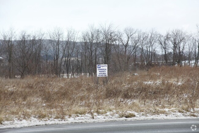
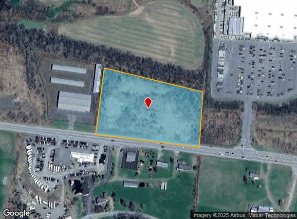
23 W State St
Oneonta, NY
003FM 3012 & 2087 0 4
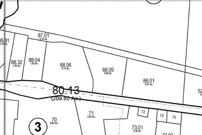
364600-300-000-0003-088-001-0000
Otsego
Commercialacreage
New York
AE
88.001
36077C0659E
4.97 AC
2025
Otsego County
2024
Albany/Schenectady/Troy
590900
DEMOGRAPHICS near 23 W State St
1 Mile
3 Mile
5 Mile
2024 Total Population
737
17,409
23,527
2029 Population
734
17,374
23,479
Pop Growth 2024-2029
(0.41%)
(0.20%)
(0.20%)
Average Age
44
35
37
2024 Total Households
281
5,267
7,406
HH Growth 2024-2029
(0.71%)
(0.13%)
(0.38%)
Median Household Inc
$65,454
$57,945
$58,821
Avg Household Size
2.30
2.10
2.10
2024 Avg HH Vehicles
2.00
1.00
2.00
Median Home Value
$168,594
$164,950
$168,613
Median Year Built
1978
1949
1951
Nearby Places
- Restaurants
- Banks
- Shops
- Fitness
- Groceries
SALE & LEASE HISTORY
LISTING DATE
SALE/LEASE

Sep 24, 2016
For Sale
Nearby Properties
Address
Land Use
TOTAL SIZE
Lot Size
Zoning
Address
Land Use
TOTAL SIZE
Lot Size
Zoning
44,216 SF
106.49 AC
610
Address
Land Use
TOTAL SIZE
Lot Size
Zoning
10,927 SF
142.34 AC
610
Address
Land Use
TOTAL SIZE
Lot Size
Zoning
204.26 AC
01
Address
Land Use
TOTAL SIZE
Lot Size
Zoning
216,150 SF
3.04 AC
610
Address
Land Use
TOTAL SIZE
Lot Size
Zoning
103.77 AC
01
Address
Land Use
TOTAL SIZE
Lot Size
Zoning
456,905 SF
73.89 AC
620
Address
Land Use
TOTAL SIZE
Lot Size
Zoning
126,759 SF
0.97 AC
610
Address
Land Use
TOTAL SIZE
Lot Size
Zoning
170,000 SF
15.79 AC
120
Address
Land Use
TOTAL SIZE
Lot Size
Zoning
275,240 SF
28.08 AC
Address
Land Use
TOTAL SIZE
Lot Size
Zoning
141,104 SF
17.85 AC
01
Address
Land Use
TOTAL SIZE
Lot Size
Zoning
Address
Land Use
TOTAL SIZE
Lot Size
Zoning
179,626 SF
21.80 AC
01
Address
Land Use
TOTAL SIZE
Lot Size
Zoning
134,563 SF
33.59 AC
Address
Land Use
TOTAL SIZE
Lot Size
Zoning
55,551 SF
6 AC
Address
Land Use
TOTAL SIZE
Lot Size
Zoning
80,492 SF
9.32 AC
Address
Land Use
TOTAL SIZE
Lot Size
Zoning
71,504 SF
4.09 AC
Address
Land Use
TOTAL SIZE
Lot Size
Zoning
36,629 SF
2.11 AC
610
Address
Land Use
TOTAL SIZE
Lot Size
Zoning
113.33 AC
520
Address
Land Use
TOTAL SIZE
Lot Size
Zoning
83,256 SF
1.30 AC
620
Address
Land Use
TOTAL SIZE
Lot Size
Zoning
64,072 SF
1.53 AC
330
Address
Land Use
TOTAL SIZE
Lot Size
Zoning
67,224 SF
8.11 AC
Address
Land Use
TOTAL SIZE
Lot Size
Zoning
0.01 AC
Address
Land Use
TOTAL SIZE
Lot Size
Zoning
83,384 SF
10.45 AC
Address
Land Use
TOTAL SIZE
Lot Size
Zoning
53,900 SF
4.08 AC
Address
Land Use
TOTAL SIZE
Lot Size
Zoning
8,839 SF
15.16 AC
140
Address
Land Use
TOTAL SIZE
Lot Size
Zoning
73,580 SF
0.51 AC
310
Address
Land Use
TOTAL SIZE
Lot Size
Zoning
49,047 SF
11.37 AC
01
Address
Land Use
TOTAL SIZE
Lot Size
Zoning
142.46 AC
Address
Land Use
TOTAL SIZE
Lot Size
Zoning
67,528 SF
3.10 AC
620
Address
Land Use
TOTAL SIZE
Lot Size
Zoning
64,588 SF
8.64 AC
01
The World's #1 Commercial Real Estate Marketplace
Connect with us
© 2025 CoStar Group
The information above has been obtained from sources believed reliable. While we do not doubt its accuracy we have not verified it and make no guarantee, warranty or representation about it. It is your responsibility to independently confirm its accuracy and completeness. Any projections, opinions, assumptions, or estimates used are for example only and do not represent the current or future performance of the property. The value of this transaction to you depends on tax and other factors which should be evaluated by your tax, financial, and legal advisors. You and your advisors should conduct a careful, independent investigation of the property to determine to your satisfaction the suitability of the property for your needs.