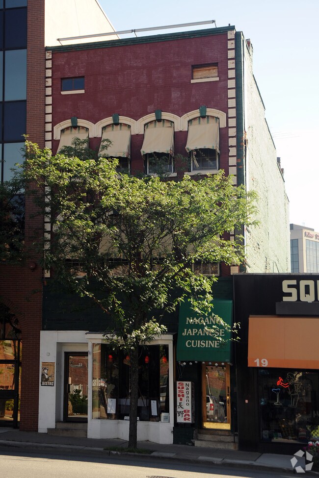
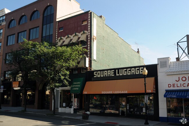
Property Record
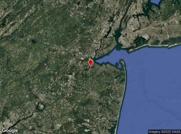
23 Washington St, Morristown, NJ 07960
NEARBY LISTINGS FOR SALE OR LEASE
Property Detail
23 Washington St
Newark, NJ-PA
Morris
24-05901-0000-00011
New Jersey
Commercialnec
11
2024
0.05 AC
2025
Morristown Region
007907
Northern New Jersey
3,840 SF
DEMOGRAPHICS near 23 Washington St
1 Mile
3 Mile
5 Mile
2024 Total Population
20,471
58,480
120,553
2029 Population
20,511
58,619
120,525
Pop Growth 2024-2029
+ 0.20%
+ 0.24%
(0.02%)
Average Age
38
41
41
2024 Total Households
8,616
23,082
44,844
HH Growth 2024-2029
+ 0.53%
+ 0.39%
+ 0.07%
Median Household Inc
$111,561
$139,868
$145,061
Avg Household Size
2.30
2.40
2.50
2024 Avg HH Vehicles
2.00
2.00
2.00
Median Home Value
$569,141
$653,328
$665,754
Median Year Built
1963
1968
1969
Nearby Places
Map Layers
Map Styles
 Street
 Aerial
- Restaurants
- Banks
- Shops
- Fitness
- Groceries
PUBLIC TRANSPORTATION
COMMUTER RAIL
South Amboy (North Jersey Coast Line - NJ Transit Commuter Rail (NJ Transit))
DRIVE
WALK
Distance
South Amboy (North Jersey Coast Line - NJ Transit Commuter Rail (NJ Transit))
8 min
4.3 mi
Aberdeen Matawan (North Jersey Coast Line - NJ Transit Commuter Rail (NJ Transit))
DRIVE
WALK
Distance
Aberdeen Matawan (North Jersey Coast Line - NJ Transit Commuter Rail (NJ Transit))
8 min
5.3 mi
AIRPORT
Newark Liberty International
DRIVE
WALK
Distance
Newark Liberty International
34 min
27.8 mi
Trenton Mercer
DRIVE
WALK
Distance
Trenton Mercer
58 min
38.8 mi
Freight Ports
New York Container Terminal
DRIVE
WALK
Distance
New York Container Terminal
28 min
20.0 mi
Nearby Properties
Address
Land Use
TOTAL SIZE
Lot Size
Zoning
Address
Land Use
TOTAL SIZE
Lot Size
Zoning
0.28 AC
CBD
Address
Land Use
TOTAL SIZE
Lot Size
Zoning
Address
Land Use
TOTAL SIZE
Lot Size
Zoning
Address
Land Use
TOTAL SIZE
Lot Size
Zoning
Address
Land Use
TOTAL SIZE
Lot Size
Zoning
10.58 AC
APTH
Address
Land Use
TOTAL SIZE
Lot Size
Zoning
726 SF
75.46 AC
P
Address
Land Use
TOTAL SIZE
Lot Size
Zoning
7,902 SF
47.49 AC
TCD
Address
Land Use
TOTAL SIZE
Lot Size
Zoning
7,904 SF
60 AC
AF
Address
Land Use
TOTAL SIZE
Lot Size
Zoning
7,902 SF
62.41 AC
R20
Address
Land Use
TOTAL SIZE
Lot Size
Zoning
7,904 SF
39.92 AC
TCD
Address
Land Use
TOTAL SIZE
Lot Size
Zoning
8.99 AC
MF0
Address
Land Use
TOTAL SIZE
Lot Size
Zoning
31.22 AC
G1
Address
Land Use
TOTAL SIZE
Lot Size
Zoning
1.58 AC
Address
Land Use
TOTAL SIZE
Lot Size
Zoning
6.80 AC
RM
Address
Land Use
TOTAL SIZE
Lot Size
Zoning
7,904 SF
38.30 AC
AF
Address
Land Use
TOTAL SIZE
Lot Size
Zoning
329.22 AC
I
Address
Land Use
TOTAL SIZE
Lot Size
Zoning
Address
Land Use
TOTAL SIZE
Lot Size
Zoning
7,905 SF
26.55 AC
CC
Address
Land Use
TOTAL SIZE
Lot Size
Zoning
Address
Land Use
TOTAL SIZE
Lot Size
Zoning
169.71 AC
I
Address
Land Use
TOTAL SIZE
Lot Size
Zoning
7,904 SF
30 AC
AF
Address
Land Use
TOTAL SIZE
Lot Size
Zoning
7,905 SF
22.82 AC
CC
Address
Land Use
TOTAL SIZE
Lot Size
Zoning
7,801 SF
39.88 AC
AF
Address
Land Use
TOTAL SIZE
Lot Size
Zoning
7,801 SF
30.77 AC
AF
Address
Land Use
TOTAL SIZE
Lot Size
Zoning
7,801 SF
33.28 AC
AF
Address
Land Use
TOTAL SIZE
Lot Size
Zoning
7,904 SF
14.66 AC
R15
Address
Land Use
TOTAL SIZE
Lot Size
Zoning
19.97 AC
P
Address
Land Use
TOTAL SIZE
Lot Size
Zoning
15.92 AC
R20
Address
Land Use
TOTAL SIZE
Lot Size
Zoning
7,904 SF
69.62 AC
AF
Address
Land Use
TOTAL SIZE
Lot Size
Zoning
8,000 SF
312.58 AC
ER
The World's #1 Commercial Real Estate Marketplace
Connect with us
© 2025 CoStar Group
The information above has been obtained from sources believed reliable. While we do not doubt its accuracy we have not verified it and make no guarantee, warranty or representation about it. It is your responsibility to independently confirm its accuracy and completeness. Any projections, opinions, assumptions, or estimates used are for example only and do not represent the current or future performance of the property. The value of this transaction to you depends on tax and other factors which should be evaluated by your tax, financial, and legal advisors. You and your advisors should conduct a careful, independent investigation of the property to determine to your satisfaction the suitability of the property for your needs.