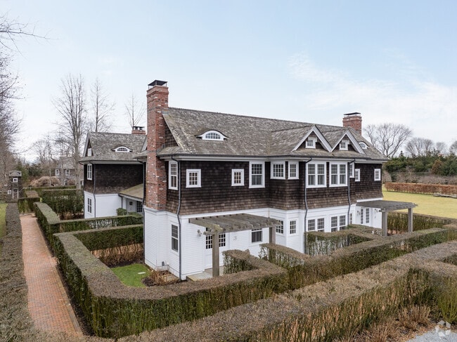
Property Record
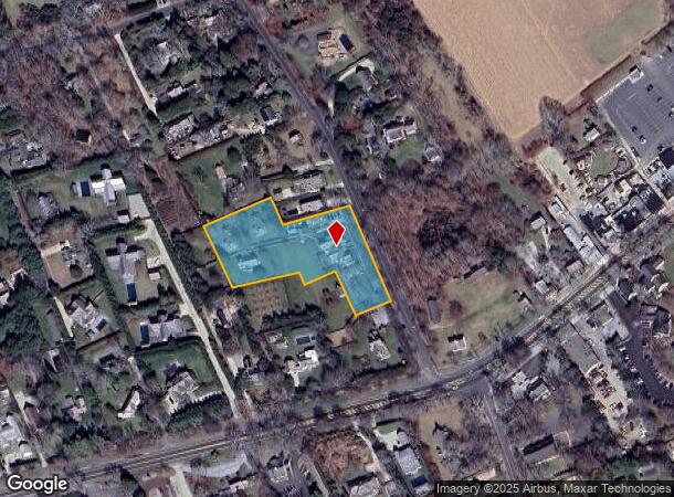
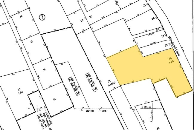
23 Windmill Ln, Southampton, NY 11968
NEARBY LISTINGS FOR SALE OR LEASE
-
-
View all Southampton listings for sale on LoopNet.com
Property Detail
23 Windmill Ln
Nassau County-Suffolk County, NY
BALASSES & ORS N TOLER & HWY A TRAGES & ORS LORIS & ORS TC-170
0300-168-00-07-00-030-000
Suffolk
Apartment
New York
X
30
36103C0557H
1.83 AC
2024
Suffolk
2024
Long Island (New York)
190802
DEMOGRAPHICS near 23 Windmill Ln
1 Mile
3 Mile
5 Mile
2024 Total Population
1,191
14,912
29,571
2029 Population
1,173
15,407
31,080
Pop Growth 2024-2029
(1.51%)
+ 3.32%
+ 5.10%
Average Age
45
43
44
2024 Total Households
480
5,559
11,338
HH Growth 2024-2029
(2.29%)
+ 3.31%
+ 5.20%
Median Household Inc
$129,824
$115,635
$129,841
Avg Household Size
2.40
2.60
2.60
2024 Avg HH Vehicles
2.00
2.00
2.00
Median Home Value
$1,046,047
$1,000,989
$977,403
Median Year Built
1983
1979
1980
Nearby Places
Map Layers
Map Styles
 Street
 Aerial
- Restaurants
- Banks
- Shops
- Fitness
- Groceries
PUBLIC TRANSPORTATION
TRANSIT/SUBWAY
Amagansett Station (Montauk Branch - Long Island Rail Road)
DRIVE
WALK
Distance
Amagansett Station (Montauk Branch - Long Island Rail Road)
2 min
16 min
0.8 mi
COMMUTER RAIL
Amagansett Station (Montauk Branch - Long Island Rail Road)
DRIVE
WALK
Distance
Amagansett Station (Montauk Branch - Long Island Rail Road)
2 min
16 min
0.8 mi
East Hampton Station (Montauk Branch - Long Island Rail Road)
DRIVE
WALK
Distance
East Hampton Station (Montauk Branch - Long Island Rail Road)
7 min
2.9 mi
Freight Ports
Port of New Haven
DRIVE
WALK
Distance
Port of New Haven
204 min
91.6 mi
Nearby Properties
Address
Land Use
TOTAL SIZE
Lot Size
Zoning
Address
Land Use
TOTAL SIZE
Lot Size
Zoning
0.69 AC
CR60
Address
Land Use
TOTAL SIZE
Lot Size
Zoning
3,298 SF
0.18 AC
VILLA
Address
Land Use
TOTAL SIZE
Lot Size
Zoning
53.67 AC
Address
Land Use
TOTAL SIZE
Lot Size
Zoning
3.01 AC
Address
Land Use
TOTAL SIZE
Lot Size
Zoning
Address
Land Use
TOTAL SIZE
Lot Size
Zoning
0.77 AC
R80
Address
Land Use
TOTAL SIZE
Lot Size
Zoning
0.50 AC
R20
Address
Land Use
TOTAL SIZE
Lot Size
Zoning
Address
Land Use
TOTAL SIZE
Lot Size
Zoning
8.10 AC
Address
Land Use
TOTAL SIZE
Lot Size
Zoning
2.10 AC
Address
Land Use
TOTAL SIZE
Lot Size
Zoning
Address
Land Use
TOTAL SIZE
Lot Size
Zoning
9.50 AC
Address
Land Use
TOTAL SIZE
Lot Size
Zoning
Address
Land Use
TOTAL SIZE
Lot Size
Zoning
4.38 AC
Address
Land Use
TOTAL SIZE
Lot Size
Zoning
79.86 AC
Address
Land Use
TOTAL SIZE
Lot Size
Zoning
4.65 AC
Address
Land Use
TOTAL SIZE
Lot Size
Zoning
1.50 AC
Address
Land Use
TOTAL SIZE
Lot Size
Zoning
1.38 AC
Address
Land Use
TOTAL SIZE
Lot Size
Zoning
4.69 AC
Address
Land Use
TOTAL SIZE
Lot Size
Zoning
9.50 AC
Address
Land Use
TOTAL SIZE
Lot Size
Zoning
Address
Land Use
TOTAL SIZE
Lot Size
Zoning
7.30 AC
IND1
Address
Land Use
TOTAL SIZE
Lot Size
Zoning
Address
Land Use
TOTAL SIZE
Lot Size
Zoning
Address
Land Use
TOTAL SIZE
Lot Size
Zoning
57.03 AC
Address
Land Use
TOTAL SIZE
Lot Size
Zoning
Address
Land Use
TOTAL SIZE
Lot Size
Zoning
Address
Land Use
TOTAL SIZE
Lot Size
Zoning
Address
Land Use
TOTAL SIZE
Lot Size
Zoning
33.50 AC
Address
Land Use
TOTAL SIZE
Lot Size
Zoning
The World's #1 Commercial Real Estate Marketplace
Connect with us
© 2026 CoStar Group
The information above has been obtained from sources believed reliable. While we do not doubt its accuracy we have not verified it and make no guarantee, warranty or representation about it. It is your responsibility to independently confirm its accuracy and completeness. Any projections, opinions, assumptions, or estimates used are for example only and do not represent the current or future performance of the property. The value of this transaction to you depends on tax and other factors which should be evaluated by your tax, financial, and legal advisors. You and your advisors should conduct a careful, independent investigation of the property to determine to your satisfaction the suitability of the property for your needs.