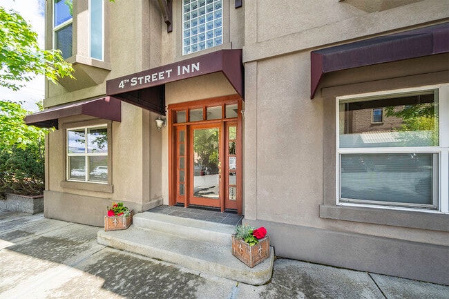
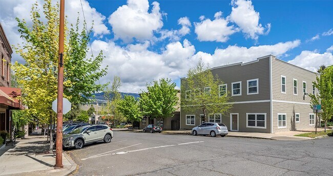
Property Record
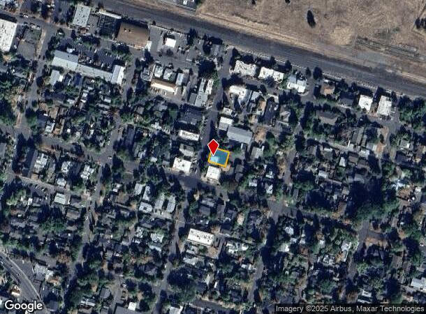
230 4Th St, Ashland, OR 97520

NEARBY LISTINGS FOR SALE OR LEASE
Property Detail
230 4Th St
10945411
Partition Plat #P-73-2000 Sur#16748
Commercialbuilding
Jackson
X
Oregon
41029C2204F
2
2024
0.10 AC
2025
Medford/Grants Pass
002000
Other Market Areas
2,400 SF
Medford, OR
DEMOGRAPHICS near 230 4Th St
1 Mile
3 Mile
5 Mile
2024 Total Population
13,685
26,233
31,853
2029 Population
14,038
26,877
32,470
Pop Growth 2024-2029
+ 2.58%
+ 2.45%
+ 1.94%
Average Age
43
44
44
2024 Total Households
6,297
12,139
14,538
HH Growth 2024-2029
+ 2.83%
+ 2.60%
+ 2.08%
Median Household Inc
$59,930
$64,819
$63,456
Avg Household Size
2.00
2.00
2.10
2024 Avg HH Vehicles
2.00
2.00
2.00
Median Home Value
$591,594
$561,048
$524,576
Median Year Built
1985
1985
1984
Nearby Places
Map Layers
Map Styles
 Street
 Aerial
- Restaurants
- Banks
- Shops
- Fitness
- Groceries
PUBLIC TRANSPORTATION
AIRPORT
Rogue Valley International - Medford
DRIVE
WALK
Distance
Rogue Valley International - Medford
26 min
16.0 mi
Freight Ports
Port of Coos Bay, OR
DRIVE
WALK
Distance
Port of Coos Bay, OR
235 min
177.4 mi
SALE & LEASE HISTORY
LISTING DATE
SALE/LEASE

Sep 01, 2021
For Sale
Nearby Properties
Address
Land Use
TOTAL SIZE
Lot Size
Zoning
Address
Land Use
TOTAL SIZE
Lot Size
Zoning
17.46 AC
SO
Address
Land Use
TOTAL SIZE
Lot Size
Zoning
78,000 SF
15.17 AC
SO
Address
Land Use
TOTAL SIZE
Lot Size
Zoning
25,300 SF
14.69 AC
SO
Address
Land Use
TOTAL SIZE
Lot Size
Zoning
21.36 AC
SO
Address
Land Use
TOTAL SIZE
Lot Size
Zoning
25.14 AC
R-1-5
Address
Land Use
TOTAL SIZE
Lot Size
Zoning
9.73 AC
R-1-5
Address
Land Use
TOTAL SIZE
Lot Size
Zoning
142,419 SF
6.33 AC
HC
Address
Land Use
TOTAL SIZE
Lot Size
Zoning
11.04 AC
SO
Address
Land Use
TOTAL SIZE
Lot Size
Zoning
80 AC
WR-20
Address
Land Use
TOTAL SIZE
Lot Size
Zoning
12.05 AC
R-2
Address
Land Use
TOTAL SIZE
Lot Size
Zoning
3.83 AC
R-1-5
Address
Land Use
TOTAL SIZE
Lot Size
Zoning
29.34 AC
SO
Address
Land Use
TOTAL SIZE
Lot Size
Zoning
123,060 SF
7.22 AC
SO
Address
Land Use
TOTAL SIZE
Lot Size
Zoning
3.46 AC
R-2
Address
Land Use
TOTAL SIZE
Lot Size
Zoning
31.79 AC
WR-20
Address
Land Use
TOTAL SIZE
Lot Size
Zoning
196,614 SF
10.05 AC
C-1
Address
Land Use
TOTAL SIZE
Lot Size
Zoning
27.25 AC
WR
Address
Land Use
TOTAL SIZE
Lot Size
Zoning
43,034 SF
0.96 AC
C-1-D
Address
Land Use
TOTAL SIZE
Lot Size
Zoning
26,208 SF
2.85 AC
HC
Address
Land Use
TOTAL SIZE
Lot Size
Zoning
24.96 AC
WR
Address
Land Use
TOTAL SIZE
Lot Size
Zoning
320,862 SF
5.91 AC
C-1
Address
Land Use
TOTAL SIZE
Lot Size
Zoning
26,175 SF
2.57 AC
GC
Address
Land Use
TOTAL SIZE
Lot Size
Zoning
6,633 SF
1.70 AC
C-1
Address
Land Use
TOTAL SIZE
Lot Size
Zoning
20.03 AC
WR-20
Address
Land Use
TOTAL SIZE
Lot Size
Zoning
0.37 AC
C-1-D
Address
Land Use
TOTAL SIZE
Lot Size
Zoning
40,673 SF
2.72 AC
C-1
Address
Land Use
TOTAL SIZE
Lot Size
Zoning
18.84 AC
WR-20
Address
Land Use
TOTAL SIZE
Lot Size
Zoning
56,386 SF
2.98 AC
C-1
Address
Land Use
TOTAL SIZE
Lot Size
Zoning
65,160 SF
4.82 AC
E-1
Address
Land Use
TOTAL SIZE
Lot Size
Zoning
90,048 SF
1.81 AC
HC
The World's #1 Commercial Real Estate Marketplace
Connect with us
© 2025 CoStar Group
The information above has been obtained from sources believed reliable. While we do not doubt its accuracy we have not verified it and make no guarantee, warranty or representation about it. It is your responsibility to independently confirm its accuracy and completeness. Any projections, opinions, assumptions, or estimates used are for example only and do not represent the current or future performance of the property. The value of this transaction to you depends on tax and other factors which should be evaluated by your tax, financial, and legal advisors. You and your advisors should conduct a careful, independent investigation of the property to determine to your satisfaction the suitability of the property for your needs.