Property Record
230 Clarks Neck Rd, Washington, NC 27889


Property Detail
230 Clarks Neck Rd
5676-05-4911
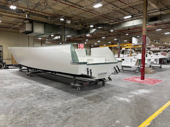
30.05 AC SEACREST MARINESTANADYNE INC
Manufacturinglight
BEAUFORT
I2
North Carolina
AE The base floodplain where base flood elevations are provided. AE Zones are now used on new format FIRMs instead of A1-A30 Zones.
30.05 AC
2025
North Carolina Northeast Area
2025
Other Market Areas
930300
Washington, NC
182,874 SF
NEARBY LISTINGS FOR SALE OR LEASE
DEMOGRAPHICS near 230 Clarks Neck Rd
1 mile
3 mile
5 mile
2025 Total Population
861
10,424
19,599
2030 Population
844
10,282
19,400
Pop Growth 2025-2030
(1.97%)
(1.36%)
(1.02%)
Average Age
43
43
44
2025 Total Households
382
4,550
8,388
HH Growth 2025-2030
(2.09%)
(1.45%)
(1.13%)
Median Household Inc
$38,518
$42,412
$50,527
Avg Household Size
2.20
2.20
2.30
2025 Avg HH Vehicles
2.00
2.00
2.00
Median Home Value
$184,558
$191,360
$191,221
Median Year Built
1974
1971
1978
Nearby Places
Map Layers
Map Styles
 Street
 Aerial
Layers
 Traffic
 Biking
Places
Listings with unknown addresses are not visible on the map
- Restaurants
- Banks
- Shops
- Fitness
- Groceries
PUBLIC TRANSPORTATION
AIRPORT
Pitt-Greenville
Drive
Walk
Distance
Pitt-Greenville
32 min
22.2 mi
Freight Ports
Port of Morehead City
Drive
Walk
Distance
Port of Morehead City
112 min
77.6 mi
SALE & LEASE HISTORY
LISTING DATE
SALE/LEASE

May 22, 2025
For Sale
Jun 12, 2019
For Sale
Jul 23, 2018
For Sale
Nearby Properties
Address
Land Use
TOTAL SIZE
Lot Size
Zoning
Address
Land Use
TOTAL SIZE
Lot Size
Zoning
119,607 SF
10 AC
Address
Land Use
TOTAL SIZE
Lot Size
Zoning
6,120 SF
472.76 AC
Address
Land Use
TOTAL SIZE
Lot Size
Zoning
4,597 SF
18.58 AC
B3
Address
Land Use
TOTAL SIZE
Lot Size
Zoning
190,121 SF
15.77 AC
Address
Land Use
TOTAL SIZE
Lot Size
Zoning
533 SF
17.45 AC
R8
Address
Land Use
TOTAL SIZE
Lot Size
Zoning
152,940 SF
35.41 AC
B2
Address
Land Use
TOTAL SIZE
Lot Size
Zoning
28.49 AC
Address
Land Use
TOTAL SIZE
Lot Size
Zoning
90,294 SF
14.42 AC
B3
Address
Land Use
TOTAL SIZE
Lot Size
Zoning
3.51 AC
Address
Land Use
TOTAL SIZE
Lot Size
Zoning
291,760 SF
28.56 AC
I2
Address
Land Use
TOTAL SIZE
Lot Size
Zoning
51,300 SF
1.41 AC
Address
Land Use
TOTAL SIZE
Lot Size
Zoning
3,142 SF
12.97 AC
R6
Address
Land Use
TOTAL SIZE
Lot Size
Zoning
12,352 SF
96.73 AC
Address
Land Use
TOTAL SIZE
Lot Size
Zoning
4.39 AC
B2
Address
Land Use
TOTAL SIZE
Lot Size
Zoning
100,608 SF
10.03 AC
B3
Address
Land Use
TOTAL SIZE
Lot Size
Zoning
24,752 SF
4.70 AC
OI
Address
Land Use
TOTAL SIZE
Lot Size
Zoning
2.11 AC
B2
Address
Land Use
TOTAL SIZE
Lot Size
Zoning
14,500 SF
12.50 AC
R6S
Address
Land Use
TOTAL SIZE
Lot Size
Zoning
108,970 SF
54.88 AC
Address
Land Use
TOTAL SIZE
Lot Size
Zoning
39,622 SF
2.68 AC
Address
Land Use
TOTAL SIZE
Lot Size
Zoning
131,025 SF
45.57 AC
I2
Address
Land Use
TOTAL SIZE
Lot Size
Zoning
45,707 SF
19.80 AC
Address
Land Use
TOTAL SIZE
Lot Size
Zoning
5.46 AC
OI
Address
Land Use
TOTAL SIZE
Lot Size
Zoning
29,496 SF
13.35 AC
RA20
Address
Land Use
TOTAL SIZE
Lot Size
Zoning
2,270 SF
22.08 AC
Address
Land Use
TOTAL SIZE
Lot Size
Zoning
30,328 SF
1.24 AC
B1H
Address
Land Use
TOTAL SIZE
Lot Size
Zoning
27,864 SF
0.92 AC
RHD
Address
Land Use
TOTAL SIZE
Lot Size
Zoning
17,640 SF
1.78 AC
OI
Address
Land Use
TOTAL SIZE
Lot Size
Zoning
10,633 SF
8.46 AC
I2
Address
Land Use
TOTAL SIZE
Lot Size
Zoning
54,804 SF
5 AC
OI
The World's #1 Commercial Real Estate Marketplace
Connect with us
© 2026 CoStar Group
The information above has been obtained from sources believed reliable. While we do not doubt its accuracy we have not verified it and make no guarantee, warranty or representation about it. It is your responsibility to independently confirm its accuracy and completeness. Any projections, opinions, assumptions, or estimates used are for example only and do not represent the current or future performance of the property. The value of this transaction to you depends on tax and other factors which should be evaluated by your tax, financial, and legal advisors. You and your advisors should conduct a careful, independent investigation of the property to determine to your satisfaction the suitability of the property for your needs.