Property Record
230 Davis Loop, Oxford, AL 36203
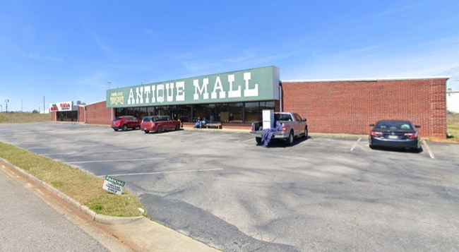

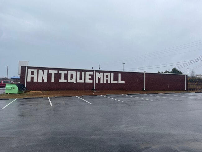
Property Detail
230 Davis Loop
Anniston-Oxford, AL
SEC 27 TSP 16 RNG 08 LOT 25 PATE CROSSING PHASE FOUR PLAT B OOK DD PAGES 27, 28, 29, & 30 BEING PT OF NE1/4 OF NW1/4 SEC 27 T
21-08-27-0-000-009.012
Calhoun
Storebuilding
Alabama
B and X Area of moderate flood hazard, usually the area between the limits of the 100-year and 500-year floods.
25
2025
1.40 AC
2025
Gadsden/Anniston Area
001102
Other Market Areas
20,900 SF
NEARBY LISTINGS FOR SALE OR LEASE
DEMOGRAPHICS near 230 Davis Loop
1 mile
3 mile
5 mile
2025 Total Population
757
18,880
37,248
2030 Population
727
18,742
37,417
Pop Growth 2025-2030
(3.96%)
(0.73%)
+ 0.45%
Average Age
36
43
42
2025 Total Households
351
7,856
15,235
HH Growth 2025-2030
(3.99%)
(0.90%)
+ 0.41%
Median Household Inc
$34,877
$63,109
$55,130
Avg Household Size
2.20
2.30
2.30
2025 Avg HH Vehicles
2.00
2.00
2.00
Median Home Value
$152,830
$201,283
$176,507
Median Year Built
1989
1980
1976
Nearby Places
Map Layers
Map Styles
 Street
 Aerial
Transit
 Traffic
 Biking
Places
Listings with unknown addresses are not visible on the map
- Restaurants
- Banks
- Shops
- Fitness
- Groceries
SALE & LEASE HISTORY
LISTING DATE
SALE/LEASE

Oct 10, 2017
For Lease
Nov 02, 2017
For Lease
Nearby Properties
Address
Land Use
TOTAL SIZE
Lot Size
Zoning
Address
Land Use
TOTAL SIZE
Lot Size
Zoning
45,466 SF
18 AC
Address
Land Use
TOTAL SIZE
Lot Size
Zoning
23,480 SF
14 AC
Address
Land Use
TOTAL SIZE
Lot Size
Zoning
5.32 AC
Address
Land Use
TOTAL SIZE
Lot Size
Zoning
126,689 SF
8.49 AC
Address
Land Use
TOTAL SIZE
Lot Size
Zoning
18.90 AC
Address
Land Use
TOTAL SIZE
Lot Size
Zoning
1,972 SF
22.80 AC
Address
Land Use
TOTAL SIZE
Lot Size
Zoning
17,254 SF
22 AC
Address
Land Use
TOTAL SIZE
Lot Size
Zoning
4,356 SF
60.40 AC
Address
Land Use
TOTAL SIZE
Lot Size
Zoning
1,335 SF
76 AC
Address
Land Use
TOTAL SIZE
Lot Size
Zoning
138,072 SF
11.60 AC
Address
Land Use
TOTAL SIZE
Lot Size
Zoning
341,374 SF
15.88 AC
Address
Land Use
TOTAL SIZE
Lot Size
Zoning
201,670 SF
27.50 AC
Address
Land Use
TOTAL SIZE
Lot Size
Zoning
74,927 SF
2.47 AC
Address
Land Use
TOTAL SIZE
Lot Size
Zoning
346,532 SF
41 AC
Address
Land Use
TOTAL SIZE
Lot Size
Zoning
64,772 SF
2.56 AC
Address
Land Use
TOTAL SIZE
Lot Size
Zoning
160,000 SF
21 AC
Address
Land Use
TOTAL SIZE
Lot Size
Zoning
56,520 SF
2.51 AC
Address
Land Use
TOTAL SIZE
Lot Size
Zoning
4,366 SF
0.97 AC
Address
Land Use
TOTAL SIZE
Lot Size
Zoning
76,250 SF
14.60 AC
Address
Land Use
TOTAL SIZE
Lot Size
Zoning
4,030 SF
11.20 AC
Address
Land Use
TOTAL SIZE
Lot Size
Zoning
102,436 SF
12.52 AC
Address
Land Use
TOTAL SIZE
Lot Size
Zoning
534,926 SF
21.75 AC
Address
Land Use
TOTAL SIZE
Lot Size
Zoning
Address
Land Use
TOTAL SIZE
Lot Size
Zoning
54,232 SF
2.27 AC
Address
Land Use
TOTAL SIZE
Lot Size
Zoning
47,700 SF
Address
Land Use
TOTAL SIZE
Lot Size
Zoning
50,180 SF
7.60 AC
Address
Land Use
TOTAL SIZE
Lot Size
Zoning
135,128 SF
10.01 AC
Address
Land Use
TOTAL SIZE
Lot Size
Zoning
14,015 SF
8.50 AC
Address
Land Use
TOTAL SIZE
Lot Size
Zoning
12,695 SF
0.75 AC
Address
Land Use
TOTAL SIZE
Lot Size
Zoning
86,508 SF
20 AC
The World's #1 Commercial Real Estate Marketplace
Connect with us
© 2026 CoStar Group
The information above has been obtained from sources believed reliable. While we do not doubt its accuracy we have not verified it and make no guarantee, warranty or representation about it. It is your responsibility to independently confirm its accuracy and completeness. Any projections, opinions, assumptions, or estimates used are for example only and do not represent the current or future performance of the property. The value of this transaction to you depends on tax and other factors which should be evaluated by your tax, financial, and legal advisors. You and your advisors should conduct a careful, independent investigation of the property to determine to your satisfaction the suitability of the property for your needs.