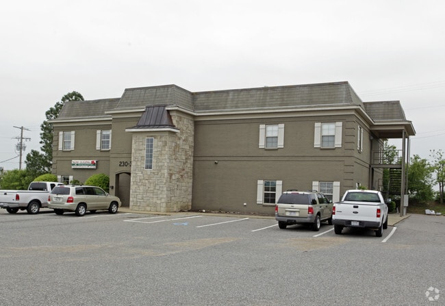
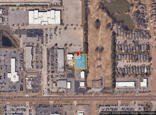
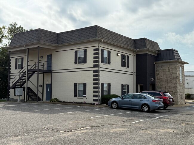
Property Record
230 Goodman Rd E, Southaven, MS 38671
NEARBY LISTINGS FOR SALE OR LEASE
Property Detail
230 Goodman Rd E
Memphis, TN-MS-AR
Goodman S/D
1079301600000300
GOODMAN S/D LOT 3
Officebuilding
DeSoto
X
Mississippi
28033C0078H
3
2024
0.62 AC
2024
DeSoto County
070522
Memphis
7,421 SF
DEMOGRAPHICS near 230 Goodman Rd E
1 Mile
3 Mile
5 Mile
2024 Total Population
4,181
47,489
116,600
2029 Population
4,520
52,024
124,537
Pop Growth 2024-2029
+ 8.11%
+ 9.55%
+ 6.81%
Average Age
41
38
38
2024 Total Households
1,700
18,563
43,720
HH Growth 2024-2029
+ 8.12%
+ 9.66%
+ 6.84%
Median Household Inc
$65,000
$51,534
$55,889
Avg Household Size
2.40
2.50
2.60
2024 Avg HH Vehicles
2.00
2.00
2.00
Median Home Value
$160,729
$164,591
$182,783
Median Year Built
1987
1992
1989
Nearby Places
- Restaurants
- Banks
- Shops
- Fitness
- Groceries
PUBLIC TRANSPORTATION
AIRPORT
Memphis International
DRIVE
WALK
Distance
Memphis International
13 min
7.7 mi
Freight Ports
Port of Shreveport
DRIVE
WALK
Distance
Port of Shreveport
415 min
382.4 mi
SALE & LEASE HISTORY
LISTING DATE
SALE/LEASE

May 06, 2025
For Lease
May 02, 2017
For Lease
Feb 25, 2019
For Lease
Nearby Properties
Address
Land Use
TOTAL SIZE
Lot Size
Zoning
Address
Land Use
TOTAL SIZE
Lot Size
Zoning
1,013,319 SF
38.86 AC
EMP
Address
Land Use
TOTAL SIZE
Lot Size
Zoning
732,894 SF
79.73 AC
WD
Address
Land Use
TOTAL SIZE
Lot Size
Zoning
853,440 SF
39.22 AC
EMP
Address
Land Use
TOTAL SIZE
Lot Size
Zoning
265,600 SF
22.03 AC
CA
Address
Land Use
TOTAL SIZE
Lot Size
Zoning
432,700 SF
28.16 AC
EMP
Address
Land Use
TOTAL SIZE
Lot Size
Zoning
1,040,736 SF
57.67 AC
M-1
Address
Land Use
TOTAL SIZE
Lot Size
Zoning
188,404 SF
59.17 AC
R-8
Address
Land Use
TOTAL SIZE
Lot Size
Zoning
843,202 SF
51 AC
PBP
Address
Land Use
TOTAL SIZE
Lot Size
Zoning
226,438 SF
19.52 AC
C-1
Address
Land Use
TOTAL SIZE
Lot Size
Zoning
39.98 AC
PUD
Address
Land Use
TOTAL SIZE
Lot Size
Zoning
741,634 SF
34.89 AC
PBP
Address
Land Use
TOTAL SIZE
Lot Size
Zoning
62,561 SF
33.01 AC
PUD
Address
Land Use
TOTAL SIZE
Lot Size
Zoning
779,780 SF
46.22 AC
PBP
Address
Land Use
TOTAL SIZE
Lot Size
Zoning
18,830 SF
25.45 AC
PUD
Address
Land Use
TOTAL SIZE
Lot Size
Zoning
111,541 SF
8.88 AC
R-8
Address
Land Use
TOTAL SIZE
Lot Size
Zoning
15,472 SF
25.97 AC
PUD
Address
Land Use
TOTAL SIZE
Lot Size
Zoning
611,307 SF
29.51 AC
PBP
Address
Land Use
TOTAL SIZE
Lot Size
Zoning
703,642 SF
37.11 AC
PBP
Address
Land Use
TOTAL SIZE
Lot Size
Zoning
618,927 SF
28.71 AC
PBP
Address
Land Use
TOTAL SIZE
Lot Size
Zoning
14,122 SF
24 AC
PUD
Address
Land Use
TOTAL SIZE
Lot Size
Zoning
554,932 SF
24.57 AC
PBP
Address
Land Use
TOTAL SIZE
Lot Size
Zoning
519,762 SF
29.67 AC
PBP
Address
Land Use
TOTAL SIZE
Lot Size
Zoning
117,148 SF
21.33 AC
EMP
Address
Land Use
TOTAL SIZE
Lot Size
Zoning
552,590 SF
36.77 AC
PBP
Address
Land Use
TOTAL SIZE
Lot Size
Zoning
397,766 SF
37.80 AC
PBP
Address
Land Use
TOTAL SIZE
Lot Size
Zoning
468,106 SF
22.28 AC
PBP
Address
Land Use
TOTAL SIZE
Lot Size
Zoning
374,928 SF
22.60 AC
PBP
Address
Land Use
TOTAL SIZE
Lot Size
Zoning
34,358 SF
26.89 AC
C-4
Address
Land Use
TOTAL SIZE
Lot Size
Zoning
10,341 SF
13.94 AC
RM-6
Address
Land Use
TOTAL SIZE
Lot Size
Zoning
430,984 SF
21.84 AC
PBP
The World's #1 Commercial Real Estate Marketplace
Connect with us
© 2025 CoStar Group
The information above has been obtained from sources believed reliable. While we do not doubt its accuracy we have not verified it and make no guarantee, warranty or representation about it. It is your responsibility to independently confirm its accuracy and completeness. Any projections, opinions, assumptions, or estimates used are for example only and do not represent the current or future performance of the property. The value of this transaction to you depends on tax and other factors which should be evaluated by your tax, financial, and legal advisors. You and your advisors should conduct a careful, independent investigation of the property to determine to your satisfaction the suitability of the property for your needs.