Property Record
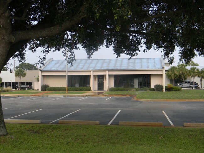
230 Main St, Destin, FL 32541


Property Detail
230 Main St
Crestview-Fort Walton Beach-Destin, FL
COM AT SE COR OF BLK 1-A KELLY HOMES E49.89 FT TO CENTERLINE OF MAIN ST S 31.88 FT TO INT OF AIRPORT RD E439.54 FT S50.82 FT W185.32 FT TO POB W53.27 FT S125 FT W150 FT S203.43 FT E200 FT N292.11 FT TO POB AS OR
00-2S-22-0000-0058-0030
Okaloosa
Financialbuilding
Florida
B and X Area of moderate flood hazard, usually the area between the limits of the 100-year and 500-year floods.
30
2025
0.99 AC
2025
Fort Walton Beach
023305
Other Market Areas
2,498 SF
NEARBY LISTINGS FOR SALE OR LEASE
DEMOGRAPHICS near 230 Main St
1 mile
3 mile
5 mile
2025 Total Population
9,639
21,342
27,377
2030 Population
10,621
23,533
30,229
Pop Growth 2025-2030
+ 10.19%
+ 10.27%
+ 10.42%
Average Age
44
45
45
2025 Total Households
4,147
9,655
12,347
HH Growth 2025-2030
+ 10.73%
+ 10.73%
+ 10.80%
Median Household Inc
$94,470
$95,787
$98,901
Avg Household Size
2.20
2.20
2.20
2025 Avg HH Vehicles
2.00
2.00
2.00
Median Home Value
$446,370
$496,380
$577,313
Median Year Built
1991
1994
1996
Nearby Places
Map Layers
Map Styles
 Street
 Aerial
Layers
 Traffic
 Biking
Places
Listings with unknown addresses are not visible on the map
- Restaurants
- Banks
- Shops
- Fitness
- Groceries
PUBLIC TRANSPORTATION
AIRPORT
Eglin AFB/Destin-Ft Walton Beach
Drive
Walk
Distance
Eglin AFB/Destin-Ft Walton Beach
48 min
19.4 mi
Freight Ports
Port of Panama City
Drive
Walk
Distance
Port of Panama City
78 min
50.2 mi
Nearby Properties
Address
Land Use
TOTAL SIZE
Lot Size
Zoning
Address
Land Use
TOTAL SIZE
Lot Size
Zoning
3,351.06 AC
Address
Land Use
TOTAL SIZE
Lot Size
Zoning
233,598 SF
213.03 AC
Address
Land Use
TOTAL SIZE
Lot Size
Zoning
335,190 SF
10.36 AC
Address
Land Use
TOTAL SIZE
Lot Size
Zoning
148,945 SF
12.83 AC
Address
Land Use
TOTAL SIZE
Lot Size
Zoning
125,459 SF
12.57 AC
Address
Land Use
TOTAL SIZE
Lot Size
Zoning
29,385 SF
211.96 AC
Address
Land Use
TOTAL SIZE
Lot Size
Zoning
181,240 SF
11.20 AC
Address
Land Use
TOTAL SIZE
Lot Size
Zoning
164,408 SF
7.98 AC
Address
Land Use
TOTAL SIZE
Lot Size
Zoning
53,437 SF
29.97 AC
Address
Land Use
TOTAL SIZE
Lot Size
Zoning
92.71 AC
Address
Land Use
TOTAL SIZE
Lot Size
Zoning
124,578 SF
13.85 AC
Address
Land Use
TOTAL SIZE
Lot Size
Zoning
135,154 SF
15.22 AC
Address
Land Use
TOTAL SIZE
Lot Size
Zoning
56,375 SF
3.51 AC
Address
Land Use
TOTAL SIZE
Lot Size
Zoning
36,890 SF
2.23 AC
Address
Land Use
TOTAL SIZE
Lot Size
Zoning
13.42 AC
Address
Land Use
TOTAL SIZE
Lot Size
Zoning
231,112 SF
23.03 AC
Address
Land Use
TOTAL SIZE
Lot Size
Zoning
95,621 SF
21.62 AC
Address
Land Use
TOTAL SIZE
Lot Size
Zoning
6,630 SF
25.69 AC
Address
Land Use
TOTAL SIZE
Lot Size
Zoning
49,123 SF
2.36 AC
Address
Land Use
TOTAL SIZE
Lot Size
Zoning
3.85 AC
Address
Land Use
TOTAL SIZE
Lot Size
Zoning
33,420 SF
2.56 AC
Address
Land Use
TOTAL SIZE
Lot Size
Zoning
56,505 SF
2.34 AC
Address
Land Use
TOTAL SIZE
Lot Size
Zoning
78,590 SF
11.24 AC
Address
Land Use
TOTAL SIZE
Lot Size
Zoning
1,768 SF
7.20 AC
Address
Land Use
TOTAL SIZE
Lot Size
Zoning
19,487 SF
51.73 AC
Address
Land Use
TOTAL SIZE
Lot Size
Zoning
88,816 SF
6.03 AC
Address
Land Use
TOTAL SIZE
Lot Size
Zoning
131,676 SF
4.57 AC
Address
Land Use
TOTAL SIZE
Lot Size
Zoning
126,224 SF
11.27 AC
Address
Land Use
TOTAL SIZE
Lot Size
Zoning
50,867 SF
2.72 AC
Address
Land Use
TOTAL SIZE
Lot Size
Zoning
19,864 SF
1.50 AC
The World's #1 Commercial Real Estate Marketplace
Connect with us
© 2026 CoStar Group
The information above has been obtained from sources believed reliable. While we do not doubt its accuracy we have not verified it and make no guarantee, warranty or representation about it. It is your responsibility to independently confirm its accuracy and completeness. Any projections, opinions, assumptions, or estimates used are for example only and do not represent the current or future performance of the property. The value of this transaction to you depends on tax and other factors which should be evaluated by your tax, financial, and legal advisors. You and your advisors should conduct a careful, independent investigation of the property to determine to your satisfaction the suitability of the property for your needs.