Property Record
230 Schenectady Ave, Brooklyn, NY 11213

Property Detail
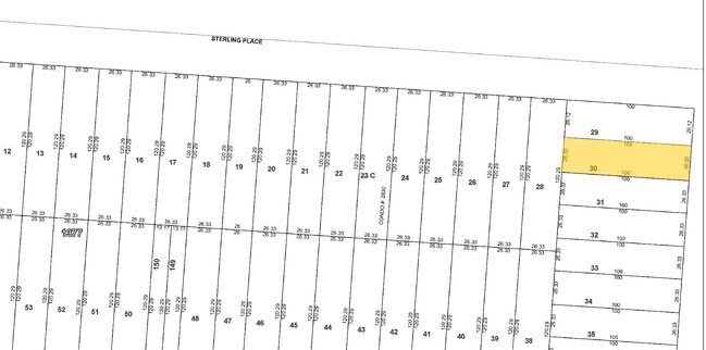
230 Schenectady Ave
01377-0030
DOCID-2016012900982001
Multifamilydwelling
Kings
R6
New York
B and X Area of moderate flood hazard, usually the area between the limits of the 100-year and 500-year floods.
30
2024
0.06 AC
2025
Crown Heights
035301
Long Island (New York)
6,006 SF
New York-Jersey City-White Plains, NY-NJ
NEARBY LISTINGS FOR SALE OR LEASE
DEMOGRAPHICS near 230 Schenectady Ave
1 mile
3 mile
5 mile
2024 Total Population
182,497
1,353,472
2,687,634
2029 Population
181,026
1,344,675
2,666,714
Pop Growth 2024-2029
(0.81%)
(0.65%)
(0.78%)
Average Age
39
39
39
2024 Total Households
68,730
502,495
998,738
HH Growth 2024-2029
(1.30%)
(0.98%)
(0.72%)
Median Household Inc
$64,798
$78,062
$82,717
Avg Household Size
2.50
2.50
2.50
2024 Avg HH Vehicles
.00
.00
1.00
Median Home Value
$1,025,415
$895,395
$879,316
Median Year Built
1947
1948
1948
Nearby Places
Map Layers
Map Styles
 Street
 Aerial
Transit
 Traffic
 Biking
Places
Listings with unknown addresses are not visible on the map
- Restaurants
- Banks
- Shops
- Fitness
- Groceries
PUBLIC TRANSPORTATION
TRANSIT/SUBWAY
Crown Heights-Utica Avenue (3 - New York MTA Subway (The Subway), 4 - New York MTA Subway (The Subway))
Drive
Walk
Distance
Crown Heights-Utica Avenue (3 - New York MTA Subway (The Subway), 4 - New York MTA Subway (The Subway))
1 min
4 min
0.2 mi
Kingston Avenue (3 - New York MTA Subway (The Subway), 4 - New York MTA Subway (The Subway))
Drive
Walk
Distance
Kingston Avenue (3 - New York MTA Subway (The Subway), 4 - New York MTA Subway (The Subway))
2 min
11 min
0.6 mi
Utica Avenue (A - New York MTA Subway (The Subway), C - New York MTA Subway (The Subway))
Drive
Walk
Distance
Utica Avenue (A - New York MTA Subway (The Subway), C - New York MTA Subway (The Subway))
3 min
13 min
0.7 mi
Sutter Avenue-Rutland Road (3 - New York MTA Subway (The Subway), 4 - New York MTA Subway (The Subway))
Drive
Walk
Distance
Sutter Avenue-Rutland Road (3 - New York MTA Subway (The Subway), 4 - New York MTA Subway (The Subway))
3 min
18 min
0.9 mi
Kingston-Throop Avenues (A - New York MTA Subway (The Subway), C - New York MTA Subway (The Subway))
Drive
Walk
Distance
Kingston-Throop Avenues (A - New York MTA Subway (The Subway), C - New York MTA Subway (The Subway))
4 min
18 min
0.9 mi
COMMUTER RAIL
Nostrand Avenue Station (Far Rockaway Branch - Long Island Rail Road, Hempstead Branch - Long Island Rail Road, Long Beach Branch - Long Island Rail Road, West Hempstead Branch - Long Island Rail Road)
Drive
Walk
Distance
Nostrand Avenue Station (Far Rockaway Branch - Long Island Rail Road, Hempstead Branch - Long Island Rail Road, Long Beach Branch - Long Island Rail Road, West Hempstead Branch - Long Island Rail Road)
6 min
1.7 mi
East New York Station (Far Rockaway Branch - Long Island Rail Road, Long Beach Branch - Long Island Rail Road, West Hempstead Branch - Long Island Rail Road)
Drive
Walk
Distance
East New York Station (Far Rockaway Branch - Long Island Rail Road, Long Beach Branch - Long Island Rail Road, West Hempstead Branch - Long Island Rail Road)
5 min
1.8 mi
AIRPORT
LaGuardia
Drive
Walk
Distance
LaGuardia
24 min
10.1 mi
John F Kennedy International
Drive
Walk
Distance
John F Kennedy International
19 min
11.0 mi
Newark Liberty International
Drive
Walk
Distance
Newark Liberty International
34 min
18.1 mi
Freight Ports
NY - Red Hook Container Terminal
Drive
Walk
Distance
NY - Red Hook Container Terminal
14 min
5.3 mi
The World's #1 Commercial Real Estate Marketplace
Connect with us
© 2026 CoStar Group
The information above has been obtained from sources believed reliable. While we do not doubt its accuracy we have not verified it and make no guarantee, warranty or representation about it. It is your responsibility to independently confirm its accuracy and completeness. Any projections, opinions, assumptions, or estimates used are for example only and do not represent the current or future performance of the property. The value of this transaction to you depends on tax and other factors which should be evaluated by your tax, financial, and legal advisors. You and your advisors should conduct a careful, independent investigation of the property to determine to your satisfaction the suitability of the property for your needs.