Property Record
2300 Division Ave S, Grand Rapids, MI 49507
NEARBY LISTINGS FOR SALE OR LEASE
Property Detail
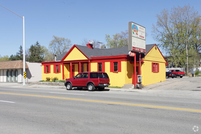
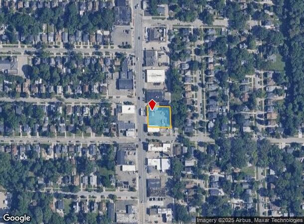
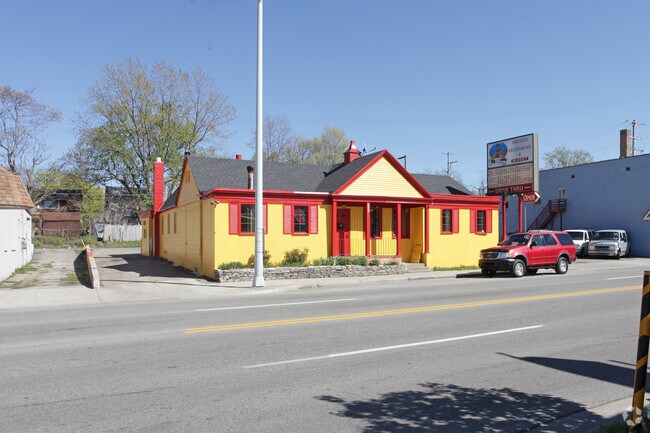
2300 Division Ave S
41-18-07-151-026
Fayne Add
Restaurantbuilding
LOTS 26 35 & 36 * FAYNE ADDITION
X
Kent
26081C0416D
Michigan
2024
0.36 AC
2025
Central Grand Rapids
004100
West Michigan
2,681 SF
Grand Rapids-Wyoming, MI
DEMOGRAPHICS near 2300 Division Ave S
1 Mile
3 Mile
5 Mile
2024 Total Population
18,403
134,813
293,718
2029 Population
18,363
135,448
295,155
Pop Growth 2024-2029
(0.22%)
+ 0.47%
+ 0.49%
Average Age
33
35
36
2024 Total Households
5,671
50,488
114,667
HH Growth 2024-2029
(0.12%)
+ 0.57%
+ 0.55%
Median Household Inc
$54,872
$58,121
$60,403
Avg Household Size
3.10
2.60
2.40
2024 Avg HH Vehicles
2.00
2.00
2.00
Median Home Value
$150,036
$171,099
$194,352
Median Year Built
1947
1953
1960
Nearby Places
Map Layers
Map Styles
 Street
 Aerial
- Restaurants
- Banks
- Shops
- Fitness
- Groceries
PUBLIC TRANSPORTATION
COMMUTER RAIL
DRIVE
WALK
Distance
7 min
3.7 mi
AIRPORT
Gerald R Ford International
DRIVE
WALK
Distance
Gerald R Ford International
21 min
10.4 mi
Nearby Properties
Address
Land Use
TOTAL SIZE
Lot Size
Zoning
Address
Land Use
TOTAL SIZE
Lot Size
Zoning
265,905 SF
1.99 AC
TN-CC
Address
Land Use
TOTAL SIZE
Lot Size
Zoning
649,177 SF
55.67 AC
SD-IT
Address
Land Use
TOTAL SIZE
Lot Size
Zoning
138,122 SF
1.01 AC
TN-CC
Address
Land Use
TOTAL SIZE
Lot Size
Zoning
941,968 SF
38.56 AC
SD-IT
Address
Land Use
TOTAL SIZE
Lot Size
Zoning
398,607 SF
33.51 AC
R4
Address
Land Use
TOTAL SIZE
Lot Size
Zoning
164,591 SF
1.28 AC
TN-CC
Address
Land Use
TOTAL SIZE
Lot Size
Zoning
194,153 SF
15.84 AC
MCN-C
Address
Land Use
TOTAL SIZE
Lot Size
Zoning
Address
Land Use
TOTAL SIZE
Lot Size
Zoning
201,100 SF
0.90 AC
TN-CC
Address
Land Use
TOTAL SIZE
Lot Size
Zoning
1,426,319 SF
54.81 AC
SD-IT
Address
Land Use
TOTAL SIZE
Lot Size
Zoning
88,327 SF
2.74 AC
TN-CC
Address
Land Use
TOTAL SIZE
Lot Size
Zoning
87.39 AC
I2
Address
Land Use
TOTAL SIZE
Lot Size
Zoning
269,990 SF
1.28 AC
TN-CC
Address
Land Use
TOTAL SIZE
Lot Size
Zoning
3.31 AC
TN-CC
Address
Land Use
TOTAL SIZE
Lot Size
Zoning
269,990 SF
1.28 AC
TN-CC
Address
Land Use
TOTAL SIZE
Lot Size
Zoning
13.71 AC
MCN-LDR
Address
Land Use
TOTAL SIZE
Lot Size
Zoning
3.31 AC
TN-CC
Address
Land Use
TOTAL SIZE
Lot Size
Zoning
536,296 SF
26.16 AC
SD-IT
Address
Land Use
TOTAL SIZE
Lot Size
Zoning
225,504 SF
0.50 AC
TN-CC
Address
Land Use
TOTAL SIZE
Lot Size
Zoning
179,436 SF
24.94 AC
I2
Address
Land Use
TOTAL SIZE
Lot Size
Zoning
348,367 SF
12.15 AC
SD-IT
Address
Land Use
TOTAL SIZE
Lot Size
Zoning
29.13 AC
Address
Land Use
TOTAL SIZE
Lot Size
Zoning
251,562 SF
15.56 AC
MZ
Address
Land Use
TOTAL SIZE
Lot Size
Zoning
31,365 SF
TN-TCC
Address
Land Use
TOTAL SIZE
Lot Size
Zoning
162,228 SF
14.31 AC
R4
Address
Land Use
TOTAL SIZE
Lot Size
Zoning
135,254 SF
0.26 AC
TN-CC
Address
Land Use
TOTAL SIZE
Lot Size
Zoning
131,004 SF
0.64 AC
TN-CC
Address
Land Use
TOTAL SIZE
Lot Size
Zoning
89,565 SF
0.16 AC
TN-CC
Address
Land Use
TOTAL SIZE
Lot Size
Zoning
122,570 SF
1.17 AC
TN-TCC
Address
Land Use
TOTAL SIZE
Lot Size
Zoning
123,066 SF
0.30 AC
TN-CC
The World's #1 Commercial Real Estate Marketplace
Connect with us
© 2025 CoStar Group
The information above has been obtained from sources believed reliable. While we do not doubt its accuracy we have not verified it and make no guarantee, warranty or representation about it. It is your responsibility to independently confirm its accuracy and completeness. Any projections, opinions, assumptions, or estimates used are for example only and do not represent the current or future performance of the property. The value of this transaction to you depends on tax and other factors which should be evaluated by your tax, financial, and legal advisors. You and your advisors should conduct a careful, independent investigation of the property to determine to your satisfaction the suitability of the property for your needs.