Property Record
2300 E State Rd, Lansing, MI 48906
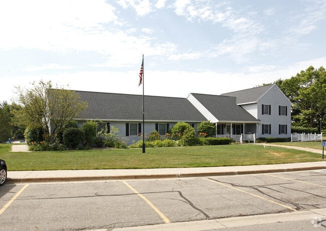

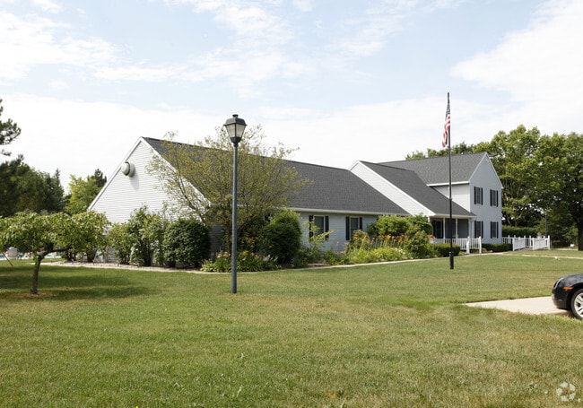
Property Detail
2300 E State Rd
050-035-200-010-00
COM 370.54 FT W & 120 FT S OF N 1/4 COR SEC 35 T5NR2W, TH S 3231.15 FT ALG WUS-127 ROW, TH S04D17M30SE ALG ROW 1113.55 FT TO
Clubslodgesprofessionalassociations
Clinton
MHP
Michigan
B and X Area of moderate flood hazard, usually the area between the limits of the 100-year and 500-year floods.
69.64 AC
2024
Outer Clinton County
2025
West Michigan
010104
Lansing-East Lansing, MI
4,590 SF
NEARBY LISTINGS FOR SALE OR LEASE
DEMOGRAPHICS near 2300 E State Rd
1 mile
3 mile
5 mile
2025 Total Population
1,892
38,145
139,867
2030 Population
1,895
39,086
144,596
Pop Growth 2025-2030
+ 0.16%
+ 2.47%
+ 3.38%
Average Age
42
38
36
2025 Total Households
829
17,281
57,438
HH Growth 2025-2030
0.00%
+ 2.67%
+ 3.61%
Median Household Inc
$78,485
$62,281
$58,206
Avg Household Size
2.20
2.10
2.20
2025 Avg HH Vehicles
2.00
2.00
2.00
Median Home Value
$97,109
$188,151
$203,324
Median Year Built
1985
1976
1971
Nearby Places
Map Layers
Map Styles
 Street
 Aerial
Transit
 Traffic
 Biking
Places
Listings with unknown addresses are not visible on the map
- Restaurants
- Banks
- Shops
- Fitness
- Groceries
PUBLIC TRANSPORTATION
COMMUTER RAIL
East Lansing Amtrak Station (Blue Water - Amtrak)
Drive
Walk
Distance
East Lansing Amtrak Station (Blue Water - Amtrak)
15 min
7.2 mi
AIRPORT
Capital Region International
Drive
Walk
Distance
Capital Region International
15 min
6.2 mi
Freight Ports
Port of Toledo
Drive
Walk
Distance
Port of Toledo
153 min
118.4 mi
Nearby Properties
Address
Land Use
TOTAL SIZE
Lot Size
Zoning
Address
Land Use
TOTAL SIZE
Lot Size
Zoning
42,875 SF
35 AC
PD
Address
Land Use
TOTAL SIZE
Lot Size
Zoning
7,579 SF
83.53 AC
PD
Address
Land Use
TOTAL SIZE
Lot Size
Zoning
42,875 SF
28.77 AC
Address
Land Use
TOTAL SIZE
Lot Size
Zoning
14,304 SF
3.37 AC
MIXED Z
Address
Land Use
TOTAL SIZE
Lot Size
Zoning
73,179 SF
58.17 AC
RM14
Address
Land Use
TOTAL SIZE
Lot Size
Zoning
63,461 SF
32 AC
F COMM
Address
Land Use
TOTAL SIZE
Lot Size
Zoning
13.13 AC
Address
Land Use
TOTAL SIZE
Lot Size
Zoning
66.43 AC
Address
Land Use
TOTAL SIZE
Lot Size
Zoning
16,466 SF
14.82 AC
DEVELOPMEN
Address
Land Use
TOTAL SIZE
Lot Size
Zoning
2,137 SF
12.72 AC
H LT IN
Address
Land Use
TOTAL SIZE
Lot Size
Zoning
19,035 SF
12.32 AC
RM08
Address
Land Use
TOTAL SIZE
Lot Size
Zoning
20,438 SF
17.81 AC
DEVELOPMEN
Address
Land Use
TOTAL SIZE
Lot Size
Zoning
300,760 SF
27.22 AC
RM08
Address
Land Use
TOTAL SIZE
Lot Size
Zoning
183,047 SF
24.36 AC
B4
Address
Land Use
TOTAL SIZE
Lot Size
Zoning
142,152 SF
47.56 AC
B4
Address
Land Use
TOTAL SIZE
Lot Size
Zoning
9,280 SF
24.38 AC
RC
Address
Land Use
TOTAL SIZE
Lot Size
Zoning
51,248 SF
4.85 AC
I HVY
Address
Land Use
TOTAL SIZE
Lot Size
Zoning
118,415 SF
4.74 AC
RM22
Address
Land Use
TOTAL SIZE
Lot Size
Zoning
63.94 AC
Address
Land Use
TOTAL SIZE
Lot Size
Zoning
8,834 SF
17.46 AC
DEVELOPMEN
Address
Land Use
TOTAL SIZE
Lot Size
Zoning
19,035 SF
11.98 AC
RM08
Address
Land Use
TOTAL SIZE
Lot Size
Zoning
61,194 SF
0.55 AC
F COMME
Address
Land Use
TOTAL SIZE
Lot Size
Zoning
Address
Land Use
TOTAL SIZE
Lot Size
Zoning
29,292 SF
8.21 AC
DEVELOPMEN
Address
Land Use
TOTAL SIZE
Lot Size
Zoning
76,606 SF
1.75 AC
Address
Land Use
TOTAL SIZE
Lot Size
Zoning
69,768 SF
8.22 AC
D ADMIN
Address
Land Use
TOTAL SIZE
Lot Size
Zoning
2,000 SF
0.91 AC
PD
Address
Land Use
TOTAL SIZE
Lot Size
Zoning
22,785 SF
10.26 AC
Address
Land Use
TOTAL SIZE
Lot Size
Zoning
6,030 SF
7.63 AC
RM22
Address
Land Use
TOTAL SIZE
Lot Size
Zoning
11,640 SF
19.05 AC
RM14
The World's #1 Commercial Real Estate Marketplace
Connect with us
© 2026 CoStar Group
The information above has been obtained from sources believed reliable. While we do not doubt its accuracy we have not verified it and make no guarantee, warranty or representation about it. It is your responsibility to independently confirm its accuracy and completeness. Any projections, opinions, assumptions, or estimates used are for example only and do not represent the current or future performance of the property. The value of this transaction to you depends on tax and other factors which should be evaluated by your tax, financial, and legal advisors. You and your advisors should conduct a careful, independent investigation of the property to determine to your satisfaction the suitability of the property for your needs.