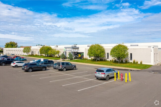
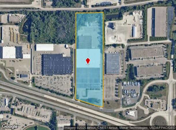
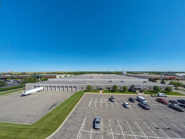
Property Record
2300 Highway 13 W, Burnsville, MN 55337
Current Lease Availabilities
NEARBY LISTINGS FOR SALE OR LEASE
Property Detail
2300 Highway 13 W
Minneapolis-St. Paul-Bloomington, MN-WI
First Industrial Addition
02-26650-01-010
FIRST INDUSTRIAL ADDITION 1 1
Industrialgeneral
Dakota
AE
Minnesota
27053C0475F
10
2024
21.17 AC
2024
South Central
060710
Minneapolis/St Paul
421,893 SF
DEMOGRAPHICS near 2300 Highway 13 W
1 Mile
3 Mile
5 Mile
2024 Total Population
5,052
65,107
179,253
2029 Population
5,188
66,253
181,981
Pop Growth 2024-2029
+ 2.69%
+ 1.76%
+ 1.52%
Average Age
35
40
40
2024 Total Households
1,793
25,389
70,261
HH Growth 2024-2029
+ 2.68%
+ 1.72%
+ 1.38%
Median Household Inc
$72,675
$85,453
$90,665
Avg Household Size
2.70
2.50
2.50
2024 Avg HH Vehicles
2.00
2.00
2.00
Median Home Value
$282,081
$305,875
$328,778
Median Year Built
1977
1979
1981
Nearby Places
Map Layers
Map Styles
 Street
 Aerial
- Restaurants
- Banks
- Shops
- Fitness
- Groceries
PUBLIC TRANSPORTATION
AIRPORT
Minneapolis-St Paul International/Wold-Chamberlain
DRIVE
WALK
Distance
Minneapolis-St Paul International/Wold-Chamberlain
21 min
12.9 mi
Nearby Properties
Address
Land Use
TOTAL SIZE
Lot Size
Zoning
Address
Land Use
TOTAL SIZE
Lot Size
Zoning
339,871 SF
26.64 AC
Address
Land Use
TOTAL SIZE
Lot Size
Zoning
525,323 SF
8.09 AC
Address
Land Use
TOTAL SIZE
Lot Size
Zoning
129,658 SF
13.52 AC
Address
Land Use
TOTAL SIZE
Lot Size
Zoning
581,195 SF
37 AC
Address
Land Use
TOTAL SIZE
Lot Size
Zoning
584,692 SF
15.70 AC
Address
Land Use
TOTAL SIZE
Lot Size
Zoning
230,883 SF
2.49 AC
Address
Land Use
TOTAL SIZE
Lot Size
Zoning
8.70 AC
Address
Land Use
TOTAL SIZE
Lot Size
Zoning
142,229 SF
26.61 AC
Address
Land Use
TOTAL SIZE
Lot Size
Zoning
394,700 SF
13.23 AC
Address
Land Use
TOTAL SIZE
Lot Size
Zoning
419,750 SF
13.83 AC
Address
Land Use
TOTAL SIZE
Lot Size
Zoning
374,415 SF
20.10 AC
Address
Land Use
TOTAL SIZE
Lot Size
Zoning
436,995 SF
22.36 AC
Address
Land Use
TOTAL SIZE
Lot Size
Zoning
289,168 SF
11.73 AC
Address
Land Use
TOTAL SIZE
Lot Size
Zoning
265,406 SF
26.78 AC
Address
Land Use
TOTAL SIZE
Lot Size
Zoning
273,843 SF
17.55 AC
Address
Land Use
TOTAL SIZE
Lot Size
Zoning
177,489 SF
1.75 AC
Address
Land Use
TOTAL SIZE
Lot Size
Zoning
276,290 SF
7.44 AC
Address
Land Use
TOTAL SIZE
Lot Size
Zoning
216,267 SF
3.69 AC
Address
Land Use
TOTAL SIZE
Lot Size
Zoning
234,348 SF
11.21 AC
Address
Land Use
TOTAL SIZE
Lot Size
Zoning
174,245 SF
2.90 AC
Address
Land Use
TOTAL SIZE
Lot Size
Zoning
190,865 SF
3.67 AC
Address
Land Use
TOTAL SIZE
Lot Size
Zoning
287,255 SF
14.69 AC
Address
Land Use
TOTAL SIZE
Lot Size
Zoning
239,047 SF
9.14 AC
Address
Land Use
TOTAL SIZE
Lot Size
Zoning
106,944 SF
13.21 AC
Address
Land Use
TOTAL SIZE
Lot Size
Zoning
216,700 SF
43.17 AC
Address
Land Use
TOTAL SIZE
Lot Size
Zoning
217,534 SF
18.77 AC
Address
Land Use
TOTAL SIZE
Lot Size
Zoning
256,907 SF
7.43 AC
Address
Land Use
TOTAL SIZE
Lot Size
Zoning
136,535 SF
4.99 AC
Address
Land Use
TOTAL SIZE
Lot Size
Zoning
324,094 SF
44.01 AC
Address
Land Use
TOTAL SIZE
Lot Size
Zoning
153,369 SF
4.84 AC
The World's #1 Commercial Real Estate Marketplace
Connect with us
© 2026 CoStar Group
The information above has been obtained from sources believed reliable. While we do not doubt its accuracy we have not verified it and make no guarantee, warranty or representation about it. It is your responsibility to independently confirm its accuracy and completeness. Any projections, opinions, assumptions, or estimates used are for example only and do not represent the current or future performance of the property. The value of this transaction to you depends on tax and other factors which should be evaluated by your tax, financial, and legal advisors. You and your advisors should conduct a careful, independent investigation of the property to determine to your satisfaction the suitability of the property for your needs.