Property Record
2300 N Main St, Joplin, MO 64801

NEARBY LISTINGS FOR SALE OR LEASE
Property Detail
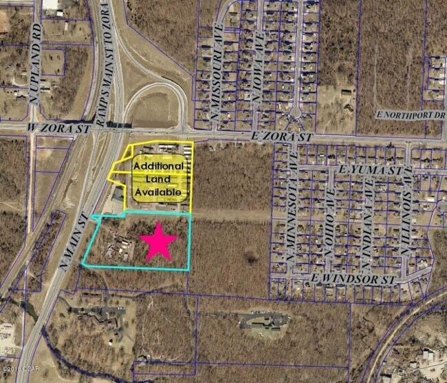
2300 N Main St
16-7.0-35-00-000-010.000
Jop
Apartment
JOP MISC BEG 650 S NE COR NW NW S 453.66 W 825.77 N 61 DEG W 84.33 N 21 DEG E 408.42 E 212.92 N 40 E 537.61 TO POB EX HWY 43 R/W
X
Jasper
29097C0257E
Missouri
2024
8.06 AC
2025
Missouri South Area
010200
Other Market Areas
1,602 SF
Joplin, MO-KS
DEMOGRAPHICS near 2300 N Main St
1 mile
3 mile
5 mile
2024 Total Population
2,186
39,447
81,986
2029 Population
2,230
40,706
84,693
Pop Growth 2024-2029
+ 2.01%
+ 3.19%
+ 3.30%
Average Age
42
38
39
2024 Total Households
894
16,328
33,626
HH Growth 2024-2029
+ 1.90%
+ 3.25%
+ 3.30%
Median Household Inc
$58,636
$46,188
$51,511
Avg Household Size
2.40
2.30
2.30
2024 Avg HH Vehicles
2.00
2.00
2.00
Median Home Value
$192,256
$144,960
$152,652
Median Year Built
1986
1977
1986
Nearby Places
Map Layers
Map Styles
 Street
 Aerial
Transit
 Traffic
 Biking
Places
Listings with unknown addresses are not visible on the map
- Restaurants
- Banks
- Shops
- Fitness
- Groceries
SALE & LEASE HISTORY
LISTING DATE
SALE/LEASE

Feb 03, 2020
For Sale
Nearby Properties
Address
Land Use
TOTAL SIZE
Lot Size
Zoning
Address
Land Use
TOTAL SIZE
Lot Size
Zoning
605,856 SF
40.96 AC
Address
Land Use
TOTAL SIZE
Lot Size
Zoning
28,488 SF
2.34 AC
Address
Land Use
TOTAL SIZE
Lot Size
Zoning
220,377 SF
10.45 AC
Address
Land Use
TOTAL SIZE
Lot Size
Zoning
20,619 SF
4.56 AC
Address
Land Use
TOTAL SIZE
Lot Size
Zoning
62,916 SF
0.28 AC
Address
Land Use
TOTAL SIZE
Lot Size
Zoning
135,028 SF
6.79 AC
Address
Land Use
TOTAL SIZE
Lot Size
Zoning
66,470 SF
7.71 AC
Address
Land Use
TOTAL SIZE
Lot Size
Zoning
85,574 SF
16.39 AC
Address
Land Use
TOTAL SIZE
Lot Size
Zoning
192,975 SF
23.15 AC
Address
Land Use
TOTAL SIZE
Lot Size
Zoning
Address
Land Use
TOTAL SIZE
Lot Size
Zoning
13,217 SF
6.12 AC
Address
Land Use
TOTAL SIZE
Lot Size
Zoning
151,868 SF
16.74 AC
Address
Land Use
TOTAL SIZE
Lot Size
Zoning
142,801 SF
11.85 AC
Address
Land Use
TOTAL SIZE
Lot Size
Zoning
88,710 SF
8.75 AC
Address
Land Use
TOTAL SIZE
Lot Size
Zoning
53,510 SF
6.34 AC
Address
Land Use
TOTAL SIZE
Lot Size
Zoning
73,052 SF
0.62 AC
Address
Land Use
TOTAL SIZE
Lot Size
Zoning
18,610 SF
1.66 AC
Address
Land Use
TOTAL SIZE
Lot Size
Zoning
113,028 SF
7.99 AC
Address
Land Use
TOTAL SIZE
Lot Size
Zoning
5.80 AC
Address
Land Use
TOTAL SIZE
Lot Size
Zoning
81,324 SF
5.97 AC
Address
Land Use
TOTAL SIZE
Lot Size
Zoning
15,940 SF
7.76 AC
Address
Land Use
TOTAL SIZE
Lot Size
Zoning
88,786 SF
3.92 AC
Address
Land Use
TOTAL SIZE
Lot Size
Zoning
14,670 SF
1.49 AC
Address
Land Use
TOTAL SIZE
Lot Size
Zoning
87,112 SF
4.45 AC
Address
Land Use
TOTAL SIZE
Lot Size
Zoning
373,562 SF
42.56 AC
Address
Land Use
TOTAL SIZE
Lot Size
Zoning
65,468 SF
10.30 AC
Address
Land Use
TOTAL SIZE
Lot Size
Zoning
45,880 SF
4.81 AC
Address
Land Use
TOTAL SIZE
Lot Size
Zoning
243,712 SF
25.32 AC
Address
Land Use
TOTAL SIZE
Lot Size
Zoning
15,372 SF
2.80 AC
The World's #1 Commercial Real Estate Marketplace
Connect with us
© 2026 CoStar Group
The information above has been obtained from sources believed reliable. While we do not doubt its accuracy we have not verified it and make no guarantee, warranty or representation about it. It is your responsibility to independently confirm its accuracy and completeness. Any projections, opinions, assumptions, or estimates used are for example only and do not represent the current or future performance of the property. The value of this transaction to you depends on tax and other factors which should be evaluated by your tax, financial, and legal advisors. You and your advisors should conduct a careful, independent investigation of the property to determine to your satisfaction the suitability of the property for your needs.