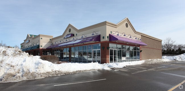
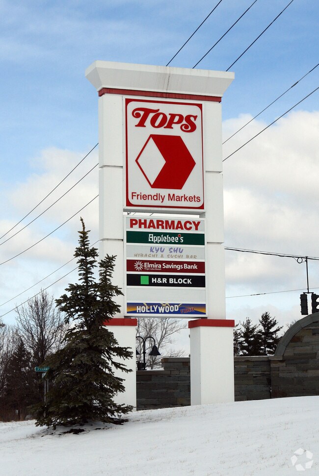
Property Record
2300 N Triphammer Rd, Ithaca, NY 14850

NEARBY LISTINGS FOR SALE OR LEASE
Property Detail
2300 N Triphammer Rd
503201-047-001-0001-021-002-0000
BUFFALO-CASELLBERRY 2.63 RICHARD FRANCO 10.745 BENDERSON TRUST 86.625
Stripcommercialcenter
Tompkins
X
New York
36109C0201D
21.002
2025
2.60 AC
2024
Ithaca/Elmira
000600
Other Market Areas
20,740 SF
Ithaca, NY
DEMOGRAPHICS near 2300 N Triphammer Rd
1 Mile
3 Mile
5 Mile
2024 Total Population
6,507
36,405
61,575
2029 Population
5,723
31,909
53,905
Pop Growth 2024-2029
(12.05%)
(12.35%)
(12.46%)
Average Age
42
34
35
2024 Total Households
2,916
13,189
23,265
HH Growth 2024-2029
(14.13%)
(16.35%)
(16.35%)
Median Household Inc
$92,884
$61,378
$64,032
Avg Household Size
2.10
2.00
2.00
2024 Avg HH Vehicles
1.00
1.00
1.00
Median Home Value
$378,220
$360,007
$330,656
Median Year Built
1977
1971
1973
Nearby Places
- Restaurants
- Banks
- Shops
- Fitness
- Groceries
PUBLIC TRANSPORTATION
AIRPORT
Ithaca Tompkins International
DRIVE
WALK
Distance
Ithaca Tompkins International
5 min
2.0 mi
Elmira/Corning Regional
DRIVE
WALK
Distance
Elmira/Corning Regional
53 min
38.1 mi
SALE & LEASE HISTORY
LISTING DATE
SALE/LEASE

Sep 25, 2016
For Lease
Nearby Properties
Address
Land Use
TOTAL SIZE
Lot Size
Zoning
Address
Land Use
TOTAL SIZE
Lot Size
Zoning
5,000 SF
154.28 AC
U-1
Address
Land Use
TOTAL SIZE
Lot Size
Zoning
43 AC
Address
Land Use
TOTAL SIZE
Lot Size
Zoning
36,275 SF
157.84 AC
Address
Land Use
TOTAL SIZE
Lot Size
Zoning
378,445 SF
4.39 AC
Address
Land Use
TOTAL SIZE
Lot Size
Zoning
338,706 SF
2.08 AC
U-1
Address
Land Use
TOTAL SIZE
Lot Size
Zoning
276,302 SF
15.94 AC
Address
Land Use
TOTAL SIZE
Lot Size
Zoning
1.30 AC
U-1
Address
Land Use
TOTAL SIZE
Lot Size
Zoning
50,319 SF
25.92 AC
Address
Land Use
TOTAL SIZE
Lot Size
Zoning
19,600 SF
22.51 AC
P-1
Address
Land Use
TOTAL SIZE
Lot Size
Zoning
32,162 SF
351.71 AC
Address
Land Use
TOTAL SIZE
Lot Size
Zoning
218,211 SF
0.76 AC
CBD-60
Address
Land Use
TOTAL SIZE
Lot Size
Zoning
150,015 SF
4.94 AC
U-1
Address
Land Use
TOTAL SIZE
Lot Size
Zoning
364,128 SF
107.14 AC
Address
Land Use
TOTAL SIZE
Lot Size
Zoning
20,834 SF
32.98 AC
Address
Land Use
TOTAL SIZE
Lot Size
Zoning
140,488 SF
5.90 AC
Address
Land Use
TOTAL SIZE
Lot Size
Zoning
131,532 SF
2.20 AC
U-1
Address
Land Use
TOTAL SIZE
Lot Size
Zoning
93,573 SF
0.91 AC
Address
Land Use
TOTAL SIZE
Lot Size
Zoning
8,100 SF
0.51 AC
CBD-60
Address
Land Use
TOTAL SIZE
Lot Size
Zoning
116,854 SF
1.16 AC
Address
Land Use
TOTAL SIZE
Lot Size
Zoning
115,796 SF
26.51 AC
Address
Land Use
TOTAL SIZE
Lot Size
Zoning
0.93 AC
U-1
Address
Land Use
TOTAL SIZE
Lot Size
Zoning
130,781 SF
20.10 AC
Address
Land Use
TOTAL SIZE
Lot Size
Zoning
75,168 SF
22.92 AC
Address
Land Use
TOTAL SIZE
Lot Size
Zoning
112,392 SF
0.76 AC
B-2B
Address
Land Use
TOTAL SIZE
Lot Size
Zoning
185,997 SF
0.17 AC
CBD-140
Address
Land Use
TOTAL SIZE
Lot Size
Zoning
26,658 SF
0.69 AC
R-3A
Address
Land Use
TOTAL SIZE
Lot Size
Zoning
5,555 SF
12.07 AC
P-1
Address
Land Use
TOTAL SIZE
Lot Size
Zoning
6,910 SF
19.46 AC
Address
Land Use
TOTAL SIZE
Lot Size
Zoning
792 SF
49.77 AC
The World's #1 Commercial Real Estate Marketplace
Connect with us
© 2025 CoStar Group
The information above has been obtained from sources believed reliable. While we do not doubt its accuracy we have not verified it and make no guarantee, warranty or representation about it. It is your responsibility to independently confirm its accuracy and completeness. Any projections, opinions, assumptions, or estimates used are for example only and do not represent the current or future performance of the property. The value of this transaction to you depends on tax and other factors which should be evaluated by your tax, financial, and legal advisors. You and your advisors should conduct a careful, independent investigation of the property to determine to your satisfaction the suitability of the property for your needs.