Property Record
2300 Ne 10Th St, Unincorporated, OK 73160

NEARBY LISTINGS FOR SALE OR LEASE
Property Detail
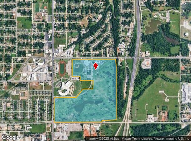
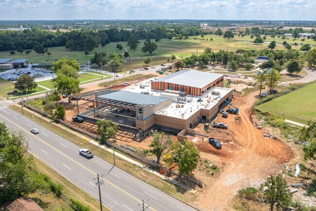
2300 Ne 10Th St
Oklahoma City, OK
Oklahoma Township
168662050
OKLAHOMA TOWNSHIP 000 000 NW4 SEC 36 12N 3W EX BEG 40FT S & 40FT E NW/C SD NW4 TH E735FT S660FT E340FT S700FT MORE OR LESS SWLY 220FT MORE OR LESSW950FT N1519.25FT TO BEG & EX BEG 1650FT E 1560FT S & 322FTN NW/C SD NW4 TH N318FT W535FT S490FT MORE OR
Taxexempt
Oklahoma
X
Oklahoma
40109C0305H
110.72 AC
0
South
2024
Oklahoma City
109500
DEMOGRAPHICS near 2300 Ne 10Th St
1 Mile
3 Mile
5 Mile
2024 Total Population
7,119
47,280
170,987
2029 Population
7,518
49,137
177,231
Pop Growth 2024-2029
+ 5.60%
+ 3.93%
+ 3.65%
Average Age
40
38
37
2024 Total Households
3,257
21,592
71,505
HH Growth 2024-2029
+ 5.68%
+ 4.11%
+ 3.65%
Median Household Inc
$25,337
$38,873
$44,122
Avg Household Size
2.10
2.10
2.30
2024 Avg HH Vehicles
1.00
2.00
2.00
Median Home Value
$78,580
$96,407
$118,986
Median Year Built
1956
1959
1961
Nearby Places
Map Layers
Map Styles
 Street
 Aerial
- Restaurants
- Banks
- Shops
- Fitness
- Groceries
PUBLIC TRANSPORTATION
COMMUTER RAIL
Oklahoma City (Heartland Flyer - Amtrak)
DRIVE
WALK
Distance
Oklahoma City (Heartland Flyer - Amtrak)
6 min
4.1 mi
AIRPORT
Will Rogers World
DRIVE
WALK
Distance
Will Rogers World
24 min
13.5 mi
Freight Ports
Tulsa Port Of Catoosa
DRIVE
WALK
Distance
Tulsa Port Of Catoosa
130 min
120.9 mi
Nearby Properties
Address
Land Use
TOTAL SIZE
Lot Size
Zoning
Address
Land Use
TOTAL SIZE
Lot Size
Zoning
3,029,769 SF
7.21 AC
DBD
Address
Land Use
TOTAL SIZE
Lot Size
Zoning
187,346 SF
13.75 AC
PUD
Address
Land Use
TOTAL SIZE
Lot Size
Zoning
1,376,216 SF
3.22 AC
DBD
Address
Land Use
TOTAL SIZE
Lot Size
Zoning
52,331 SF
2.72 AC
DBD
Address
Land Use
TOTAL SIZE
Lot Size
Zoning
324,688 SF
1.36 AC
DBD
Address
Land Use
TOTAL SIZE
Lot Size
Zoning
101,216 SF
1.23 AC
Address
Land Use
TOTAL SIZE
Lot Size
Zoning
951,493 SF
2.24 AC
DBD
Address
Land Use
TOTAL SIZE
Lot Size
Zoning
628,486 SF
0.53 AC
DBD
Address
Land Use
TOTAL SIZE
Lot Size
Zoning
511,817 SF
3.85 AC
DBD
Address
Land Use
TOTAL SIZE
Lot Size
Zoning
40,914 SF
0.50 AC
DTD-1
Address
Land Use
TOTAL SIZE
Lot Size
Zoning
413,783 SF
6.25 AC
DBD
Address
Land Use
TOTAL SIZE
Lot Size
Zoning
194,762 SF
3 AC
DTD-1
Address
Land Use
TOTAL SIZE
Lot Size
Zoning
91,352 SF
0.68 AC
DBD
Address
Land Use
TOTAL SIZE
Lot Size
Zoning
303,589 SF
7.17 AC
PUD
Address
Land Use
TOTAL SIZE
Lot Size
Zoning
382,618 SF
5.13 AC
BC
Address
Land Use
TOTAL SIZE
Lot Size
Zoning
164,861 SF
0.32 AC
Address
Land Use
TOTAL SIZE
Lot Size
Zoning
38,866 SF
2.89 AC
DBD
Address
Land Use
TOTAL SIZE
Lot Size
Zoning
307,772 SF
1.32 AC
DBD
Address
Land Use
TOTAL SIZE
Lot Size
Zoning
281,052 SF
1.89 AC
DBD
Address
Land Use
TOTAL SIZE
Lot Size
Zoning
42,450 SF
0.32 AC
BC
Address
Land Use
TOTAL SIZE
Lot Size
Zoning
302,236 SF
2.62 AC
SPUD
Address
Land Use
TOTAL SIZE
Lot Size
Zoning
279,464 SF
1.49 AC
DBD
Address
Land Use
TOTAL SIZE
Lot Size
Zoning
188,121 SF
0.83 AC
BC
Address
Land Use
TOTAL SIZE
Lot Size
Zoning
344,045 SF
0.55 AC
DBD
Address
Land Use
TOTAL SIZE
Lot Size
Zoning
246,881 SF
1.10 AC
DBD
Address
Land Use
TOTAL SIZE
Lot Size
Zoning
502,508 SF
2.27 AC
DBD
Address
Land Use
TOTAL SIZE
Lot Size
Zoning
184,398 SF
8.09 AC
PUD
Address
Land Use
TOTAL SIZE
Lot Size
Zoning
373,348 SF
0.80 AC
DBD
Address
Land Use
TOTAL SIZE
Lot Size
Zoning
621,489 SF
3.10 AC
DBD
Address
Land Use
TOTAL SIZE
Lot Size
Zoning
150,272 SF
1.54 AC
DBD
The World's #1 Commercial Real Estate Marketplace
Connect with us
© 2025 CoStar Group
The information above has been obtained from sources believed reliable. While we do not doubt its accuracy we have not verified it and make no guarantee, warranty or representation about it. It is your responsibility to independently confirm its accuracy and completeness. Any projections, opinions, assumptions, or estimates used are for example only and do not represent the current or future performance of the property. The value of this transaction to you depends on tax and other factors which should be evaluated by your tax, financial, and legal advisors. You and your advisors should conduct a careful, independent investigation of the property to determine to your satisfaction the suitability of the property for your needs.