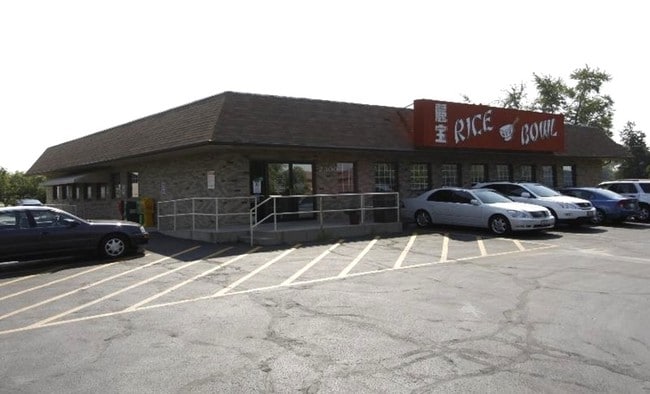
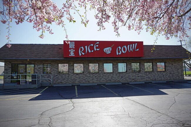
Property Record
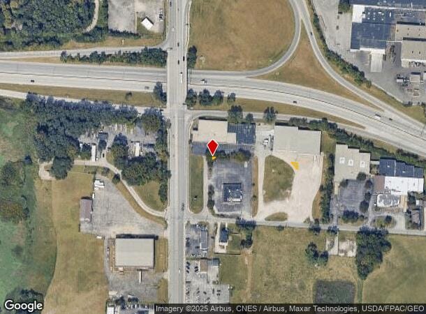
2300 S High St, Columbus, OH 43207
NEARBY LISTINGS FOR SALE OR LEASE
Property Detail
2300 S High St
010-104058
0.006 ACRE R22 T4 S4 COURT LOT 1-2
Commercialacreage
Franklin
X
Ohio
39049C0336K
1-2
2024
0.01 AC
2024
Southeast
030500
Columbus
27,909 SF
Columbus, OH
DEMOGRAPHICS near 2300 S High St
1 Mile
3 Mile
5 Mile
2024 Total Population
5,688
75,103
241,326
2029 Population
5,769
75,890
244,517
Pop Growth 2024-2029
+ 1.42%
+ 1.05%
+ 1.32%
Average Age
41
38
38
2024 Total Households
2,361
31,757
104,464
HH Growth 2024-2029
+ 1.44%
+ 1.07%
+ 1.39%
Median Household Inc
$43,583
$55,823
$58,632
Avg Household Size
2.30
2.20
2.20
2024 Avg HH Vehicles
2.00
2.00
2.00
Median Home Value
$126,859
$179,338
$198,497
Median Year Built
1951
1958
1963
Nearby Places
Map Layers
Map Styles
 Street
 Aerial
- Restaurants
- Banks
- Shops
- Fitness
- Groceries
PUBLIC TRANSPORTATION
AIRPORT
Rickenbacker International
DRIVE
WALK
Distance
Rickenbacker International
17 min
8.8 mi
John Glenn Columbus International
DRIVE
WALK
Distance
John Glenn Columbus International
19 min
11.6 mi
Freight Ports
Port of Toledo
DRIVE
WALK
Distance
Port of Toledo
189 min
148.8 mi
SALE & LEASE HISTORY
LISTING DATE
SALE/LEASE

Sep 26, 2016
For Lease
Sep 23, 2016
For Sale
Nearby Properties
Address
Land Use
TOTAL SIZE
Lot Size
Zoning
Address
Land Use
TOTAL SIZE
Lot Size
Zoning
1,949,795 SF
20.56 AC
Address
Land Use
TOTAL SIZE
Lot Size
Zoning
1,467,891 SF
10.49 AC
Address
Land Use
TOTAL SIZE
Lot Size
Zoning
382.42 AC
Address
Land Use
TOTAL SIZE
Lot Size
Zoning
304,340 SF
3.86 AC
Address
Land Use
TOTAL SIZE
Lot Size
Zoning
477,854 SF
0.72 AC
Address
Land Use
TOTAL SIZE
Lot Size
Zoning
832,673 SF
2.87 AC
Address
Land Use
TOTAL SIZE
Lot Size
Zoning
339,231 SF
0.73 AC
Address
Land Use
TOTAL SIZE
Lot Size
Zoning
669,626 SF
0.97 AC
Address
Land Use
TOTAL SIZE
Lot Size
Zoning
859,800 SF
68.91 AC
Address
Land Use
TOTAL SIZE
Lot Size
Zoning
496,729 SF
3.47 AC
Address
Land Use
TOTAL SIZE
Lot Size
Zoning
243,888 SF
0.88 AC
Address
Land Use
TOTAL SIZE
Lot Size
Zoning
360,962 SF
33.91 AC
Address
Land Use
TOTAL SIZE
Lot Size
Zoning
440,454 SF
3.92 AC
Address
Land Use
TOTAL SIZE
Lot Size
Zoning
523,793 SF
6.94 AC
Address
Land Use
TOTAL SIZE
Lot Size
Zoning
157,856 SF
0.74 AC
Address
Land Use
TOTAL SIZE
Lot Size
Zoning
184,068 SF
0.19 AC
Address
Land Use
TOTAL SIZE
Lot Size
Zoning
192,038 SF
2.84 AC
Address
Land Use
TOTAL SIZE
Lot Size
Zoning
503,279 SF
1.99 AC
Address
Land Use
TOTAL SIZE
Lot Size
Zoning
190,553 SF
0.54 AC
Address
Land Use
TOTAL SIZE
Lot Size
Zoning
127,270 SF
4.41 AC
Address
Land Use
TOTAL SIZE
Lot Size
Zoning
490,170 SF
2.91 AC
Address
Land Use
TOTAL SIZE
Lot Size
Zoning
455,534 SF
3.01 AC
Address
Land Use
TOTAL SIZE
Lot Size
Zoning
173,562 SF
0.54 AC
Address
Land Use
TOTAL SIZE
Lot Size
Zoning
386,669 SF
32.15 AC
Address
Land Use
TOTAL SIZE
Lot Size
Zoning
241,205 SF
1.77 AC
Address
Land Use
TOTAL SIZE
Lot Size
Zoning
209,884 SF
3.04 AC
Address
Land Use
TOTAL SIZE
Lot Size
Zoning
163,629 SF
26.71 AC
Address
Land Use
TOTAL SIZE
Lot Size
Zoning
229,640 SF
2.88 AC
Address
Land Use
TOTAL SIZE
Lot Size
Zoning
361,060 SF
1.49 AC
Address
Land Use
TOTAL SIZE
Lot Size
Zoning
155,716 SF
0.66 AC
The World's #1 Commercial Real Estate Marketplace
Connect with us
© 2025 CoStar Group
The information above has been obtained from sources believed reliable. While we do not doubt its accuracy we have not verified it and make no guarantee, warranty or representation about it. It is your responsibility to independently confirm its accuracy and completeness. Any projections, opinions, assumptions, or estimates used are for example only and do not represent the current or future performance of the property. The value of this transaction to you depends on tax and other factors which should be evaluated by your tax, financial, and legal advisors. You and your advisors should conduct a careful, independent investigation of the property to determine to your satisfaction the suitability of the property for your needs.