Property Record
2300 Skyline Dr, Mesquite, TX 75149


NEARBY LISTINGS FOR SALE OR LEASE
Property Detail
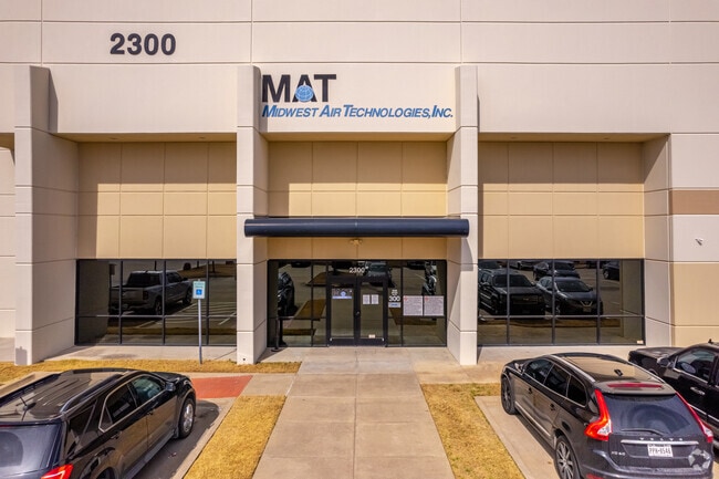
2300 Skyline Dr
Dallas-Fort Worth-Arlington, TX
Skyline Trade Center
381932000A0030000
SKYLINE TRADE CENTER BLK A LT 3 ACS 27.703 INT201100131845 DD05192011 CO-DC 1932000A00300 3CM1932000A
Warehouse
Dallas
X
Texas
48113C0370K
3
2024
27.70 AC
2025
East Dallas/Mesquite
017805
Dallas/Ft Worth
491,561 SF
DEMOGRAPHICS near 2300 Skyline Dr
1 Mile
3 Mile
5 Mile
2024 Total Population
8,831
118,428
315,078
2029 Population
8,674
116,413
310,405
Pop Growth 2024-2029
(1.78%)
(1.70%)
(1.48%)
Average Age
35
34
35
2024 Total Households
2,610
38,289
100,550
HH Growth 2024-2029
(2.07%)
(2.00%)
(1.73%)
Median Household Inc
$57,342
$51,358
$54,242
Avg Household Size
3.20
3.00
3.00
2024 Avg HH Vehicles
2.00
2.00
2.00
Median Home Value
$159,619
$167,946
$187,259
Median Year Built
1973
1979
1975
Nearby Places
Map Layers
Map Styles
 Street
 Aerial
- Restaurants
- Banks
- Shops
- Fitness
- Groceries
PUBLIC TRANSPORTATION
AIRPORT
Dallas Love Field
DRIVE
WALK
Distance
Dallas Love Field
30 min
15.8 mi
Dallas-Fort Worth International
DRIVE
WALK
Distance
Dallas-Fort Worth International
45 min
36.5 mi
Freight Ports
Port of Shreveport
DRIVE
WALK
Distance
Port of Shreveport
203 min
187.6 mi
Nearby Properties
Address
Land Use
TOTAL SIZE
Lot Size
Zoning
Address
Land Use
TOTAL SIZE
Lot Size
Zoning
567,463 SF
19.43 AC
Z31
Address
Land Use
TOTAL SIZE
Lot Size
Zoning
768,482 SF
40.44 AC
Z109
Address
Land Use
TOTAL SIZE
Lot Size
Zoning
194,385 SF
44.63 AC
Z396
Address
Land Use
TOTAL SIZE
Lot Size
Zoning
144,858 SF
9.69 AC
Z206
Address
Land Use
TOTAL SIZE
Lot Size
Zoning
184,728 SF
21.62 AC
Z298
Address
Land Use
TOTAL SIZE
Lot Size
Zoning
544,700 SF
29.75 AC
Z125
Address
Land Use
TOTAL SIZE
Lot Size
Zoning
296,370 SF
17.15 AC
Z16
Address
Land Use
TOTAL SIZE
Lot Size
Zoning
352,187 SF
20.32 AC
Z237
Address
Land Use
TOTAL SIZE
Lot Size
Zoning
255,008 SF
30.39 AC
Z250
Address
Land Use
TOTAL SIZE
Lot Size
Zoning
386,240 SF
20.03 AC
Z237
Address
Land Use
TOTAL SIZE
Lot Size
Zoning
588,625 SF
29.01 AC
Z109
Address
Land Use
TOTAL SIZE
Lot Size
Zoning
555,510 SF
32.62 AC
Z31
Address
Land Use
TOTAL SIZE
Lot Size
Zoning
97,000 SF
12.57 AC
Z239
Address
Land Use
TOTAL SIZE
Lot Size
Zoning
487,200 SF
29.56 AC
Z109
Address
Land Use
TOTAL SIZE
Lot Size
Zoning
902,719 SF
50.31 AC
Z109
Address
Land Use
TOTAL SIZE
Lot Size
Zoning
509,014 SF
30.82 AC
Z31
Address
Land Use
TOTAL SIZE
Lot Size
Zoning
530,100 SF
28.84 AC
Z109
Address
Land Use
TOTAL SIZE
Lot Size
Zoning
508,750 SF
32.15 AC
Z125
Address
Land Use
TOTAL SIZE
Lot Size
Zoning
298,255 SF
15.59 AC
Z237
Address
Land Use
TOTAL SIZE
Lot Size
Zoning
457,076 SF
27.74 AC
Z109
Address
Land Use
TOTAL SIZE
Lot Size
Zoning
242,741 SF
14.25 AC
Z237
Address
Land Use
TOTAL SIZE
Lot Size
Zoning
263,564 SF
12.71 AC
Z237
Address
Land Use
TOTAL SIZE
Lot Size
Zoning
223,216 SF
17.17 AC
Z31
Address
Land Use
TOTAL SIZE
Lot Size
Zoning
214,853 SF
6.60 AC
Z372
Address
Land Use
TOTAL SIZE
Lot Size
Zoning
441,696 SF
30.72 AC
Z31
Address
Land Use
TOTAL SIZE
Lot Size
Zoning
263,968 SF
11.51 AC
Z237
Address
Land Use
TOTAL SIZE
Lot Size
Zoning
397,800 SF
25.51 AC
Z125
Address
Land Use
TOTAL SIZE
Lot Size
Zoning
284,470 SF
25.31 AC
Z31
Address
Land Use
TOTAL SIZE
Lot Size
Zoning
206,646 SF
10.35 AC
Z237
The World's #1 Commercial Real Estate Marketplace
Connect with us
© 2025 CoStar Group
The information above has been obtained from sources believed reliable. While we do not doubt its accuracy we have not verified it and make no guarantee, warranty or representation about it. It is your responsibility to independently confirm its accuracy and completeness. Any projections, opinions, assumptions, or estimates used are for example only and do not represent the current or future performance of the property. The value of this transaction to you depends on tax and other factors which should be evaluated by your tax, financial, and legal advisors. You and your advisors should conduct a careful, independent investigation of the property to determine to your satisfaction the suitability of the property for your needs.