Property Record
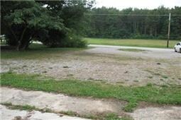
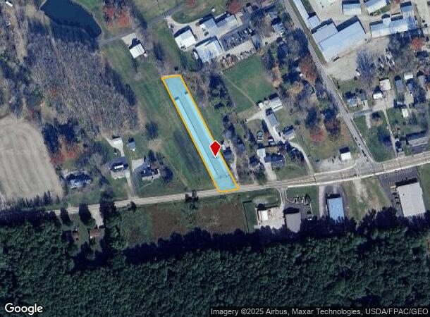
2300 Us Highway 50, Batavia, OH 45103
NEARBY LISTINGS FOR SALE OR LEASE
-
-
View all Batavia listings for sale on LoopNet.com
Property Detail
2300 Us Highway 50
30-29-12J-055
Military Survey Number 4237
Publicstorage
Clermont
X
Ohio
39025C0235G
1.03 AC
2024
Milford/Wards Corner
2024
Cincinnati/Dayton
040800
Cincinnati, OH-KY-IN
6,750 SF
DEMOGRAPHICS near 2300 Us Highway 50
1 Mile
3 Mile
5 Mile
2024 Total Population
1,189
5,638
25,555
2029 Population
1,179
5,746
26,177
Pop Growth 2024-2029
(0.84%)
+ 1.92%
+ 2.43%
Average Age
44
44
41
2024 Total Households
526
2,149
9,556
HH Growth 2024-2029
(1.14%)
+ 1.72%
+ 2.45%
Median Household Inc
$37,083
$67,723
$72,591
Avg Household Size
2.30
2.50
2.60
2024 Avg HH Vehicles
2.00
2.00
2.00
Median Home Value
$233,000
$255,870
$236,633
Median Year Built
1974
1977
1988
Nearby Places
Map Layers
Map Styles
 Street
 Aerial
- Restaurants
- Banks
- Shops
- Fitness
- Groceries
PUBLIC TRANSPORTATION
AIRPORT
Cincinnati/Northern Kentucky International
DRIVE
WALK
Distance
Cincinnati/Northern Kentucky International
52 min
36.1 mi
Nearby Properties
Address
Land Use
TOTAL SIZE
Lot Size
Zoning
Address
Land Use
TOTAL SIZE
Lot Size
Zoning
11,215 SF
20.57 AC
Address
Land Use
TOTAL SIZE
Lot Size
Zoning
11,566 SF
28.70 AC
Address
Land Use
TOTAL SIZE
Lot Size
Zoning
26,263 SF
49.43 AC
Address
Land Use
TOTAL SIZE
Lot Size
Zoning
120.47 AC
Address
Land Use
TOTAL SIZE
Lot Size
Zoning
115,094 SF
18.53 AC
Address
Land Use
TOTAL SIZE
Lot Size
Zoning
30,540 SF
20.57 AC
Address
Land Use
TOTAL SIZE
Lot Size
Zoning
7,392 SF
12 AC
Address
Land Use
TOTAL SIZE
Lot Size
Zoning
7,936 SF
4.08 AC
Address
Land Use
TOTAL SIZE
Lot Size
Zoning
81,672 SF
10.57 AC
Address
Land Use
TOTAL SIZE
Lot Size
Zoning
14,700 SF
68.88 AC
Address
Land Use
TOTAL SIZE
Lot Size
Zoning
20,656 SF
220.68 AC
Address
Land Use
TOTAL SIZE
Lot Size
Zoning
5,153 SF
99.19 AC
Address
Land Use
TOTAL SIZE
Lot Size
Zoning
47,500 SF
7.71 AC
Address
Land Use
TOTAL SIZE
Lot Size
Zoning
37.47 AC
Address
Land Use
TOTAL SIZE
Lot Size
Zoning
21,729 SF
19.47 AC
Address
Land Use
TOTAL SIZE
Lot Size
Zoning
62,526 SF
5 AC
Address
Land Use
TOTAL SIZE
Lot Size
Zoning
5,319 SF
8.97 AC
Address
Land Use
TOTAL SIZE
Lot Size
Zoning
10,120 SF
1.17 AC
Address
Land Use
TOTAL SIZE
Lot Size
Zoning
4.03 AC
Address
Land Use
TOTAL SIZE
Lot Size
Zoning
14,671 SF
2.70 AC
Address
Land Use
TOTAL SIZE
Lot Size
Zoning
4,488 SF
1 AC
Address
Land Use
TOTAL SIZE
Lot Size
Zoning
17,720 SF
4 AC
Address
Land Use
TOTAL SIZE
Lot Size
Zoning
3,948 SF
5.40 AC
Address
Land Use
TOTAL SIZE
Lot Size
Zoning
8,132 SF
7.44 AC
Address
Land Use
TOTAL SIZE
Lot Size
Zoning
11,979 SF
1.57 AC
Address
Land Use
TOTAL SIZE
Lot Size
Zoning
7,591 SF
1.24 AC
Address
Land Use
TOTAL SIZE
Lot Size
Zoning
11,560 SF
1.86 AC
Address
Land Use
TOTAL SIZE
Lot Size
Zoning
15,686 SF
2.84 AC
Address
Land Use
TOTAL SIZE
Lot Size
Zoning
8,763 SF
1.15 AC
Address
Land Use
TOTAL SIZE
Lot Size
Zoning
1.72 AC
The World's #1 Commercial Real Estate Marketplace
Connect with us
© 2025 CoStar Group
The information above has been obtained from sources believed reliable. While we do not doubt its accuracy we have not verified it and make no guarantee, warranty or representation about it. It is your responsibility to independently confirm its accuracy and completeness. Any projections, opinions, assumptions, or estimates used are for example only and do not represent the current or future performance of the property. The value of this transaction to you depends on tax and other factors which should be evaluated by your tax, financial, and legal advisors. You and your advisors should conduct a careful, independent investigation of the property to determine to your satisfaction the suitability of the property for your needs.