Property Record
23000 Cristo Rey Dr, Los Altos, CA 94024


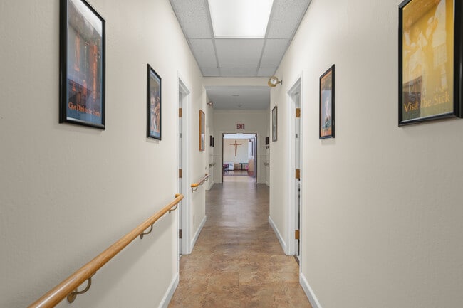
This Property Is For Sale
NEARBY LISTINGS FOR SALE OR LEASE
-
-
View all Los Altos listings for sale on LoopNet.com
Property Detail
23000 Cristo Rey Dr
342-05-023
Portion Rancho San Antonio
Religious
Santa Clara
D
California
06087C0050E
29.20 AC
2024
Los Altos
2025
South Bay/San Jose
511707
San Jose-Sunnyvale-Santa Clara, CA
DEMOGRAPHICS near 23000 Cristo Rey Dr
1 Mile
3 Mile
5 Mile
2024 Total Population
8,164
91,712
316,815
2029 Population
7,965
88,889
309,442
Pop Growth 2024-2029
(2.44%)
(3.08%)
(2.33%)
Average Age
46
42
40
2024 Total Households
2,971
31,314
116,605
HH Growth 2024-2029
(2.63%)
(3.40%)
(2.52%)
Median Household Inc
$216,718
$225,757
$203,227
Avg Household Size
2.70
2.80
2.60
2024 Avg HH Vehicles
2.00
2.00
2.00
Median Home Value
$1,140,507
$1,141,971
$1,134,509
Median Year Built
1970
1966
1971
Nearby Places
Map Layers
Map Styles
 Street
 Aerial
- Restaurants
- Banks
- Shops
- Fitness
- Groceries
PUBLIC TRANSPORTATION
COMMUTER RAIL
Sunnyvale (Caltrain - Caltrain (Caltrain), Express - Caltrain (Caltrain), Limited - Caltrain (Caltrain), Local Weekday - Caltrain (Caltrain), Local Weekend - Caltrain (Caltrain))
DRIVE
WALK
Distance
Sunnyvale (Caltrain - Caltrain (Caltrain), Express - Caltrain (Caltrain), Limited - Caltrain (Caltrain), Local Weekday - Caltrain (Caltrain), Local Weekend - Caltrain (Caltrain))
14 min
6.7 mi
Mountain View (Caltrain - Caltrain (Caltrain))
DRIVE
WALK
Distance
Mountain View (Caltrain - Caltrain (Caltrain))
13 min
6.7 mi
AIRPORT
Norman Y Mineta San Jose International
DRIVE
WALK
Distance
Norman Y Mineta San Jose International
21 min
13.1 mi
San Francisco International
DRIVE
WALK
Distance
San Francisco International
42 min
31.7 mi
Metro Oakland International
DRIVE
WALK
Distance
Metro Oakland International
55 min
40.4 mi
Freight Ports
Port of Redwood City
DRIVE
WALK
Distance
Port of Redwood City
27 min
18.5 mi
Nearby Properties
Address
Land Use
TOTAL SIZE
Lot Size
Zoning
Address
Land Use
TOTAL SIZE
Lot Size
Zoning
196,100 SF
1.32 AC
PCMR
Address
Land Use
TOTAL SIZE
Lot Size
Zoning
211,024 SF
9.92 AC
P
Address
Land Use
TOTAL SIZE
Lot Size
Zoning
381,064 SF
20.42 AC
R322
Address
Land Use
TOTAL SIZE
Lot Size
Zoning
141,232 SF
7.98 AC
P(CGM
Address
Land Use
TOTAL SIZE
Lot Size
Zoning
77,375 SF
8.41 AC
P(ML)
Address
Land Use
TOTAL SIZE
Lot Size
Zoning
103,910 SF
6.68 AC
P
Address
Land Use
TOTAL SIZE
Lot Size
Zoning
50,244 SF
6.35 AC
P(ML)
Address
Land Use
TOTAL SIZE
Lot Size
Zoning
76.50 AC
A-D1
Address
Land Use
TOTAL SIZE
Lot Size
Zoning
202,714 SF
15.03 AC
CGRG
Address
Land Use
TOTAL SIZE
Lot Size
Zoning
139,607 SF
1.29 AC
PD
Address
Land Use
TOTAL SIZE
Lot Size
Zoning
208,850 SF
1.31 AC
C
Address
Land Use
TOTAL SIZE
Lot Size
Zoning
328,292 SF
19.72 AC
R322
Address
Land Use
TOTAL SIZE
Lot Size
Zoning
Address
Land Use
TOTAL SIZE
Lot Size
Zoning
80,000 SF
4.64 AC
0/ITR
Address
Land Use
TOTAL SIZE
Lot Size
Zoning
4.45 AC
CU
Address
Land Use
TOTAL SIZE
Lot Size
Zoning
0.34 AC
R1-7.
Address
Land Use
TOTAL SIZE
Lot Size
Zoning
162,368 SF
1.03 AC
PCMR
Address
Land Use
TOTAL SIZE
Lot Size
Zoning
103,638 SF
4.65 AC
CG
Address
Land Use
TOTAL SIZE
Lot Size
Zoning
160,056 SF
4.96 AC
R3
Address
Land Use
TOTAL SIZE
Lot Size
Zoning
126,247 SF
8.26 AC
CG
Address
Land Use
TOTAL SIZE
Lot Size
Zoning
157,922 SF
0.99 AC
PCMR
Address
Land Use
TOTAL SIZE
Lot Size
Zoning
60,556 SF
4 AC
PCGML
Address
Land Use
TOTAL SIZE
Lot Size
Zoning
100,352 SF
4.92 AC
R3B
Address
Land Use
TOTAL SIZE
Lot Size
Zoning
2.99 AC
P
Address
Land Use
TOTAL SIZE
Lot Size
Zoning
81,824 SF
5.10 AC
R3-2*
Address
Land Use
TOTAL SIZE
Lot Size
Zoning
31,627 SF
4.86 AC
P(ML)
Address
Land Use
TOTAL SIZE
Lot Size
Zoning
155,326 SF
0.98 AC
PCMR
Address
Land Use
TOTAL SIZE
Lot Size
Zoning
181,169 SF
9.26 AC
PD
Address
Land Use
TOTAL SIZE
Lot Size
Zoning
54,240 SF
1.16 AC
CG
Address
Land Use
TOTAL SIZE
Lot Size
Zoning
277,654 SF
5.35 AC
R3
The World's #1 Commercial Real Estate Marketplace
Connect with us
© 2025 CoStar Group
The information above has been obtained from sources believed reliable. While we do not doubt its accuracy we have not verified it and make no guarantee, warranty or representation about it. It is your responsibility to independently confirm its accuracy and completeness. Any projections, opinions, assumptions, or estimates used are for example only and do not represent the current or future performance of the property. The value of this transaction to you depends on tax and other factors which should be evaluated by your tax, financial, and legal advisors. You and your advisors should conduct a careful, independent investigation of the property to determine to your satisfaction the suitability of the property for your needs.