Property Record
23001 Ladbrook Dr, Sterling, VA 20166


NEARBY LISTINGS FOR SALE OR LEASE
Property Detail
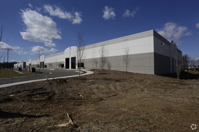
23001 Ladbrook Dr
Washington-Arlington-Alexandria, DC-VA-MD-WV
Minalter
091-36-8186
MINALTER LOT 2A 201611280080607/8P 201709130056905/6P
Warehouse
Loudoun
X
Virginia
51107C0380E
2a
2025
21.39 AC
2025
Rt 28/Dulles North
611901
Washington, DC
319,600 SF
DEMOGRAPHICS near 23001 Ladbrook Dr
1 Mile
3 Mile
5 Mile
2024 Total Population
5,570
63,281
196,511
2029 Population
5,983
69,042
209,893
Pop Growth 2024-2029
+ 7.41%
+ 9.10%
+ 6.81%
Average Age
35
34
36
2024 Total Households
1,724
20,458
65,780
HH Growth 2024-2029
+ 7.60%
+ 9.30%
+ 6.97%
Median Household Inc
$121,170
$177,385
$150,659
Avg Household Size
3.10
3.10
2.90
2024 Avg HH Vehicles
2.00
2.00
2.00
Median Home Value
$719,820
$724,437
$668,668
Median Year Built
2004
2010
2004
Nearby Places
Map Layers
Map Styles
 Street
 Aerial
- Restaurants
- Banks
- Shops
- Fitness
- Groceries
PUBLIC TRANSPORTATION
AIRPORT
Washington Dulles International
DRIVE
WALK
Distance
Washington Dulles International
15 min
5.7 mi
Ronald Reagan Washington Ntl
DRIVE
WALK
Distance
Ronald Reagan Washington Ntl
48 min
31.5 mi
Freight Ports
Port of Baltimore
DRIVE
WALK
Distance
Port of Baltimore
87 min
63.3 mi
Nearby Properties
Address
Land Use
TOTAL SIZE
Lot Size
Zoning
Address
Land Use
TOTAL SIZE
Lot Size
Zoning
2,700,000 SF
7.51 AC
PDGI
Address
Land Use
TOTAL SIZE
Lot Size
Zoning
125.80 AC
TRC
Address
Land Use
TOTAL SIZE
Lot Size
Zoning
624,852 SF
22.54 AC
R24
Address
Land Use
TOTAL SIZE
Lot Size
Zoning
549,027 SF
21.01 AC
R16
Address
Land Use
TOTAL SIZE
Lot Size
Zoning
326.06 AC
GI
Address
Land Use
TOTAL SIZE
Lot Size
Zoning
378,278 SF
112.87 AC
PDGI
Address
Land Use
TOTAL SIZE
Lot Size
Zoning
48.30 AC
PDIP
Address
Land Use
TOTAL SIZE
Lot Size
Zoning
59.20 AC
IP
Address
Land Use
TOTAL SIZE
Lot Size
Zoning
264,155 SF
10.95 AC
PDTRC
Address
Land Use
TOTAL SIZE
Lot Size
Zoning
29,800 SF
43.29 AC
IP
Address
Land Use
TOTAL SIZE
Lot Size
Zoning
230.43 AC
PDGI
Address
Land Use
TOTAL SIZE
Lot Size
Zoning
454,700 SF
54.92 AC
PDGI
Address
Land Use
TOTAL SIZE
Lot Size
Zoning
320,609 SF
2.02 AC
PDTRC
Address
Land Use
TOTAL SIZE
Lot Size
Zoning
198,672 SF
21.41 AC
R16
Address
Land Use
TOTAL SIZE
Lot Size
Zoning
61,692 SF
19.86 AC
PDH4
Address
Land Use
TOTAL SIZE
Lot Size
Zoning
259,361 SF
65.01 AC
PDH4
Address
Land Use
TOTAL SIZE
Lot Size
Zoning
238,594 SF
50.64 AC
PDGI
Address
Land Use
TOTAL SIZE
Lot Size
Zoning
141.53 AC
PDGI
Address
Land Use
TOTAL SIZE
Lot Size
Zoning
136.07 AC
PDGI
Address
Land Use
TOTAL SIZE
Lot Size
Zoning
290,695 SF
3.32 AC
PDOP
Address
Land Use
TOTAL SIZE
Lot Size
Zoning
1 SF
1.93 AC
GB
Address
Land Use
TOTAL SIZE
Lot Size
Zoning
243,052 SF
50.01 AC
PDH3
Address
Land Use
TOTAL SIZE
Lot Size
Zoning
39.89 AC
PDGI
Address
Land Use
TOTAL SIZE
Lot Size
Zoning
507,073 SF
3.81 AC
TRC
Address
Land Use
TOTAL SIZE
Lot Size
Zoning
192,639 SF
0.96 AC
PDTRC
Address
Land Use
TOTAL SIZE
Lot Size
Zoning
128,948 SF
11.16 AC
PDH4
Address
Land Use
TOTAL SIZE
Lot Size
Zoning
126,263 SF
9.09 AC
PDH4
Address
Land Use
TOTAL SIZE
Lot Size
Zoning
243,908 SF
19.51 AC
GI
Address
Land Use
TOTAL SIZE
Lot Size
Zoning
171,403 SF
0.90 AC
PDTRC
The World's #1 Commercial Real Estate Marketplace
Connect with us
© 2026 CoStar Group
The information above has been obtained from sources believed reliable. While we do not doubt its accuracy we have not verified it and make no guarantee, warranty or representation about it. It is your responsibility to independently confirm its accuracy and completeness. Any projections, opinions, assumptions, or estimates used are for example only and do not represent the current or future performance of the property. The value of this transaction to you depends on tax and other factors which should be evaluated by your tax, financial, and legal advisors. You and your advisors should conduct a careful, independent investigation of the property to determine to your satisfaction the suitability of the property for your needs.