Property Record
2301 E Evesham Rd, Voorhees, NJ 08043
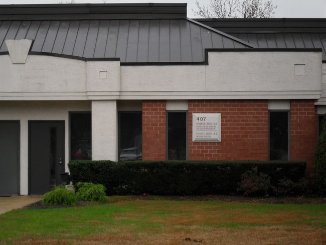
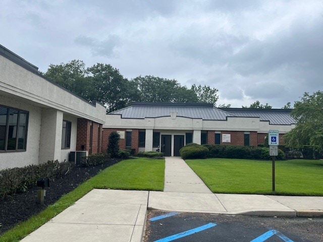

This Property Is For Sale
NEARBY LISTINGS FOR SALE OR LEASE
Property Detail
2301 E Evesham Rd
34-00202-26-00001-06-C0110
Camden
Commercialnec
New Jersey
X
1.6
34007C0127E
0.02 AC
2024
South Camden County
2025
Philadelphia
607502
Philadelphia-Camden-Wilmington, PA-NJ-DE-MD
1,048 SF
DEMOGRAPHICS near 2301 E Evesham Rd
1 Mile
3 Mile
5 Mile
2024 Total Population
7,289
72,094
212,173
2029 Population
7,229
72,146
212,543
Pop Growth 2024-2029
(0.82%)
+ 0.07%
+ 0.17%
Average Age
45
43
41
2024 Total Households
2,876
27,463
82,990
HH Growth 2024-2029
(0.90%)
+ 0.08%
+ 0.19%
Median Household Inc
$117,131
$117,484
$98,445
Avg Household Size
2.40
2.50
2.50
2024 Avg HH Vehicles
2.00
2.00
2.00
Median Home Value
$389,999
$352,591
$304,384
Median Year Built
1986
1978
1973
Nearby Places
- Restaurants
- Banks
- Shops
- Fitness
- Groceries
PUBLIC TRANSPORTATION
COMMUTER RAIL
Lindenwold (Njt) (Atlantic City Line - NJ Transit Commuter Rail (NJ Transit))
DRIVE
WALK
Distance
Lindenwold (Njt) (Atlantic City Line - NJ Transit Commuter Rail (NJ Transit))
8 min
3.7 mi
Cherry Hill (Atlantic City Line - NJ Transit Commuter Rail (NJ Transit))
DRIVE
WALK
Distance
Cherry Hill (Atlantic City Line - NJ Transit Commuter Rail (NJ Transit))
15 min
8.1 mi
AIRPORT
Philadelphia International
DRIVE
WALK
Distance
Philadelphia International
34 min
20.8 mi
Trenton Mercer
DRIVE
WALK
Distance
Trenton Mercer
57 min
39.5 mi
Freight Ports
Broadway Terminal - Pier 5
DRIVE
WALK
Distance
Broadway Terminal - Pier 5
19 min
12.3 mi
Nearby Properties
Address
Land Use
TOTAL SIZE
Lot Size
Zoning
Address
Land Use
TOTAL SIZE
Lot Size
Zoning
58.91 AC
MB
Address
Land Use
TOTAL SIZE
Lot Size
Zoning
256,152 SF
58.91 AC
MB
Address
Land Use
TOTAL SIZE
Lot Size
Zoning
79.35 AC
CP
Address
Land Use
TOTAL SIZE
Lot Size
Zoning
270,246 SF
0.71 AC
RA
Address
Land Use
TOTAL SIZE
Lot Size
Zoning
18.79 AC
Address
Land Use
TOTAL SIZE
Lot Size
Zoning
16.61 AC
SH
Address
Land Use
TOTAL SIZE
Lot Size
Zoning
232,026 SF
24.41 AC
B
Address
Land Use
TOTAL SIZE
Lot Size
Zoning
25,536 SF
18.71 AC
Address
Land Use
TOTAL SIZE
Lot Size
Zoning
44.80 AC
C-1
Address
Land Use
TOTAL SIZE
Lot Size
Zoning
5 AC
C-1
Address
Land Use
TOTAL SIZE
Lot Size
Zoning
168,264 SF
30.98 AC
TC
Address
Land Use
TOTAL SIZE
Lot Size
Zoning
258,896 SF
11.25 AC
TC
Address
Land Use
TOTAL SIZE
Lot Size
Zoning
4,177 SF
32.42 AC
SH
Address
Land Use
TOTAL SIZE
Lot Size
Zoning
244,640 SF
11.04 AC
TC
Address
Land Use
TOTAL SIZE
Lot Size
Zoning
414,080 SF
15.75 AC
TC
Address
Land Use
TOTAL SIZE
Lot Size
Zoning
Address
Land Use
TOTAL SIZE
Lot Size
Zoning
114,852 SF
12.73 AC
GB2
Address
Land Use
TOTAL SIZE
Lot Size
Zoning
38.13 AC
CP
Address
Land Use
TOTAL SIZE
Lot Size
Zoning
57.50 AC
Address
Land Use
TOTAL SIZE
Lot Size
Zoning
147,136 SF
9.55 AC
TC
Address
Land Use
TOTAL SIZE
Lot Size
Zoning
185,936 SF
11.30 AC
TC
Address
Land Use
TOTAL SIZE
Lot Size
Zoning
Address
Land Use
TOTAL SIZE
Lot Size
Zoning
40,116 SF
2.84 AC
TC
Address
Land Use
TOTAL SIZE
Lot Size
Zoning
122,264 SF
5 AC
RR
Address
Land Use
TOTAL SIZE
Lot Size
Zoning
58,330 SF
5.08 AC
MB
Address
Land Use
TOTAL SIZE
Lot Size
Zoning
90,080 SF
5.22 AC
MB
Address
Land Use
TOTAL SIZE
Lot Size
Zoning
42.80 AC
MF
Address
Land Use
TOTAL SIZE
Lot Size
Zoning
332,344 SF
11.99 AC
R10
Address
Land Use
TOTAL SIZE
Lot Size
Zoning
11.29 AC
Address
Land Use
TOTAL SIZE
Lot Size
Zoning
25.28 AC
C-1
The World's #1 Commercial Real Estate Marketplace
Connect with us
© 2025 CoStar Group
The information above has been obtained from sources believed reliable. While we do not doubt its accuracy we have not verified it and make no guarantee, warranty or representation about it. It is your responsibility to independently confirm its accuracy and completeness. Any projections, opinions, assumptions, or estimates used are for example only and do not represent the current or future performance of the property. The value of this transaction to you depends on tax and other factors which should be evaluated by your tax, financial, and legal advisors. You and your advisors should conduct a careful, independent investigation of the property to determine to your satisfaction the suitability of the property for your needs.