Property Record
2301 Interstate 70 Dr Nw, Columbia, MO 65202


NEARBY LISTINGS FOR SALE OR LEASE
-
-
-
-
-
-
No Photo
-
View all Columbia listings for sale on LoopNet.com
Property Detail
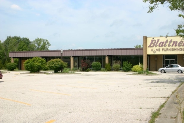
2301 Interstate 70 Dr Nw
16-211-00-01-003-00-01
Scheulen Acres
Publicstorage
SCHEULEN ACRES BLK II LOT 1A
X
Boone
29019C0280E
Missouri
2025
1
2025
7.50 AC
001402
Other Market Areas
30,688 SF
Columbia, MO
DEMOGRAPHICS near 2301 Interstate 70 Dr Nw
1 Mile
3 Mile
5 Mile
2024 Total Population
4,962
47,778
104,478
2029 Population
5,270
50,664
110,554
Pop Growth 2024-2029
+ 6.21%
+ 6.04%
+ 5.82%
Average Age
37
37
36
2024 Total Households
2,220
20,386
42,192
HH Growth 2024-2029
+ 6.53%
+ 6.35%
+ 6.30%
Median Household Inc
$50,649
$56,575
$57,072
Avg Household Size
2.20
2.20
2.20
2024 Avg HH Vehicles
2.00
2.00
2.00
Median Home Value
$190,543
$231,091
$231,509
Median Year Built
1980
1985
1987
Nearby Places
Map Layers
Map Styles
 Street
 Aerial
- Restaurants
- Banks
- Shops
- Fitness
- Groceries
PUBLIC TRANSPORTATION
AIRPORT
Columbia Regional
DRIVE
WALK
Distance
Columbia Regional
22 min
17.1 mi
Freight Ports
Tulsa Port of Inola
DRIVE
WALK
Distance
Tulsa Port of Inola
383 min
339.7 mi
Nearby Properties
Address
Land Use
TOTAL SIZE
Lot Size
Zoning
Address
Land Use
TOTAL SIZE
Lot Size
Zoning
166,344 SF
33.80 AC
O1R3
Address
Land Use
TOTAL SIZE
Lot Size
Zoning
10,500 SF
23.53 AC
C3
Address
Land Use
TOTAL SIZE
Lot Size
Zoning
427,338 SF
31.01 AC
CP
Address
Land Use
TOTAL SIZE
Lot Size
Zoning
3,808 SF
0.39 AC
C2
Address
Land Use
TOTAL SIZE
Lot Size
Zoning
234,111 SF
2.27 AC
Address
Land Use
TOTAL SIZE
Lot Size
Zoning
159,169 SF
1.26 AC
R3
Address
Land Use
TOTAL SIZE
Lot Size
Zoning
60,098 SF
11.55 AC
R3
Address
Land Use
TOTAL SIZE
Lot Size
Zoning
134,625 SF
0.79 AC
C2
Address
Land Use
TOTAL SIZE
Lot Size
Zoning
61,250 SF
9.40 AC
C1
Address
Land Use
TOTAL SIZE
Lot Size
Zoning
181,262 SF
17.42 AC
Address
Land Use
TOTAL SIZE
Lot Size
Zoning
87,060 SF
0.37 AC
R3
Address
Land Use
TOTAL SIZE
Lot Size
Zoning
97,092 SF
1.56 AC
Address
Land Use
TOTAL SIZE
Lot Size
Zoning
82,970 SF
9.07 AC
C3
Address
Land Use
TOTAL SIZE
Lot Size
Zoning
136,448 SF
0.78 AC
C2
Address
Land Use
TOTAL SIZE
Lot Size
Zoning
191,918 SF
21.19 AC
C1
Address
Land Use
TOTAL SIZE
Lot Size
Zoning
17,589 SF
0.52 AC
C2
Address
Land Use
TOTAL SIZE
Lot Size
Zoning
159,568 SF
9.53 AC
Address
Land Use
TOTAL SIZE
Lot Size
Zoning
20,098 SF
5.23 AC
OP
Address
Land Use
TOTAL SIZE
Lot Size
Zoning
35,436 SF
19.09 AC
Address
Land Use
TOTAL SIZE
Lot Size
Zoning
93,320 SF
0.50 AC
C2
Address
Land Use
TOTAL SIZE
Lot Size
Zoning
63,608 SF
6.89 AC
CP
Address
Land Use
TOTAL SIZE
Lot Size
Zoning
91,249 SF
11.66 AC
Address
Land Use
TOTAL SIZE
Lot Size
Zoning
115,194 SF
8.10 AC
C3
Address
Land Use
TOTAL SIZE
Lot Size
Zoning
25,578 SF
0.43 AC
C2
Address
Land Use
TOTAL SIZE
Lot Size
Zoning
116,405 SF
11.11 AC
Address
Land Use
TOTAL SIZE
Lot Size
Zoning
45,600 SF
5.32 AC
Address
Land Use
TOTAL SIZE
Lot Size
Zoning
56,860 SF
14.55 AC
Address
Land Use
TOTAL SIZE
Lot Size
Zoning
63,121 SF
11.28 AC
Address
Land Use
TOTAL SIZE
Lot Size
Zoning
80,685 SF
8.78 AC
C1
Address
Land Use
TOTAL SIZE
Lot Size
Zoning
4,442 SF
13.50 AC
R3
The World's #1 Commercial Real Estate Marketplace
Connect with us
© 2025 CoStar Group
The information above has been obtained from sources believed reliable. While we do not doubt its accuracy we have not verified it and make no guarantee, warranty or representation about it. It is your responsibility to independently confirm its accuracy and completeness. Any projections, opinions, assumptions, or estimates used are for example only and do not represent the current or future performance of the property. The value of this transaction to you depends on tax and other factors which should be evaluated by your tax, financial, and legal advisors. You and your advisors should conduct a careful, independent investigation of the property to determine to your satisfaction the suitability of the property for your needs.