Property Record
2301 S Tamiami Trl N, Nokomis, FL 34275
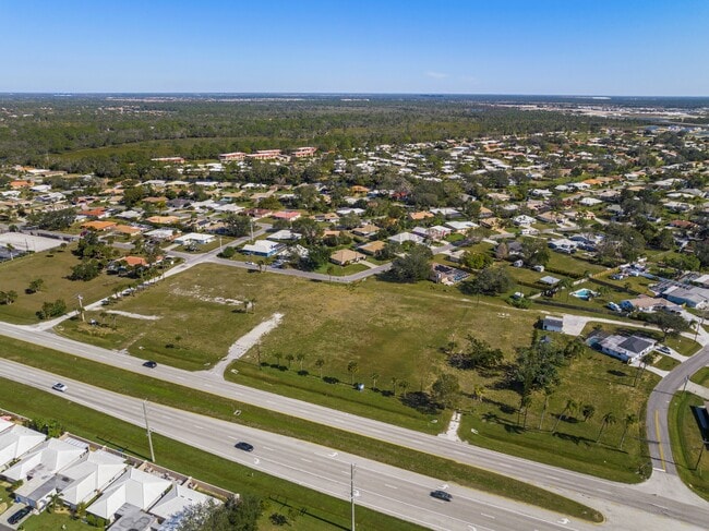
This Property Is For Sale
NEARBY LISTINGS FOR SALE OR LEASE
Property Detail
2301 S Tamiami Trl N
North Port-Sarasota-Bradenton, FL
Springhill Park
0160-10-0044
LOTS 1, 2, 3, 4, 5 & 6 SPRING HILL PARK, LESS SWLY 30 FT FOR ROW, BEING SAME LANDS AS DESC IN ORI 2020081737 & 2020117566
Commercialacreage
Sarasota
X
Florida
12115C0236G
1
2024
3.76 AC
2025
Sarasota
002201
Tampa/St Petersburg
DEMOGRAPHICS near 2301 S Tamiami Trl N
1 Mile
3 Mile
5 Mile
2024 Total Population
4,799
21,100
57,884
2029 Population
5,568
24,454
67,785
Pop Growth 2024-2029
+ 16.02%
+ 15.90%
+ 17.10%
Average Age
53
56
59
2024 Total Households
2,203
10,297
29,907
HH Growth 2024-2029
+ 16.07%
+ 15.90%
+ 17.19%
Median Household Inc
$88,465
$82,842
$75,431
Avg Household Size
2.10
2.00
1.90
2024 Avg HH Vehicles
2.00
2.00
2.00
Median Home Value
$396,659
$408,629
$394,913
Median Year Built
1983
1991
1989
Nearby Places
Map Layers
Map Styles
 Street
 Aerial
- Restaurants
- Banks
- Shops
- Fitness
- Groceries
PUBLIC TRANSPORTATION
AIRPORT
Sarasota/Bradenton International
DRIVE
WALK
Distance
Sarasota/Bradenton International
33 min
18.4 mi
Freight Ports
Port Manatee
DRIVE
WALK
Distance
Port Manatee
49 min
39.2 mi
Nearby Properties
Address
Land Use
TOTAL SIZE
Lot Size
Zoning
Address
Land Use
TOTAL SIZE
Lot Size
Zoning
308,834 SF
16 AC
PUD
Address
Land Use
TOTAL SIZE
Lot Size
Zoning
8,017 SF
56 AC
RMH
Address
Land Use
TOTAL SIZE
Lot Size
Zoning
8,562 SF
58.92 AC
RMH
Address
Land Use
TOTAL SIZE
Lot Size
Zoning
244,492 SF
73.19 AC
GU
Address
Land Use
TOTAL SIZE
Lot Size
Zoning
23,348 SF
77.03 AC
RMH
Address
Land Use
TOTAL SIZE
Lot Size
Zoning
175,813 SF
10.09 AC
CG
Address
Land Use
TOTAL SIZE
Lot Size
Zoning
425,768 SF
18.41 AC
RMF2
Address
Land Use
TOTAL SIZE
Lot Size
Zoning
124,423 SF
76 AC
GU
Address
Land Use
TOTAL SIZE
Lot Size
Zoning
73,121 SF
426.09 AC
OUE2
Address
Land Use
TOTAL SIZE
Lot Size
Zoning
209,566 SF
18.63 AC
CG
Address
Land Use
TOTAL SIZE
Lot Size
Zoning
12,552 SF
6.73 AC
RE2
Address
Land Use
TOTAL SIZE
Lot Size
Zoning
17,028 SF
3.57 AC
RE2
Address
Land Use
TOTAL SIZE
Lot Size
Zoning
12,263 SF
3.38 AC
RE2
Address
Land Use
TOTAL SIZE
Lot Size
Zoning
127,135 SF
12.37 AC
CG
Address
Land Use
TOTAL SIZE
Lot Size
Zoning
88,509 SF
12.03 AC
CG
Address
Land Use
TOTAL SIZE
Lot Size
Zoning
89,684 SF
2.42 AC
CG
Address
Land Use
TOTAL SIZE
Lot Size
Zoning
68,641 SF
6.40 AC
RTR
Address
Land Use
TOTAL SIZE
Lot Size
Zoning
112,788 SF
3.06 AC
CG
Address
Land Use
TOTAL SIZE
Lot Size
Zoning
40.20 AC
RMH
Address
Land Use
TOTAL SIZE
Lot Size
Zoning
314,254 SF
8.15 AC
RMF3
Address
Land Use
TOTAL SIZE
Lot Size
Zoning
59,645 SF
2.68 AC
CG
Address
Land Use
TOTAL SIZE
Lot Size
Zoning
18.76 AC
CG
Address
Land Use
TOTAL SIZE
Lot Size
Zoning
16,033 SF
1.93 AC
RE1
Address
Land Use
TOTAL SIZE
Lot Size
Zoning
100,001 SF
5.14 AC
CG
Address
Land Use
TOTAL SIZE
Lot Size
Zoning
897 SF
11.41 AC
GU
Address
Land Use
TOTAL SIZE
Lot Size
Zoning
17,314 SF
1.71 AC
RE1
Address
Land Use
TOTAL SIZE
Lot Size
Zoning
8,188 SF
3.38 AC
CM
Address
Land Use
TOTAL SIZE
Lot Size
Zoning
27,472 SF
8.36 AC
GU
Address
Land Use
TOTAL SIZE
Lot Size
Zoning
21,385 SF
9.23 AC
CI
Address
Land Use
TOTAL SIZE
Lot Size
Zoning
74,091 SF
1.67 AC
CI
The World's #1 Commercial Real Estate Marketplace
Connect with us
© 2025 CoStar Group
The information above has been obtained from sources believed reliable. While we do not doubt its accuracy we have not verified it and make no guarantee, warranty or representation about it. It is your responsibility to independently confirm its accuracy and completeness. Any projections, opinions, assumptions, or estimates used are for example only and do not represent the current or future performance of the property. The value of this transaction to you depends on tax and other factors which should be evaluated by your tax, financial, and legal advisors. You and your advisors should conduct a careful, independent investigation of the property to determine to your satisfaction the suitability of the property for your needs.