Property Record
2301 Shorefield Rd, Silver Spring, MD 20902
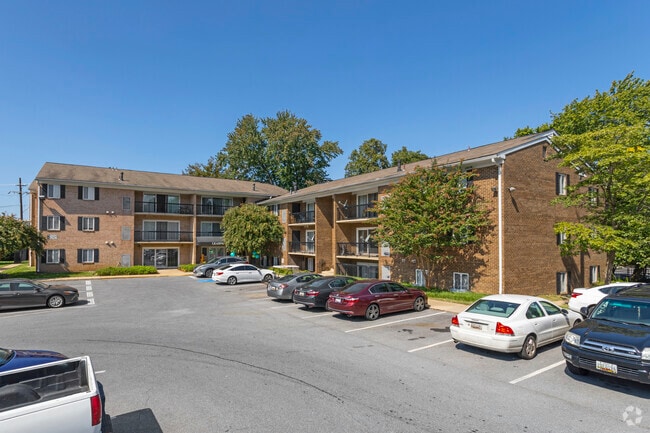

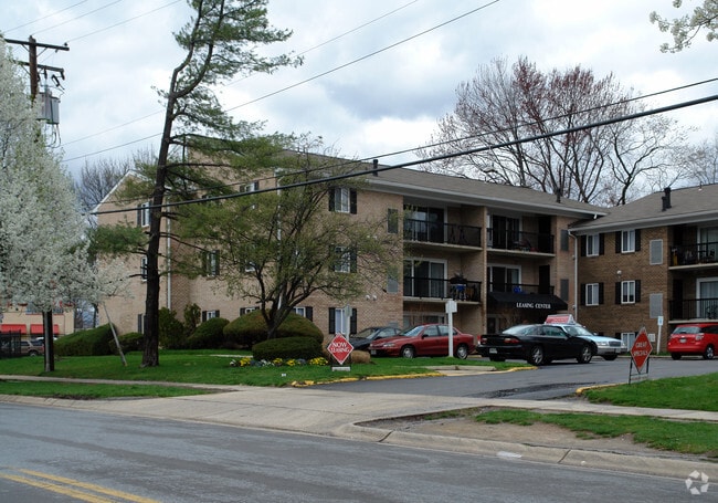

Property Detail
2301 Shorefield Rd
13-00979183
PARCEL A SHOREFIELD MANOR
Apartment
MONTGOMERY
RT15.
Maryland
B and X Area of moderate flood hazard, usually the area between the limits of the 100-year and 500-year floods.
a
0
4.64 AC
2025
Wheaton-Glenmont
703207
Washington, DC
113,836 SF
Washington-Arlington-Alexandria, DC-VA-MD-WV
NEARBY LISTINGS FOR SALE OR LEASE
-
-
View all Silver Spring listings for sale on LoopNet.com
DEMOGRAPHICS near 2301 Shorefield Rd
1 mile
3 mile
5 mile
2025 Total Population
25,270
165,326
432,133
2030 Population
26,041
169,905
444,790
Pop Growth 2025-2030
+ 3.05%
+ 2.77%
+ 2.93%
Average Age
38
40
41
2025 Total Households
7,993
54,335
161,281
HH Growth 2025-2030
+ 3.17%
+ 2.81%
+ 3.04%
Median Household Inc
$94,461
$117,684
$114,715
Avg Household Size
3.00
2.90
2.60
2025 Avg HH Vehicles
2.00
2.00
2.00
Median Home Value
$520,604
$610,399
$638,833
Median Year Built
1965
1963
1968
Nearby Places
Map Layers
Map Styles
 Street
 Aerial
Transit
 Traffic
 Biking
Places
Listings with unknown addresses are not visible on the map
- Restaurants
- Banks
- Shops
- Fitness
- Groceries
PUBLIC TRANSPORTATION
TRANSIT/SUBWAY
Glenmont (Red Line - Washington Metropolitan Area Transit Authority Metrorail (Metrorail))
Drive
Walk
Distance
Glenmont (Red Line - Washington Metropolitan Area Transit Authority Metrorail (Metrorail))
1 min
13 min
0.7 mi
COMMUTER RAIL
Kensington Marc Eb (BRUNSWICK - WASHINGTON - Maryland Transit Administration)
Drive
Walk
Distance
Kensington Marc Eb (BRUNSWICK - WASHINGTON - Maryland Transit Administration)
7 min
3.8 mi
Garrett Park Marc Eb (BRUNSWICK - WASHINGTON - Maryland Transit Administration)
Drive
Walk
Distance
Garrett Park Marc Eb (BRUNSWICK - WASHINGTON - Maryland Transit Administration)
11 min
5.0 mi
AIRPORT
Ronald Reagan Washington Ntl
Drive
Walk
Distance
Ronald Reagan Washington Ntl
31 min
16.2 mi
Washington Dulles International
Drive
Walk
Distance
Washington Dulles International
49 min
29.3 mi
Baltimore/Washington International Thurgood Marshall
Drive
Walk
Distance
Baltimore/Washington International Thurgood Marshall
41 min
30.4 mi
Freight Ports
Port of Baltimore
Drive
Walk
Distance
Port of Baltimore
45 min
33.2 mi
Nearby Properties
Address
Land Use
TOTAL SIZE
Lot Size
Zoning
Address
Land Use
TOTAL SIZE
Lot Size
Zoning
775,490 SF
14.21 AC
R60
Address
Land Use
TOTAL SIZE
Lot Size
Zoning
1,775,186 SF
75.19 AC
GR1.5
Address
Land Use
TOTAL SIZE
Lot Size
Zoning
431,630 SF
25.77 AC
R60
Address
Land Use
TOTAL SIZE
Lot Size
Zoning
364,000 SF
CR6.0
Address
Land Use
TOTAL SIZE
Lot Size
Zoning
643,335 SF
29.18 AC
R20
Address
Land Use
TOTAL SIZE
Lot Size
Zoning
460,492 SF
3.56 AC
CR4.0
Address
Land Use
TOTAL SIZE
Lot Size
Zoning
276,462 SF
15.11 AC
R60
Address
Land Use
TOTAL SIZE
Lot Size
Zoning
244,934 SF
3.59 AC
CRT2.
Address
Land Use
TOTAL SIZE
Lot Size
Zoning
164,307 SF
16.45 AC
R90
Address
Land Use
TOTAL SIZE
Lot Size
Zoning
160,000 SF
27.97 AC
R90
Address
Land Use
TOTAL SIZE
Lot Size
Zoning
164,764 SF
15.42 AC
NR0.7
Address
Land Use
TOTAL SIZE
Lot Size
Zoning
540,807 SF
8.73 AC
RH
Address
Land Use
TOTAL SIZE
Lot Size
Zoning
187,691 SF
3.03 AC
R90
Address
Land Use
TOTAL SIZE
Lot Size
Zoning
294,082 SF
12.18 AC
R20
Address
Land Use
TOTAL SIZE
Lot Size
Zoning
427,500 SF
25.70 AC
R30
Address
Land Use
TOTAL SIZE
Lot Size
Zoning
352,334 SF
1.66 AC
CR4.0
Address
Land Use
TOTAL SIZE
Lot Size
Zoning
425,295 SF
15.72 AC
CRT22
Address
Land Use
TOTAL SIZE
Lot Size
Zoning
215,937 SF
2.91 AC
CR2.0
Address
Land Use
TOTAL SIZE
Lot Size
Zoning
124,896 SF
0.37 AC
CR6.0
Address
Land Use
TOTAL SIZE
Lot Size
Zoning
321,840 SF
13.95 AC
R20
Address
Land Use
TOTAL SIZE
Lot Size
Zoning
163,463 SF
13.38 AC
R90
Address
Land Use
TOTAL SIZE
Lot Size
Zoning
332,133 SF
28.24 AC
R90
Address
Land Use
TOTAL SIZE
Lot Size
Zoning
336,300 SF
2.59 AC
CR2.5
Address
Land Use
TOTAL SIZE
Lot Size
Zoning
303,542 SF
25.13 AC
R200
Address
Land Use
TOTAL SIZE
Lot Size
Zoning
149,527 SF
21.74 AC
R60
Address
Land Use
TOTAL SIZE
Lot Size
Zoning
56.99 AC
R60
Address
Land Use
TOTAL SIZE
Lot Size
Zoning
262,984 SF
7.58 AC
R20
Address
Land Use
TOTAL SIZE
Lot Size
Zoning
387,943 SF
8.91 AC
R60
Address
Land Use
TOTAL SIZE
Lot Size
Zoning
188,160 SF
7.42 AC
R20
Address
Land Use
TOTAL SIZE
Lot Size
Zoning
122,322 SF
9.88 AC
R60
The World's #1 Commercial Real Estate Marketplace
Connect with us
© 2026 CoStar Group
The information above has been obtained from sources believed reliable. While we do not doubt its accuracy we have not verified it and make no guarantee, warranty or representation about it. It is your responsibility to independently confirm its accuracy and completeness. Any projections, opinions, assumptions, or estimates used are for example only and do not represent the current or future performance of the property. The value of this transaction to you depends on tax and other factors which should be evaluated by your tax, financial, and legal advisors. You and your advisors should conduct a careful, independent investigation of the property to determine to your satisfaction the suitability of the property for your needs.