Property Record
2301 W Ramsey St, Banning, CA 92220
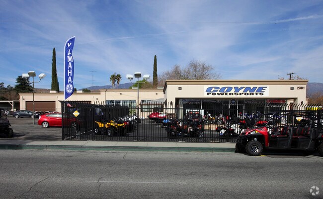

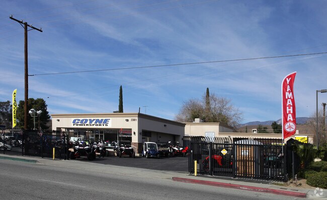

Property Detail
2301 W Ramsey St
538-162-016
1.45 ACRES M/L IN POR LOT 13 AND LOTS 14, 15 & 16 MB 020/070 WESTHAVEN VILLAGE FOR TOTAL DESCRIPTION SEE ASSESSORS MAPS
Storebuilding
Riverside
C2
California
C and X Area of minimal flood hazard, usually depicted on FIRMs as above the 500-year flood level.
16
2024
1.45 AC
2025
Beaumont/Hemet
044101
Inland Empire (California)
17,470 SF
Riverside-San Bernardino-Ontario, CA
NEARBY LISTINGS FOR SALE OR LEASE
DEMOGRAPHICS near 2301 W Ramsey St
1 mile
3 mile
5 mile
2025 Total Population
7,372
38,057
74,515
2030 Population
7,635
39,520
77,042
Pop Growth 2025-2030
+ 3.57%
+ 3.84%
+ 3.39%
Average Age
39
43
41
2025 Total Households
2,470
13,397
25,228
HH Growth 2025-2030
+ 3.24%
+ 3.25%
+ 2.91%
Median Household Inc
$64,679
$65,907
$75,622
Avg Household Size
3.00
2.70
2.80
2025 Avg HH Vehicles
2.00
2.00
2.00
Median Home Value
$310,341
$385,253
$439,954
Median Year Built
1973
1987
1992
Nearby Places
Map Layers
Map Styles
 Street
 Aerial
Layers
 Traffic
 Biking
Places
Listings with unknown addresses are not visible on the map
- Restaurants
- Banks
- Shops
- Fitness
- Groceries
PUBLIC TRANSPORTATION
AIRPORT
Palm Springs International
Drive
Walk
Distance
Palm Springs International
33 min
27.8 mi
Freight Ports
Port of Long Beach
Drive
Walk
Distance
Port of Long Beach
108 min
84.9 mi
Nearby Properties
Address
Land Use
TOTAL SIZE
Lot Size
Zoning
Address
Land Use
TOTAL SIZE
Lot Size
Zoning
146,056 SF
15.95 AC
Address
Land Use
TOTAL SIZE
Lot Size
Zoning
95,590 SF
7.48 AC
Address
Land Use
TOTAL SIZE
Lot Size
Zoning
216,071 SF
21.90 AC
Address
Land Use
TOTAL SIZE
Lot Size
Zoning
116,175 SF
4.86 AC
RA
Address
Land Use
TOTAL SIZE
Lot Size
Zoning
44,506 SF
2.35 AC
Address
Land Use
TOTAL SIZE
Lot Size
Zoning
83,989 SF
39.10 AC
M1
Address
Land Use
TOTAL SIZE
Lot Size
Zoning
39,866 SF
3.55 AC
Address
Land Use
TOTAL SIZE
Lot Size
Zoning
43,105 SF
4.23 AC
Address
Land Use
TOTAL SIZE
Lot Size
Zoning
42,325 SF
2.31 AC
Address
Land Use
TOTAL SIZE
Lot Size
Zoning
44,506 SF
2.84 AC
Address
Land Use
TOTAL SIZE
Lot Size
Zoning
54,131 SF
3.23 AC
M1
Address
Land Use
TOTAL SIZE
Lot Size
Zoning
27,359 SF
1.97 AC
C2
Address
Land Use
TOTAL SIZE
Lot Size
Zoning
42,602 SF
3.91 AC
RA
Address
Land Use
TOTAL SIZE
Lot Size
Zoning
59,641 SF
2.02 AC
CPS
Address
Land Use
TOTAL SIZE
Lot Size
Zoning
82,587 SF
6.78 AC
Address
Land Use
TOTAL SIZE
Lot Size
Zoning
39,250 SF
1.38 AC
C2
Address
Land Use
TOTAL SIZE
Lot Size
Zoning
62,796 SF
1.48 AC
Address
Land Use
TOTAL SIZE
Lot Size
Zoning
909 SF
8.17 AC
RA
Address
Land Use
TOTAL SIZE
Lot Size
Zoning
20,800 SF
1.10 AC
C2
Address
Land Use
TOTAL SIZE
Lot Size
Zoning
54,455 SF
5.53 AC
R3
Address
Land Use
TOTAL SIZE
Lot Size
Zoning
44,335 SF
4 AC
Address
Land Use
TOTAL SIZE
Lot Size
Zoning
17,272 SF
1.99 AC
Address
Land Use
TOTAL SIZE
Lot Size
Zoning
42,500 SF
4.06 AC
Address
Land Use
TOTAL SIZE
Lot Size
Zoning
11,411 SF
2.47 AC
Address
Land Use
TOTAL SIZE
Lot Size
Zoning
119,662 SF
6.65 AC
Address
Land Use
TOTAL SIZE
Lot Size
Zoning
119,400 SF
8.21 AC
M
Address
Land Use
TOTAL SIZE
Lot Size
Zoning
50,000 SF
7.13 AC
CM
Address
Land Use
TOTAL SIZE
Lot Size
Zoning
7,964 SF
1 AC
C1
The World's #1 Commercial Real Estate Marketplace
Connect with us
© 2026 CoStar Group
The information above has been obtained from sources believed reliable. While we do not doubt its accuracy we have not verified it and make no guarantee, warranty or representation about it. It is your responsibility to independently confirm its accuracy and completeness. Any projections, opinions, assumptions, or estimates used are for example only and do not represent the current or future performance of the property. The value of this transaction to you depends on tax and other factors which should be evaluated by your tax, financial, and legal advisors. You and your advisors should conduct a careful, independent investigation of the property to determine to your satisfaction the suitability of the property for your needs.