Property Record
2301 W Walnut St, Rogers, AR 72756


NEARBY LISTINGS FOR SALE OR LEASE
Property Detail
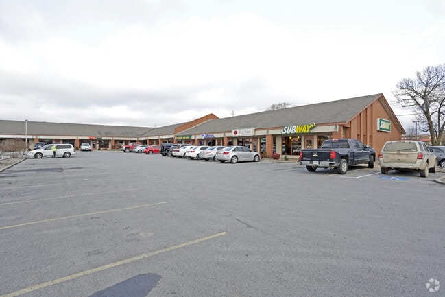
2301 W Walnut St
02-01020-000
Rogers
Regionalshoppingcenterormallwithanchorstore
PT SW NW E611 N35 SW/C SW NW POB N315 W402 S290 ALNG ROW TO HWY 71 E376.72 POB EXC SW/C SURVEY 16-50
X
Benton
05007C0260K
Arkansas
2025
2.21 AC
2025
East Rogers
020302
Fayetteville/Springdale/Rogers
24,388 SF
Fayetteville-Springdale-Rogers, AR-MO
DEMOGRAPHICS near 2301 W Walnut St
1 Mile
3 Mile
5 Mile
2024 Total Population
11,960
55,839
114,605
2029 Population
13,949
65,297
134,775
Pop Growth 2024-2029
+ 16.63%
+ 16.94%
+ 17.60%
Average Age
38
37
36
2024 Total Households
4,513
21,092
42,650
HH Growth 2024-2029
+ 16.73%
+ 17.14%
+ 17.78%
Median Household Inc
$54,389
$63,967
$76,275
Avg Household Size
2.50
2.50
2.60
2024 Avg HH Vehicles
2.00
2.00
2.00
Median Home Value
$173,585
$193,064
$251,334
Median Year Built
1986
1991
1997
Nearby Places
Map Layers
Map Styles
 Street
 Aerial
- Restaurants
- Banks
- Shops
- Fitness
- Groceries
PUBLIC TRANSPORTATION
AIRPORT
Northwest Arkansas Ntl
DRIVE
WALK
Distance
Northwest Arkansas Ntl
28 min
13.1 mi
Freight Ports
Tulsa Port of Inola
DRIVE
WALK
Distance
Tulsa Port of Inola
114 min
98.3 mi
SALE & LEASE HISTORY
LISTING DATE
SALE/LEASE

Sep 25, 2016
For Lease
Oct 22, 2021
For Lease
Nov 04, 2020
For Lease
Nearby Properties
Address
Land Use
TOTAL SIZE
Lot Size
Zoning
Address
Land Use
TOTAL SIZE
Lot Size
Zoning
441,673 SF
55.19 AC
Address
Land Use
TOTAL SIZE
Lot Size
Zoning
147,199 SF
16.11 AC
Address
Land Use
TOTAL SIZE
Lot Size
Zoning
117,522 SF
0.12 AC
Address
Land Use
TOTAL SIZE
Lot Size
Zoning
384,427 SF
10.51 AC
Address
Land Use
TOTAL SIZE
Lot Size
Zoning
216,538 SF
22.14 AC
Address
Land Use
TOTAL SIZE
Lot Size
Zoning
675,465 SF
37.34 AC
Address
Land Use
TOTAL SIZE
Lot Size
Zoning
381,924 SF
10.23 AC
Address
Land Use
TOTAL SIZE
Lot Size
Zoning
307,725 SF
9.36 AC
Address
Land Use
TOTAL SIZE
Lot Size
Zoning
375,605 SF
24.54 AC
Address
Land Use
TOTAL SIZE
Lot Size
Zoning
746,783 SF
77.03 AC
Address
Land Use
TOTAL SIZE
Lot Size
Zoning
234,432 SF
19.98 AC
Address
Land Use
TOTAL SIZE
Lot Size
Zoning
269,397 SF
27.07 AC
Address
Land Use
TOTAL SIZE
Lot Size
Zoning
42,848 SF
3.08 AC
Address
Land Use
TOTAL SIZE
Lot Size
Zoning
270,199 SF
10.23 AC
Address
Land Use
TOTAL SIZE
Lot Size
Zoning
418,411 SF
26.88 AC
Address
Land Use
TOTAL SIZE
Lot Size
Zoning
17,340 SF
14.15 AC
Address
Land Use
TOTAL SIZE
Lot Size
Zoning
542,873 SF
16.52 AC
Address
Land Use
TOTAL SIZE
Lot Size
Zoning
84,890 SF
5.89 AC
Address
Land Use
TOTAL SIZE
Lot Size
Zoning
108,103 SF
8.53 AC
Address
Land Use
TOTAL SIZE
Lot Size
Zoning
60,250 SF
60.17 AC
Address
Land Use
TOTAL SIZE
Lot Size
Zoning
6,545 SF
29.19 AC
Address
Land Use
TOTAL SIZE
Lot Size
Zoning
97,660 SF
5.35 AC
Address
Land Use
TOTAL SIZE
Lot Size
Zoning
166,973 SF
7.58 AC
Address
Land Use
TOTAL SIZE
Lot Size
Zoning
171,746 SF
9.32 AC
Address
Land Use
TOTAL SIZE
Lot Size
Zoning
264,824 SF
17.24 AC
Address
Land Use
TOTAL SIZE
Lot Size
Zoning
184,614 SF
5.04 AC
Address
Land Use
TOTAL SIZE
Lot Size
Zoning
30,456 SF
7.78 AC
Address
Land Use
TOTAL SIZE
Lot Size
Zoning
573,476 SF
57.80 AC
Address
Land Use
TOTAL SIZE
Lot Size
Zoning
152,925 SF
16.49 AC
Address
Land Use
TOTAL SIZE
Lot Size
Zoning
148,292 SF
4.32 AC
The World's #1 Commercial Real Estate Marketplace
Connect with us
© 2025 CoStar Group
The information above has been obtained from sources believed reliable. While we do not doubt its accuracy we have not verified it and make no guarantee, warranty or representation about it. It is your responsibility to independently confirm its accuracy and completeness. Any projections, opinions, assumptions, or estimates used are for example only and do not represent the current or future performance of the property. The value of this transaction to you depends on tax and other factors which should be evaluated by your tax, financial, and legal advisors. You and your advisors should conduct a careful, independent investigation of the property to determine to your satisfaction the suitability of the property for your needs.