Property Record
2302 Ebenezer Rd Se, Conyers, GA 30094


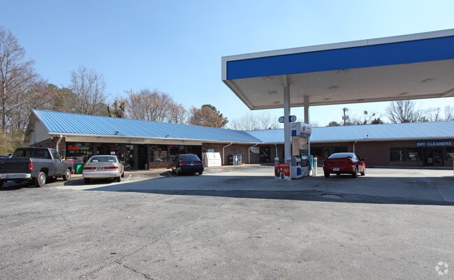
Property Detail
2302 Ebenezer Rd Se
046-A-01-0097
NE/SIDE EBENEZER RD
Conveniencestore
Rockdale
C1
Georgia
B and X Area of moderate flood hazard, usually the area between the limits of the 100-year and 500-year floods.
1.08 AC
2025
Lithonia/Conyers
2025
Atlanta
060410
Atlanta-Sandy Springs-Roswell, GA
6,400 SF
NEARBY LISTINGS FOR SALE OR LEASE
DEMOGRAPHICS near 2302 Ebenezer Rd Se
1 mile
3 mile
5 mile
2025 Total Population
3,839
30,681
92,406
2030 Population
3,981
31,964
96,599
Pop Growth 2025-2030
+ 3.70%
+ 4.18%
+ 4.54%
Average Age
40
41
39
2025 Total Households
1,350
10,978
33,435
HH Growth 2025-2030
+ 4.00%
+ 4.48%
+ 4.72%
Median Household Inc
$69,766
$91,143
$79,774
Avg Household Size
2.80
2.80
2.70
2025 Avg HH Vehicles
2.00
2.00
2.00
Median Home Value
$240,611
$313,953
$290,980
Median Year Built
1987
1988
1991
Nearby Places
Map Layers
Map Styles
 Street
 Aerial
Layers
 Traffic
 Biking
Places
Listings with unknown addresses are not visible on the map
- Restaurants
- Banks
- Shops
- Fitness
- Groceries
PUBLIC TRANSPORTATION
AIRPORT
Hartsfield - Jackson Atlanta International
Drive
Walk
Distance
Hartsfield - Jackson Atlanta International
44 min
31.6 mi
SALE & LEASE HISTORY
LISTING DATE
SALE/LEASE

Sep 24, 2016
For Sale
Dec 03, 2024
For Lease
Nearby Properties
Address
Land Use
TOTAL SIZE
Lot Size
Zoning
Address
Land Use
TOTAL SIZE
Lot Size
Zoning
5,212 SF
21.33 AC
GV-UV
Address
Land Use
TOTAL SIZE
Lot Size
Zoning
22,362 SF
28.90 AC
MXD
Address
Land Use
TOTAL SIZE
Lot Size
Zoning
140,292 SF
23.74 AC
HSB
Address
Land Use
TOTAL SIZE
Lot Size
Zoning
165,171 SF
49.79 AC
BG/ID
Address
Land Use
TOTAL SIZE
Lot Size
Zoning
8,268 SF
46.94 AC
R3
Address
Land Use
TOTAL SIZE
Lot Size
Zoning
77,600 SF
9 AC
GVUV
Address
Land Use
TOTAL SIZE
Lot Size
Zoning
216,855 SF
42.21 AC
AR
Address
Land Use
TOTAL SIZE
Lot Size
Zoning
6,561 SF
7.49 AC
GVUV
Address
Land Use
TOTAL SIZE
Lot Size
Zoning
76,140 SF
22.20 AC
RM
Address
Land Use
TOTAL SIZE
Lot Size
Zoning
94,400 SF
12.50 AC
RS14
Address
Land Use
TOTAL SIZE
Lot Size
Zoning
11,600 SF
4.36 AC
GV/SU
Address
Land Use
TOTAL SIZE
Lot Size
Zoning
78,980 SF
13.64 AC
HSB
Address
Land Use
TOTAL SIZE
Lot Size
Zoning
28,472 SF
39.03 AC
OI
Address
Land Use
TOTAL SIZE
Lot Size
Zoning
199,146 SF
22.60 AC
HSB
Address
Land Use
TOTAL SIZE
Lot Size
Zoning
57,600 SF
10.20 AC
ID
Address
Land Use
TOTAL SIZE
Lot Size
Zoning
50,400 SF
2.62 AC
M1
Address
Land Use
TOTAL SIZE
Lot Size
Zoning
127,529 SF
12.89 AC
RS-14
Address
Land Use
TOTAL SIZE
Lot Size
Zoning
48,360 SF
2 AC
GVUV
Address
Land Use
TOTAL SIZE
Lot Size
Zoning
69,113 SF
7.76 AC
RS10
Address
Land Use
TOTAL SIZE
Lot Size
Zoning
101,968 SF
11.34 AC
ID
Address
Land Use
TOTAL SIZE
Lot Size
Zoning
60,394 SF
2.33 AC
MXD
Address
Land Use
TOTAL SIZE
Lot Size
Zoning
27,111 SF
8.58 AC
MXD
Address
Land Use
TOTAL SIZE
Lot Size
Zoning
69,417 SF
13.85 AC
C1/C
Address
Land Use
TOTAL SIZE
Lot Size
Zoning
93,513 SF
11.03 AC
GVUV
Address
Land Use
TOTAL SIZE
Lot Size
Zoning
109,500 SF
6.79 AC
M1
Address
Land Use
TOTAL SIZE
Lot Size
Zoning
16,724 SF
8.33 AC
C2
Address
Land Use
TOTAL SIZE
Lot Size
Zoning
138,046 SF
18.48 AC
C2/C
Address
Land Use
TOTAL SIZE
Lot Size
Zoning
69,186 SF
2.49 AC
MXD
Address
Land Use
TOTAL SIZE
Lot Size
Zoning
134,309 SF
10.39 AC
GVUV
Address
Land Use
TOTAL SIZE
Lot Size
Zoning
81,300 SF
8.23 AC
ID
The World's #1 Commercial Real Estate Marketplace
Connect with us
© 2026 CoStar Group
The information above has been obtained from sources believed reliable. While we do not doubt its accuracy we have not verified it and make no guarantee, warranty or representation about it. It is your responsibility to independently confirm its accuracy and completeness. Any projections, opinions, assumptions, or estimates used are for example only and do not represent the current or future performance of the property. The value of this transaction to you depends on tax and other factors which should be evaluated by your tax, financial, and legal advisors. You and your advisors should conduct a careful, independent investigation of the property to determine to your satisfaction the suitability of the property for your needs.