Property Record
2303 Lednum St, Durham, NC 27705
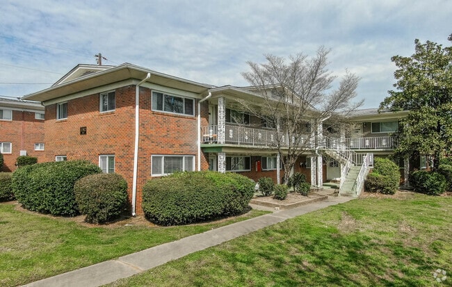

Property Detail
2303 Lednum St
106395
PROP-HAZARD CANNON ESTATE /LT#A PL:000153-000283
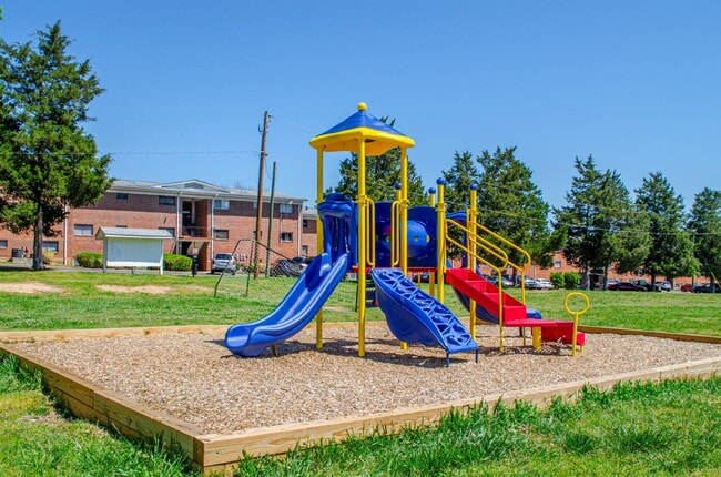
Gardenaptcourtapt5plusunits
DURHAM
RU-M
North Carolina
B and X Area of moderate flood hazard, usually the area between the limits of the 100-year and 500-year floods.
a
2025
19.04 AC
2025
Northgate
000102
Raleigh/Durham
4,644 SF
Durham-Chapel Hill, NC
NEARBY LISTINGS FOR SALE OR LEASE
DEMOGRAPHICS near 2303 Lednum St
1 mile
3 mile
5 mile
2025 Total Population
9,860
93,909
176,025
2030 Population
10,414
99,653
186,732
Pop Growth 2025-2030
+ 5.62%
+ 6.12%
+ 6.08%
Average Age
38
37
38
2025 Total Households
4,405
40,196
71,136
HH Growth 2025-2030
+ 5.90%
+ 6.68%
+ 6.48%
Median Household Inc
$68,478
$64,258
$68,885
Avg Household Size
2.20
2.10
2.30
2025 Avg HH Vehicles
1.00
1.00
2.00
Median Home Value
$454,009
$425,446
$401,832
Median Year Built
1966
1984
1983
Nearby Places
Map Layers
Map Styles
 Street
 Aerial
Transit
 Traffic
 Biking
Places
Listings with unknown addresses are not visible on the map
- Restaurants
- Banks
- Shops
- Fitness
- Groceries
PUBLIC TRANSPORTATION
COMMUTER RAIL
Durham Amtrak Station (Carolinian - Amtrak, Piedmont - Amtrak)
Drive
Walk
Distance
Durham Amtrak Station (Carolinian - Amtrak, Piedmont - Amtrak)
9 min
2.8 mi
AIRPORT
Raleigh-Durham International
Drive
Walk
Distance
Raleigh-Durham International
27 min
15.8 mi
Freight Ports
Virginia Port Authority - Richmond
Drive
Walk
Distance
Virginia Port Authority - Richmond
169 min
146.7 mi
Nearby Properties
Address
Land Use
TOTAL SIZE
Lot Size
Zoning
Address
Land Use
TOTAL SIZE
Lot Size
Zoning
8,478 SF
676.09 AC
UC
Address
Land Use
TOTAL SIZE
Lot Size
Zoning
839,237 SF
9.84 AC
DD-C
Address
Land Use
TOTAL SIZE
Lot Size
Zoning
749,544 SF
100.49 AC
OI,RS-8
Address
Land Use
TOTAL SIZE
Lot Size
Zoning
310,825 SF
3.20 AC
DD-C
Address
Land Use
TOTAL SIZE
Lot Size
Zoning
3.38 AC
DD-C
Address
Land Use
TOTAL SIZE
Lot Size
Zoning
26,512 SF
6.40 AC
CD-C
Address
Land Use
TOTAL SIZE
Lot Size
Zoning
758,666 SF
99.64 AC
PDR 2.000
Address
Land Use
TOTAL SIZE
Lot Size
Zoning
24,741 SF
5.67 AC
CD-S1
Address
Land Use
TOTAL SIZE
Lot Size
Zoning
63,921 SF
3.76 AC
DD-C
Address
Land Use
TOTAL SIZE
Lot Size
Zoning
171,375 SF
3.80 AC
DD-C
Address
Land Use
TOTAL SIZE
Lot Size
Zoning
416,469 SF
3.85 AC
MU(D)
Address
Land Use
TOTAL SIZE
Lot Size
Zoning
3.20 AC
CD-S1
Address
Land Use
TOTAL SIZE
Lot Size
Zoning
812,903 SF
9.31 AC
UC
Address
Land Use
TOTAL SIZE
Lot Size
Zoning
294,862 SF
2.37 AC
DD-C
Address
Land Use
TOTAL SIZE
Lot Size
Zoning
90,416 SF
3.87 AC
CD-S1
Address
Land Use
TOTAL SIZE
Lot Size
Zoning
478,037 SF
4.51 AC
DD-C
Address
Land Use
TOTAL SIZE
Lot Size
Zoning
132,520 SF
15.94 AC
RU-M(D)
Address
Land Use
TOTAL SIZE
Lot Size
Zoning
69,430 SF
2.61 AC
DD-C
Address
Land Use
TOTAL SIZE
Lot Size
Zoning
12,236 SF
43.44 AC
RU-M
Address
Land Use
TOTAL SIZE
Lot Size
Zoning
12,440 SF
36.51 AC
PDR 2.000
Address
Land Use
TOTAL SIZE
Lot Size
Zoning
125,552 SF
3.23 AC
UC(D)
Address
Land Use
TOTAL SIZE
Lot Size
Zoning
230,275 SF
2.12 AC
DD-C
Address
Land Use
TOTAL SIZE
Lot Size
Zoning
218,882 SF
3.10 AC
DD-S1
Address
Land Use
TOTAL SIZE
Lot Size
Zoning
441,868 SF
6.11 AC
MU(D)
Address
Land Use
TOTAL SIZE
Lot Size
Zoning
265,592 SF
2.04 AC
DD-C
Address
Land Use
TOTAL SIZE
Lot Size
Zoning
218,946 SF
1.91 AC
DD-S1
Address
Land Use
TOTAL SIZE
Lot Size
Zoning
234,754 SF
4.85 AC
UC
Address
Land Use
TOTAL SIZE
Lot Size
Zoning
368,569 SF
2.77 AC
Address
Land Use
TOTAL SIZE
Lot Size
Zoning
358,462 SF
1.48 AC
DD-C
Address
Land Use
TOTAL SIZE
Lot Size
Zoning
262,593 SF
2.73 AC
DD-C
The World's #1 Commercial Real Estate Marketplace
Connect with us
© 2026 CoStar Group
The information above has been obtained from sources believed reliable. While we do not doubt its accuracy we have not verified it and make no guarantee, warranty or representation about it. It is your responsibility to independently confirm its accuracy and completeness. Any projections, opinions, assumptions, or estimates used are for example only and do not represent the current or future performance of the property. The value of this transaction to you depends on tax and other factors which should be evaluated by your tax, financial, and legal advisors. You and your advisors should conduct a careful, independent investigation of the property to determine to your satisfaction the suitability of the property for your needs.