Property Record
2303 N State St, Bunnell, FL 32110
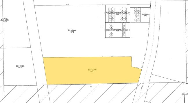

Property Detail
2303 N State St
03-12-30-5015-00000-0012
11.97 AC PALM LAKES ENTERTAINM ENT PARK BEING A PORTION OF THE SLY END OF LOT 1 DES AS POF BEING THE NW CRNR OF SEC 3 THENCE N890103E ALONG N LINE 240.96 TO A PT ON ELY ROW OF RR THENCE ALONG ELY ROW RR 2680.14 TO POB THENCE N884422E - 1313.09 TO THE
Shipyard
Flagler
L-1
Florida
B and X Area of moderate flood hazard, usually the area between the limits of the 100-year and 500-year floods.
12
2024
11.97 AC
2025
Flagler County
060206
Other Market Areas
41,710 SF
Deltona-Daytona Beach-Ormond Beach, FL
NEARBY LISTINGS FOR SALE OR LEASE
-
-
View all Bunnell listings for sale on LoopNet.com
DEMOGRAPHICS near 2303 N State St
1 mile
3 mile
5 mile
2025 Total Population
1,155
24,368
57,111
2030 Population
1,317
27,880
65,429
Pop Growth 2025-2030
+ 14.03%
+ 14.41%
+ 14.56%
Average Age
45
45
45
2025 Total Households
468
9,564
22,801
HH Growth 2025-2030
+ 13.89%
+ 14.48%
+ 14.67%
Median Household Inc
$78,723
$65,476
$65,877
Avg Household Size
2.50
2.50
2.50
2025 Avg HH Vehicles
2.00
2.00
2.00
Median Home Value
$378,357
$367,271
$364,949
Median Year Built
2003
2004
2003
Nearby Places
Map Layers
Map Styles
 Street
 Aerial
Layers
 Traffic
 Biking
Places
Listings with unknown addresses are not visible on the map
- Restaurants
- Banks
- Shops
- Fitness
- Groceries
PUBLIC TRANSPORTATION
AIRPORT
Daytona Beach International
Drive
Walk
Distance
Daytona Beach International
39 min
28.4 mi
Freight Ports
Jacksonville Port
Drive
Walk
Distance
Jacksonville Port
83 min
68.4 mi
Nearby Properties
Address
Land Use
TOTAL SIZE
Lot Size
Zoning
Address
Land Use
TOTAL SIZE
Lot Size
Zoning
320,259 SF
83.19 AC
P
Address
Land Use
TOTAL SIZE
Lot Size
Zoning
236,316 SF
61.38 AC
PSP
Address
Land Use
TOTAL SIZE
Lot Size
Zoning
138,991 SF
18.66 AC
P
Address
Land Use
TOTAL SIZE
Lot Size
Zoning
121,173 SF
10 AC
AC
Address
Land Use
TOTAL SIZE
Lot Size
Zoning
64,208 SF
8.41 AC
PSP
Address
Land Use
TOTAL SIZE
Lot Size
Zoning
68,684 SF
9.68 AC
MPD
Address
Land Use
TOTAL SIZE
Lot Size
Zoning
89,590 SF
9.90 AC
B-1
Address
Land Use
TOTAL SIZE
Lot Size
Zoning
59,889 SF
0.75 AC
R-3A
Address
Land Use
TOTAL SIZE
Lot Size
Zoning
67,008 SF
5.34 AC
B-1
Address
Land Use
TOTAL SIZE
Lot Size
Zoning
32,679 SF
101.42 AC
L-1
Address
Land Use
TOTAL SIZE
Lot Size
Zoning
112,200 SF
49.38 AC
L-1
Address
Land Use
TOTAL SIZE
Lot Size
Zoning
28,680 SF
63.21 AC
PSP
Address
Land Use
TOTAL SIZE
Lot Size
Zoning
163,592 SF
10 AC
IND-1
Address
Land Use
TOTAL SIZE
Lot Size
Zoning
4,158 SF
3.73 AC
P
Address
Land Use
TOTAL SIZE
Lot Size
Zoning
43,990 SF
4.84 AC
P
Address
Land Use
TOTAL SIZE
Lot Size
Zoning
38,420 SF
4.83 AC
C-2(F)
Address
Land Use
TOTAL SIZE
Lot Size
Zoning
76,339 SF
4 AC
B-1
Address
Land Use
TOTAL SIZE
Lot Size
Zoning
66,485 SF
28.20 AC
Address
Land Use
TOTAL SIZE
Lot Size
Zoning
41,293 SF
4.92 AC
B-1
Address
Land Use
TOTAL SIZE
Lot Size
Zoning
65,787 SF
11.88 AC
B-1
Address
Land Use
TOTAL SIZE
Lot Size
Zoning
55,468 SF
7.25 AC
O-1
Address
Land Use
TOTAL SIZE
Lot Size
Zoning
49,785 SF
1.35 AC
B-2
Address
Land Use
TOTAL SIZE
Lot Size
Zoning
31,452 SF
7.83 AC
B-1
Address
Land Use
TOTAL SIZE
Lot Size
Zoning
29,371 SF
18.32 AC
B-1
Address
Land Use
TOTAL SIZE
Lot Size
Zoning
14,850 SF
2.09 AC
COM-2
Address
Land Use
TOTAL SIZE
Lot Size
Zoning
35.41 AC
MFR-1
Address
Land Use
TOTAL SIZE
Lot Size
Zoning
36,576 SF
18.38 AC
I-C
Address
Land Use
TOTAL SIZE
Lot Size
Zoning
53,744 SF
75.79 AC
AC
The World's #1 Commercial Real Estate Marketplace
Connect with us
© 2026 CoStar Group
The information above has been obtained from sources believed reliable. While we do not doubt its accuracy we have not verified it and make no guarantee, warranty or representation about it. It is your responsibility to independently confirm its accuracy and completeness. Any projections, opinions, assumptions, or estimates used are for example only and do not represent the current or future performance of the property. The value of this transaction to you depends on tax and other factors which should be evaluated by your tax, financial, and legal advisors. You and your advisors should conduct a careful, independent investigation of the property to determine to your satisfaction the suitability of the property for your needs.