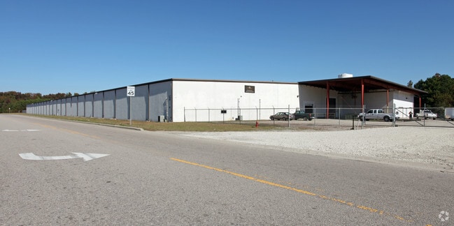
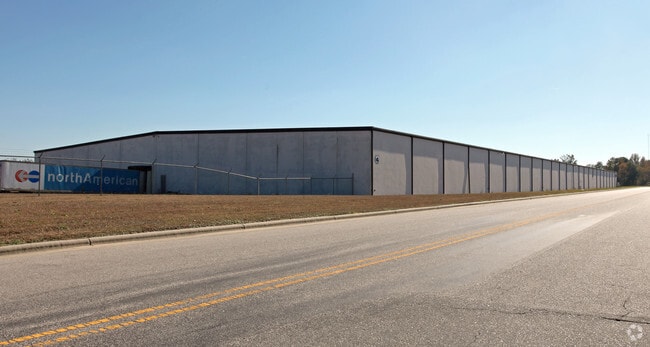
Property Record
2305 Baldree Rd S, Wilson, NC 27893

NEARBY LISTINGS FOR SALE OR LEASE
Property Detail
2305 Baldree Rd S
3720-19-8341.000
2305 BALDREE RD S 34.36AC
Manufacturinglight
Wilson
X
North Carolina
3720372000K
34.36 AC
2024
Rocky Mount/Wilson
2025
Other Market Areas
000802
Wilson, NC
192,420 SF
DEMOGRAPHICS near 2305 Baldree Rd S
1 Mile
3 Mile
5 Mile
2024 Total Population
409
24,255
45,783
2029 Population
414
24,599
46,012
Pop Growth 2024-2029
+ 1.22%
+ 1.42%
+ 0.50%
Average Age
41
41
41
2024 Total Households
155
9,960
18,979
HH Growth 2024-2029
+ 1.29%
+ 1.36%
+ 0.46%
Median Household Inc
$49,166
$34,116
$44,335
Avg Household Size
2.50
2.30
2.30
2024 Avg HH Vehicles
2.00
1.00
2.00
Median Home Value
$124,615
$102,121
$143,541
Median Year Built
1976
1975
1980
Nearby Places
Map Layers
Map Styles
 Street
 Aerial
- Restaurants
- Banks
- Shops
- Fitness
- Groceries
PUBLIC TRANSPORTATION
COMMUTER RAIL
Wilson (Carolinian - Amtrak, Palmetto - Amtrak)
DRIVE
WALK
Distance
Wilson (Carolinian - Amtrak, Palmetto - Amtrak)
6 min
2.5 mi
Freight Ports
Port of Morehead City
DRIVE
WALK
Distance
Port of Morehead City
167 min
118.5 mi
Nearby Properties
Address
Land Use
TOTAL SIZE
Lot Size
Zoning
Address
Land Use
TOTAL SIZE
Lot Size
Zoning
11,771 SF
31.78 AC
ICD
Address
Land Use
TOTAL SIZE
Lot Size
Zoning
220,639 SF
1.94 AC
CCMX
Address
Land Use
TOTAL SIZE
Lot Size
Zoning
6,704 SF
75.58 AC
ICD
Address
Land Use
TOTAL SIZE
Lot Size
Zoning
259,000 SF
69.97 AC
HI
Address
Land Use
TOTAL SIZE
Lot Size
Zoning
10,152 SF
29.71 AC
ICD
Address
Land Use
TOTAL SIZE
Lot Size
Zoning
59,319 SF
1.01 AC
CCMX
Address
Land Use
TOTAL SIZE
Lot Size
Zoning
77,125 SF
2.98 AC
GC
Address
Land Use
TOTAL SIZE
Lot Size
Zoning
150,316 SF
10.97 AC
RMX
Address
Land Use
TOTAL SIZE
Lot Size
Zoning
90,035 SF
91.87 AC
ICD
Address
Land Use
TOTAL SIZE
Lot Size
Zoning
80,000 SF
101.30 AC
HI
Address
Land Use
TOTAL SIZE
Lot Size
Zoning
25,888 SF
73.36 AC
LI
Address
Land Use
TOTAL SIZE
Lot Size
Zoning
91,637 SF
1.95 AC
CCMX
Address
Land Use
TOTAL SIZE
Lot Size
Zoning
75,622 SF
9.13 AC
ICD
Address
Land Use
TOTAL SIZE
Lot Size
Zoning
1,944 SF
13.64 AC
GR6
Address
Land Use
TOTAL SIZE
Lot Size
Zoning
13,672 SF
7.68 AC
NC
Address
Land Use
TOTAL SIZE
Lot Size
Zoning
8,616 SF
40 AC
ICD
Address
Land Use
TOTAL SIZE
Lot Size
Zoning
20,705 SF
7.88 AC
GR6
Address
Land Use
TOTAL SIZE
Lot Size
Zoning
35,406 SF
2.91 AC
GR6
Address
Land Use
TOTAL SIZE
Lot Size
Zoning
3,900 SF
16.46 AC
RMX
Address
Land Use
TOTAL SIZE
Lot Size
Zoning
7,552 SF
51.19 AC
HI
Address
Land Use
TOTAL SIZE
Lot Size
Zoning
74,555 SF
2.37 AC
CCMX
Address
Land Use
TOTAL SIZE
Lot Size
Zoning
112,721 SF
22.04 AC
GC
Address
Land Use
TOTAL SIZE
Lot Size
Zoning
108,510 SF
1.47 AC
CCMX
Address
Land Use
TOTAL SIZE
Lot Size
Zoning
129,404 SF
2.61 AC
HI
Address
Land Use
TOTAL SIZE
Lot Size
Zoning
39,321 SF
5.55 AC
ICD
Address
Land Use
TOTAL SIZE
Lot Size
Zoning
9,548 SF
33.53 AC
LI
Address
Land Use
TOTAL SIZE
Lot Size
Zoning
2,464 SF
12.82 AC
ICD
Address
Land Use
TOTAL SIZE
Lot Size
Zoning
7,260 SF
6.99 AC
RMX
Address
Land Use
TOTAL SIZE
Lot Size
Zoning
2,500 SF
34.70 AC
M2
The World's #1 Commercial Real Estate Marketplace
Connect with us
© 2025 CoStar Group
The information above has been obtained from sources believed reliable. While we do not doubt its accuracy we have not verified it and make no guarantee, warranty or representation about it. It is your responsibility to independently confirm its accuracy and completeness. Any projections, opinions, assumptions, or estimates used are for example only and do not represent the current or future performance of the property. The value of this transaction to you depends on tax and other factors which should be evaluated by your tax, financial, and legal advisors. You and your advisors should conduct a careful, independent investigation of the property to determine to your satisfaction the suitability of the property for your needs.