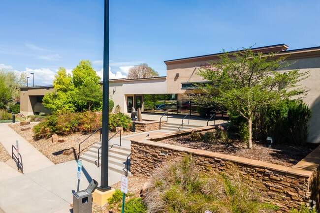
Property Record
2305 E Arapahoe Rd, Centennial, CO 80122


Current Lease Availabilities
Property Detail
2305 E Arapahoe Rd
Denver-Aurora-Centennial, CO
SUBDIVISIONCD 058202 SUBDIVISIONNAME SOUTHGLENN 10TH FLG BLOCK 001 LOT 001 LOT 1 BLK 1 SOUTHGLENN 10TH FLG
2077-23-4-11-001
Arapahoe
Officebuilding
Colorado
B and X Area of moderate flood hazard, usually the area between the limits of the 100-year and 500-year floods.
001,1
2024
3.18 AC
2025
Arapahoe Rd
005611
Denver
48,598 SF
NEARBY LISTINGS FOR SALE OR LEASE
DEMOGRAPHICS near 2305 E Arapahoe Rd
1 mile
3 mile
5 mile
2025 Total Population
12,235
100,181
293,178
2030 Population
12,317
101,733
301,567
Pop Growth 2025-2030
+ 0.67%
+ 1.55%
+ 2.86%
Average Age
44
43
42
2025 Total Households
4,906
40,009
123,427
HH Growth 2025-2030
+ 0.65%
+ 1.71%
+ 3.04%
Median Household Inc
$112,522
$119,343
$117,031
Avg Household Size
2.50
2.40
2.30
2025 Avg HH Vehicles
2.00
2.00
2.00
Median Home Value
$709,600
$740,694
$733,156
Median Year Built
1969
1977
1985
Nearby Places
Map Layers
Map Styles
 Street
 Aerial
Layers
 Traffic
 Biking
Places
Listings with unknown addresses are not visible on the map
- Restaurants
- Banks
- Shops
- Fitness
- Groceries
PUBLIC TRANSPORTATION
AIRPORT
Denver International
Drive
Walk
Distance
Denver International
42 min
32.7 mi
Freight Ports
Tulsa Port Of Catoosa
Drive
Walk
Distance
Tulsa Port Of Catoosa
738 min
715.4 mi
Nearby Properties
Address
Land Use
TOTAL SIZE
Lot Size
Zoning
Address
Land Use
TOTAL SIZE
Lot Size
Zoning
443,472 SF
7.88 AC
AMU
Address
Land Use
TOTAL SIZE
Lot Size
Zoning
481,147 SF
38.27 AC
Address
Land Use
TOTAL SIZE
Lot Size
Zoning
207,637 SF
28.17 AC
PDU
Address
Land Use
TOTAL SIZE
Lot Size
Zoning
98,523 SF
4.17 AC
Address
Land Use
TOTAL SIZE
Lot Size
Zoning
206,632 SF
33.68 AC
Address
Land Use
TOTAL SIZE
Lot Size
Zoning
250,402 SF
21 AC
Address
Land Use
TOTAL SIZE
Lot Size
Zoning
38,992 SF
1 AC
Address
Land Use
TOTAL SIZE
Lot Size
Zoning
42,444 SF
1.41 AC
Address
Land Use
TOTAL SIZE
Lot Size
Zoning
58,006 SF
1.80 AC
Address
Land Use
TOTAL SIZE
Lot Size
Zoning
329,937 SF
35.07 AC
PUD
Address
Land Use
TOTAL SIZE
Lot Size
Zoning
192,108 SF
20.03 AC
Address
Land Use
TOTAL SIZE
Lot Size
Zoning
167,287 SF
13.65 AC
Address
Land Use
TOTAL SIZE
Lot Size
Zoning
177,772 SF
16 AC
Address
Land Use
TOTAL SIZE
Lot Size
Zoning
411,924 SF
26.85 AC
LPDI
Address
Land Use
TOTAL SIZE
Lot Size
Zoning
163,695 SF
22.90 AC
Address
Land Use
TOTAL SIZE
Lot Size
Zoning
312,130 SF
20.63 AC
PDU
Address
Land Use
TOTAL SIZE
Lot Size
Zoning
463,840 SF
17.63 AC
PDU
Address
Land Use
TOTAL SIZE
Lot Size
Zoning
572,657 SF
0.21 AC
LPD-C
Address
Land Use
TOTAL SIZE
Lot Size
Zoning
90,350 SF
11.44 AC
Address
Land Use
TOTAL SIZE
Lot Size
Zoning
152,384 SF
12.89 AC
PDU
Address
Land Use
TOTAL SIZE
Lot Size
Zoning
61,607 SF
11.60 AC
LPD-C
Address
Land Use
TOTAL SIZE
Lot Size
Zoning
248,058 SF
12.24 AC
Address
Land Use
TOTAL SIZE
Lot Size
Zoning
146,156 SF
4.61 AC
Address
Land Use
TOTAL SIZE
Lot Size
Zoning
677,688 SF
2.97 AC
Address
Land Use
TOTAL SIZE
Lot Size
Zoning
28,562 SF
9.47 AC
Address
Land Use
TOTAL SIZE
Lot Size
Zoning
131,886 SF
8.39 AC
Address
Land Use
TOTAL SIZE
Lot Size
Zoning
127,932 SF
3.82 AC
Address
Land Use
TOTAL SIZE
Lot Size
Zoning
66,777 SF
5.04 AC
Address
Land Use
TOTAL SIZE
Lot Size
Zoning
68,000 SF
7.47 AC
Address
Land Use
TOTAL SIZE
Lot Size
Zoning
56,881 SF
5.53 AC
The World's #1 Commercial Real Estate Marketplace
Connect with us
© 2026 CoStar Group
The information above has been obtained from sources believed reliable. While we do not doubt its accuracy we have not verified it and make no guarantee, warranty or representation about it. It is your responsibility to independently confirm its accuracy and completeness. Any projections, opinions, assumptions, or estimates used are for example only and do not represent the current or future performance of the property. The value of this transaction to you depends on tax and other factors which should be evaluated by your tax, financial, and legal advisors. You and your advisors should conduct a careful, independent investigation of the property to determine to your satisfaction the suitability of the property for your needs.