Property Record
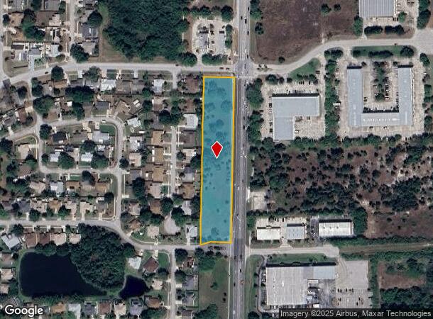
2305 Murrell Rd, Rockledge, FL 32955


NEARBY LISTINGS FOR SALE OR LEASE
Property Detail
2305 Murrell Rd
Palm Bay-Melbourne-Titusville, FL
St Michel Village
25-36-16-15-0000A.0-0000.00
ST MICHEL VILLAGE TRACT A UNDEVELOPED TRACT
Commercialacreage
Brevard
X
Florida
12009C0428H
2.76 AC
2024
Brevard County
2025
Orlando
063105
DEMOGRAPHICS near 2305 Murrell Rd
1 Mile
3 Mile
5 Mile
2024 Total Population
7,409
43,181
95,671
2029 Population
8,029
47,039
104,289
Pop Growth 2024-2029
+ 8.37%
+ 8.93%
+ 9.01%
Average Age
43
44
44
2024 Total Households
2,944
17,739
39,893
HH Growth 2024-2029
+ 8.15%
+ 8.73%
+ 8.85%
Median Household Inc
$84,550
$76,195
$68,739
Avg Household Size
2.50
2.40
2.30
2024 Avg HH Vehicles
2.00
2.00
2.00
Median Home Value
$257,388
$278,935
$289,094
Median Year Built
1987
1990
1986
Nearby Places
Map Layers
Map Styles
 Street
 Aerial
- Restaurants
- Banks
- Shops
- Fitness
- Groceries
PUBLIC TRANSPORTATION
AIRPORT
Melbourne Orlando International
DRIVE
WALK
Distance
Melbourne Orlando International
33 min
21.0 mi
Freight Ports
Port Canaveral
DRIVE
WALK
Distance
Port Canaveral
24 min
15.3 mi
SALE & LEASE HISTORY
LISTING DATE
SALE/LEASE

Sep 24, 2016
For Sale
Jun 16, 2022
For Sale
Nearby Properties
Address
Land Use
TOTAL SIZE
Lot Size
Zoning
Address
Land Use
TOTAL SIZE
Lot Size
Zoning
411,148 SF
8.13 AC
HC
Address
Land Use
TOTAL SIZE
Lot Size
Zoning
379,920 SF
19.73 AC
RU215
Address
Land Use
TOTAL SIZE
Lot Size
Zoning
326,407 SF
10 AC
C2
Address
Land Use
TOTAL SIZE
Lot Size
Zoning
308,576 SF
16.41 AC
C2
Address
Land Use
TOTAL SIZE
Lot Size
Zoning
68,677 SF
13.88 AC
RMU
Address
Land Use
TOTAL SIZE
Lot Size
Zoning
263,066 SF
13.36 AC
PUD
Address
Land Use
TOTAL SIZE
Lot Size
Zoning
181,848 SF
8.20 AC
C2
Address
Land Use
TOTAL SIZE
Lot Size
Zoning
276,665 SF
38.95 AC
R2
Address
Land Use
TOTAL SIZE
Lot Size
Zoning
117,175 SF
8.06 AC
C2
Address
Land Use
TOTAL SIZE
Lot Size
Zoning
176,800 SF
19.23 AC
R3141
Address
Land Use
TOTAL SIZE
Lot Size
Zoning
230,561 SF
13.74 AC
R3141
Address
Land Use
TOTAL SIZE
Lot Size
Zoning
206,696 SF
11.43 AC
R3
Address
Land Use
TOTAL SIZE
Lot Size
Zoning
112,095 SF
9.50 AC
C2
Address
Land Use
TOTAL SIZE
Lot Size
Zoning
104,705 SF
15.14 AC
PUD
Address
Land Use
TOTAL SIZE
Lot Size
Zoning
122,116 SF
28.56 AC
AU
Address
Land Use
TOTAL SIZE
Lot Size
Zoning
120,445 SF
9.40 AC
Address
Land Use
TOTAL SIZE
Lot Size
Zoning
249,080 SF
106.95 AC
GML
Address
Land Use
TOTAL SIZE
Lot Size
Zoning
95,862 SF
5 AC
C2
Address
Land Use
TOTAL SIZE
Lot Size
Zoning
100,050 SF
14.94 AC
R2
Address
Land Use
TOTAL SIZE
Lot Size
Zoning
87,441 SF
20.89 AC
R2
Address
Land Use
TOTAL SIZE
Lot Size
Zoning
156,248 SF
20.16 AC
C2
Address
Land Use
TOTAL SIZE
Lot Size
Zoning
110,630 SF
31.39 AC
R2
Address
Land Use
TOTAL SIZE
Lot Size
Zoning
117,078 SF
6.13 AC
R2A 8/1
Address
Land Use
TOTAL SIZE
Lot Size
Zoning
49,320 SF
4.03 AC
C2
Address
Land Use
TOTAL SIZE
Lot Size
Zoning
128,347 SF
8.60 AC
IP
Address
Land Use
TOTAL SIZE
Lot Size
Zoning
101,294 SF
20.14 AC
M2
Address
Land Use
TOTAL SIZE
Lot Size
Zoning
200,270 SF
16.63 AC
IP
Address
Land Use
TOTAL SIZE
Lot Size
Zoning
52,126 SF
4.93 AC
M1
Address
Land Use
TOTAL SIZE
Lot Size
Zoning
94,046 SF
12 AC
GU
Address
Land Use
TOTAL SIZE
Lot Size
Zoning
24,207 SF
40 AC
M2
The World's #1 Commercial Real Estate Marketplace
Connect with us
© 2025 CoStar Group
The information above has been obtained from sources believed reliable. While we do not doubt its accuracy we have not verified it and make no guarantee, warranty or representation about it. It is your responsibility to independently confirm its accuracy and completeness. Any projections, opinions, assumptions, or estimates used are for example only and do not represent the current or future performance of the property. The value of this transaction to you depends on tax and other factors which should be evaluated by your tax, financial, and legal advisors. You and your advisors should conduct a careful, independent investigation of the property to determine to your satisfaction the suitability of the property for your needs.