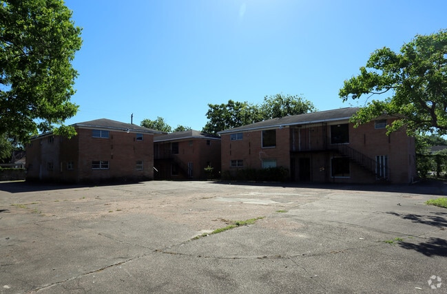
Property Record
2305 Southmore Blvd, Houston, TX 77004


Current Lease Availabilities
NEARBY LISTINGS FOR SALE OR LEASE
Property Detail
2305 Southmore Blvd
0611030000015
Riverside Terrace Sec 1
Apartment
TRS 14 & 15 BLK 11 RIVERSIDE TERRACE SEC 1
X
Harris
48201C0860L
Texas
2024
0.28 AC
2025
MacGregor
313000
Houston
7,938 SF
Houston-The Woodlands-Sugar Land, TX
DEMOGRAPHICS near 2305 Southmore Blvd
1 Mile
3 Mile
5 Mile
2024 Total Population
23,684
209,779
495,792
2029 Population
24,858
218,173
514,777
Pop Growth 2024-2029
+ 4.96%
+ 4.00%
+ 3.83%
Average Age
39
37
37
2024 Total Households
11,585
100,849
222,478
HH Growth 2024-2029
+ 4.95%
+ 4.19%
+ 4.10%
Median Household Inc
$69,449
$72,942
$73,212
Avg Household Size
1.90
1.90
2.10
2024 Avg HH Vehicles
1.00
1.00
1.00
Median Home Value
$387,182
$417,972
$407,550
Median Year Built
2000
1994
1993
Nearby Places
Map Layers
Map Styles
 Street
 Aerial
- Restaurants
- Banks
- Shops
- Fitness
- Groceries
PUBLIC TRANSPORTATION
TRANSIT/SUBWAY
Museum District Northbound (Redline - Harris County Metropolitan Transit Authority METRO Rail (METRORail))
DRIVE
WALK
Distance
Museum District Northbound (Redline - Harris County Metropolitan Transit Authority METRO Rail (METRORail))
3 min
19 min
1.0 mi
Museum District Southbound (METRORAIL RED LINE - Metropolitan Transit Authority of Harris County, Redline - Metropolitan Transit Authority of Harris County)
DRIVE
WALK
Distance
Museum District Southbound (METRORAIL RED LINE - Metropolitan Transit Authority of Harris County, Redline - Metropolitan Transit Authority of Harris County)
2 min
20 min
1.1 mi
COMMUTER RAIL
Houston (Sunset Limited - Amtrak)
DRIVE
WALK
Distance
Houston (Sunset Limited - Amtrak)
8 min
4.1 mi
AIRPORT
William P Hobby
DRIVE
WALK
Distance
William P Hobby
24 min
12.7 mi
George Bush Intcntl/Houston
DRIVE
WALK
Distance
George Bush Intcntl/Houston
28 min
21.4 mi
Freight Ports
Port of Houston
DRIVE
WALK
Distance
Port of Houston
20 min
12.0 mi
Nearby Properties
Address
Land Use
TOTAL SIZE
Lot Size
Zoning
Address
Land Use
TOTAL SIZE
Lot Size
Zoning
1,383,720 SF
1.47 AC
Address
Land Use
TOTAL SIZE
Lot Size
Zoning
1,101,686 SF
1.45 AC
Address
Land Use
TOTAL SIZE
Lot Size
Zoning
973,861 SF
1.18 AC
Address
Land Use
TOTAL SIZE
Lot Size
Zoning
899,279 SF
1.18 AC
Address
Land Use
TOTAL SIZE
Lot Size
Zoning
797,208 SF
1.46 AC
Address
Land Use
TOTAL SIZE
Lot Size
Zoning
519,409 SF
1.52 AC
Address
Land Use
TOTAL SIZE
Lot Size
Zoning
1,916,394 SF
1.46 AC
Address
Land Use
TOTAL SIZE
Lot Size
Zoning
1,871,418 SF
1.44 AC
Address
Land Use
TOTAL SIZE
Lot Size
Zoning
1,252,274 SF
2.02 AC
Address
Land Use
TOTAL SIZE
Lot Size
Zoning
1,091,726 SF
2.60 AC
Address
Land Use
TOTAL SIZE
Lot Size
Zoning
1,232,364 SF
1.49 AC
Address
Land Use
TOTAL SIZE
Lot Size
Zoning
1,436,400 SF
1.44 AC
Address
Land Use
TOTAL SIZE
Lot Size
Zoning
1,321,033 SF
1.46 AC
Address
Land Use
TOTAL SIZE
Lot Size
Zoning
4,169,721 SF
31.23 AC
Address
Land Use
TOTAL SIZE
Lot Size
Zoning
2,005,097 SF
1.44 AC
Address
Land Use
TOTAL SIZE
Lot Size
Zoning
1,374,271 SF
1.44 AC
Address
Land Use
TOTAL SIZE
Lot Size
Zoning
1,150,681 SF
1.17 AC
Address
Land Use
TOTAL SIZE
Lot Size
Zoning
515,025 SF
1.50 AC
Address
Land Use
TOTAL SIZE
Lot Size
Zoning
704,249 SF
2.34 AC
Address
Land Use
TOTAL SIZE
Lot Size
Zoning
1,657,484 SF
1.44 AC
Address
Land Use
TOTAL SIZE
Lot Size
Zoning
1,282,908 SF
2.74 AC
Address
Land Use
TOTAL SIZE
Lot Size
Zoning
1,311,133 SF
1.44 AC
Address
Land Use
TOTAL SIZE
Lot Size
Zoning
555,351 SF
1.40 AC
Address
Land Use
TOTAL SIZE
Lot Size
Zoning
1,181,384 SF
1.47 AC
Address
Land Use
TOTAL SIZE
Lot Size
Zoning
1,044,305 SF
3.16 AC
Address
Land Use
TOTAL SIZE
Lot Size
Zoning
1,162,204 SF
1.44 AC
Address
Land Use
TOTAL SIZE
Lot Size
Zoning
934,258 SF
1.45 AC
Address
Land Use
TOTAL SIZE
Lot Size
Zoning
1,103,424 SF
1.44 AC
Address
Land Use
TOTAL SIZE
Lot Size
Zoning
1,359,194 SF
Address
Land Use
TOTAL SIZE
Lot Size
Zoning
1,365,801 SF
1.44 AC
The World's #1 Commercial Real Estate Marketplace
Connect with us
© 2026 CoStar Group
The information above has been obtained from sources believed reliable. While we do not doubt its accuracy we have not verified it and make no guarantee, warranty or representation about it. It is your responsibility to independently confirm its accuracy and completeness. Any projections, opinions, assumptions, or estimates used are for example only and do not represent the current or future performance of the property. The value of this transaction to you depends on tax and other factors which should be evaluated by your tax, financial, and legal advisors. You and your advisors should conduct a careful, independent investigation of the property to determine to your satisfaction the suitability of the property for your needs.